Back in Europe we are currently breeding a rabid group of radical greenie dickheads and tree-hugging muppets who believe that the internal
combustion engine is the devil and that it has to be eradicated. They want fossil fuel and its burning outlawed and only "green"
technology should be permitted.
This uninformed minority is successfully blocking vital infrastructure projects back home which would make the life of millions
better. What I like so much about the United States is that those greenie folks out here are much more rational, less visible and less militant than that Eco-Mafia
that in Europe so often is successfully preventing the lives of the silent majority to be improved.
Don't get me wrong, my next car will be an Electric car.
and I see a lot of things out here in the U. S. where I would put a stop to if I were in the position
to do so. Examples would be the use of disposable cups and cutlery in hotels and motels, the free plastic bags available in all shops
and supermarkets and the disposal of all that preventable garbage in landfill sites (which is strictly forbidden where I come from).
But I have to say that for the average guy from Europe the attitude of the local people to life in general and their way to accept that without
internal combustion we would go back into the dark ages is very soothing. There is no replacement for the internal combustion engine that can be deployed
right now, and only improving technology can clean up our acts.
Throwing away those 1.2 billion vehicles (of which currently one in one-thousand is an EV) on our streets would certainly not improve the lives
of many people I know. So with this explanation of why I am where I currently am I shall end this sermon on one of the things that really annoys me
about Europe.
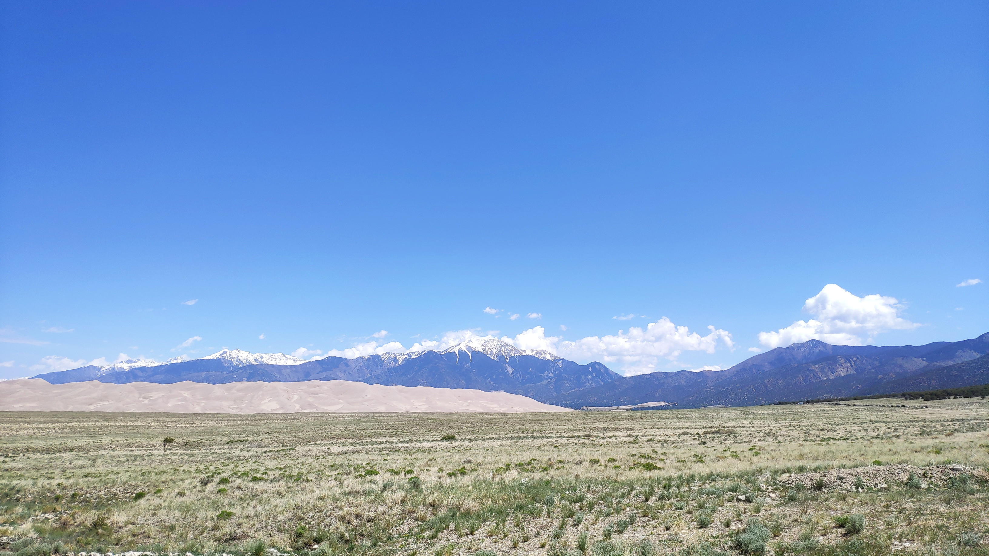
This morning at 0643 hours my personal Rocky Mountains
tour guide Bob sends out a text message, advising me to visit the
Great Sand Dunes on my way out westwards.
I do that and shortly after passing through Fort Garland I turn north
on highway 150 to those dunes. Unfortunately it is Saturday, the weather is fine, and clearly many other people had the same idea. There is a warning sign
"parking full" and vehicles are jamming the road for two miles before reaching the end of the road.
I have seen dunes before, so I turn around and take a picture from the distance:
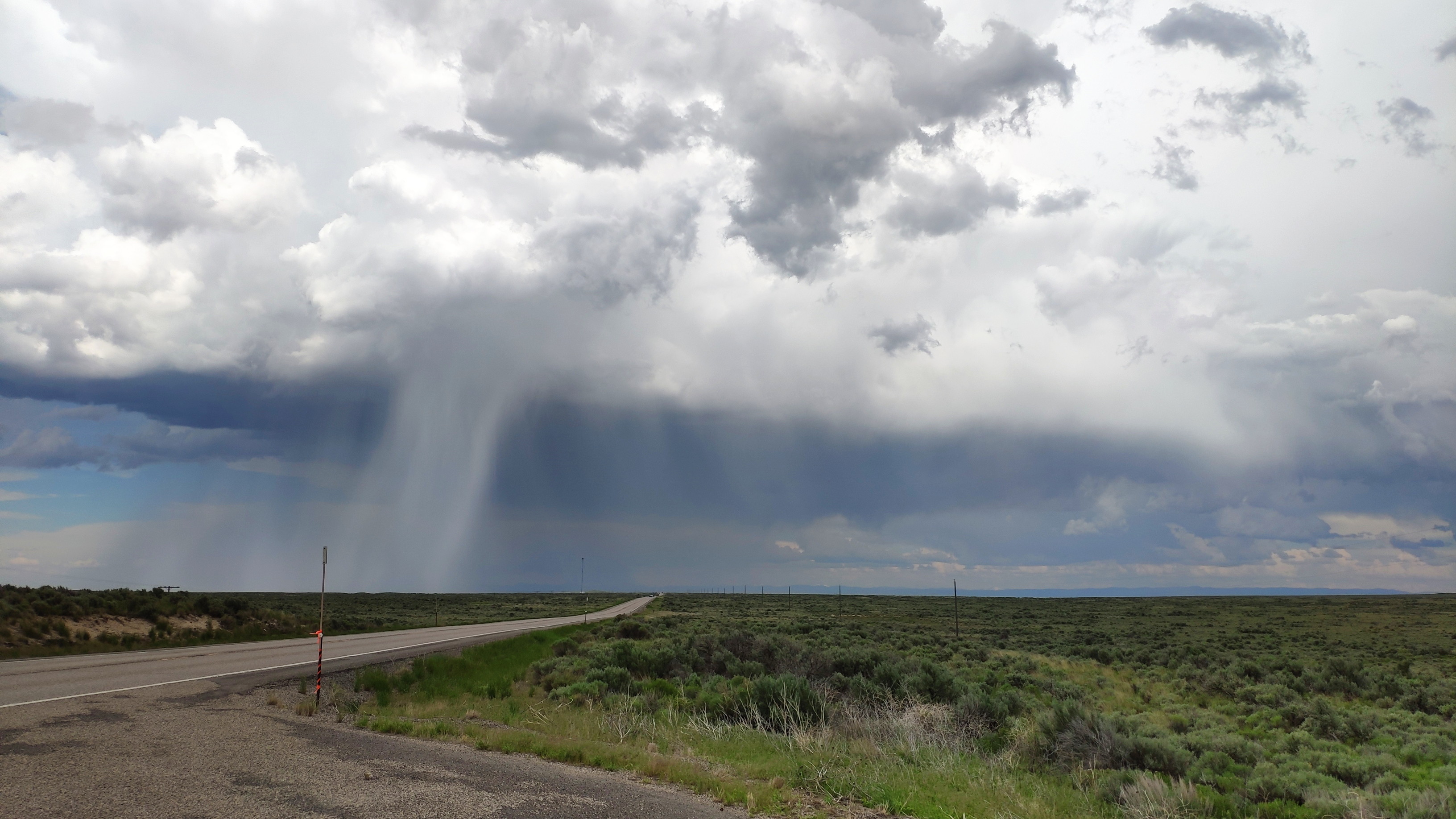
At South Fork I can see a massive storm cell over
the Wolf Creek pass. That is not only bad weather, that is outright
dangerous on a motorbike. The reason is that this is not one of our benign alpine passes we have in Europe, this is a 3300 metre high ride over
the continental divide while the snow line
currently is at 2900 metres. Even worse, the wind is from the south, meaning that simply turning around if caught in the storm is no option;
the storm would be faster and engulf me. I check my mobile phone; of course, no network.
I decide to go up to the snowline and then to decide if I can make it over the "frozen part" without being blasted by the storm. I am unbelievably
lucky; the road just winds up the hill and whenever it looks like it is going to lead into that fierce black cloud and its flashes of lightning
a gentle curve appears ahead on my GPS unit that leads away from the storm.
I manage the ride over the pass with only a few snowflakes near the summit, but on the far side at
Pagosa Springs I am showered with rain and for the next 30
kilometres the road is wet.
It looks like it hasn't rained here in a while and the dust and dirt that the wet road contains not only mean that the Marsupilami (and
myself) soon are exceedingly dirt-splattered, the road also becomes rather slippery in parts.
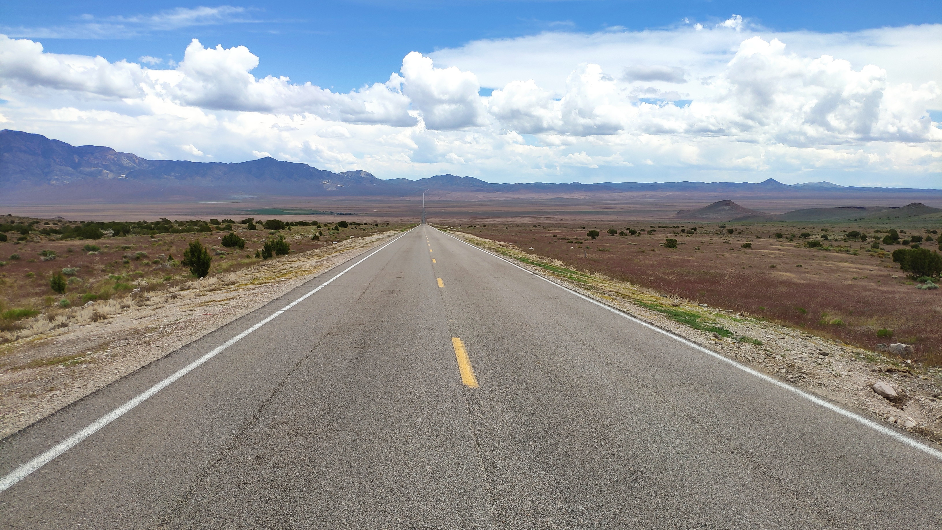
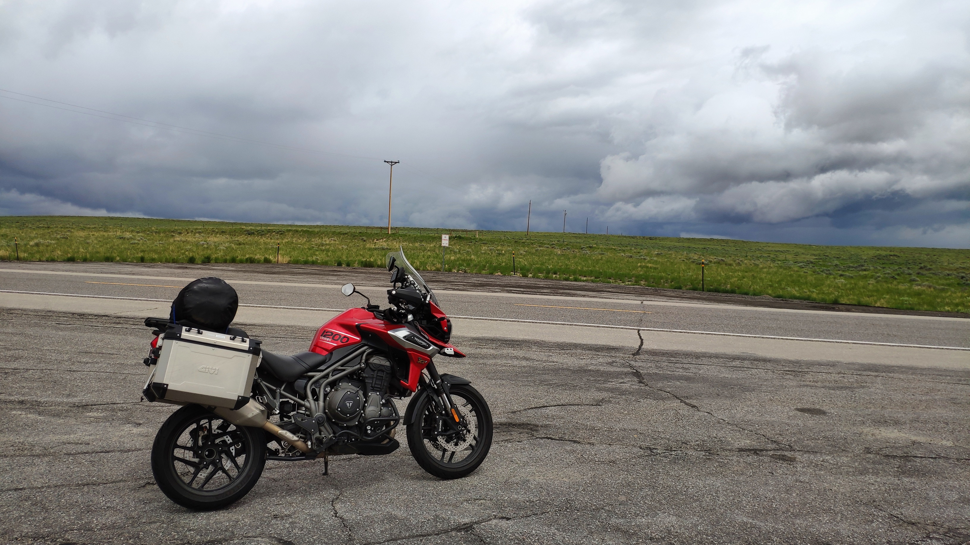
But soon the road is dry again and I am looking at the endless highway disappearing into the blue yonder of the horizon:

At Bayfield I spot a pressure wash place and wash
the bike as well as my filth-covered pants and boots.
However, other than that sprinkle of water and dirt at Pagosa Springs the weather is absolutely splendid, so I continue riding on fine,
empty roads until I reach Monticello after 540 kilometres, where I check out first
the mobile network (they have no network at all), then the four motels in town before picking the old-style
Wayside Motor Inn, which proves to be an excellent choice.
Bob is off on a week long camping trip, but finds time to send me a text, promising that today's ride will be spectacular - he should know, he planned that
ride for me. And that turns out to be true. The road winds itself through the mountains at altitudes between 1300 and 3000 metres. At 1300 metres the temperature
is about 30 degrees, at 3000 metres it is about 15 degrees centigrade. There are less bikes on this fantastic road than I would expect on a Sunday, but I meet
a few including three young Israelis who bought a bike each when they arrived in April and who are touring North America all summer. Lucky fellows.
Here are a few impressions of today's ride:
I end the day after 500 kilometres in Bryce Canyon City. That place isn't a city, not even a village. It's a hamlet of 200 souls that exclusively lives of the stream of tourists that want to see Bryce Canyon. The hamlet in essence is one giant motel with a few added eating places. I don't like that. Outside of the town is an old-fashioned motel, which I like better. It's not as good as 112 dollars should make it, I should have instead stayed at Escalante, which is a proper village and much nicer - but with hindsight everything is always different.
In the United States there appears to exist only a single factory that produces toilet paper. The variant produced is of a low
quality, single ply design that you have to fold over twice to give it the minimum strength required to perform its job. At least
that is my impression, as every single motel I have visited so far uses that awful stuff. I have also yet to find a place that features
a bidet. Never mind those hygienic shortcomings, let's get back on the road.
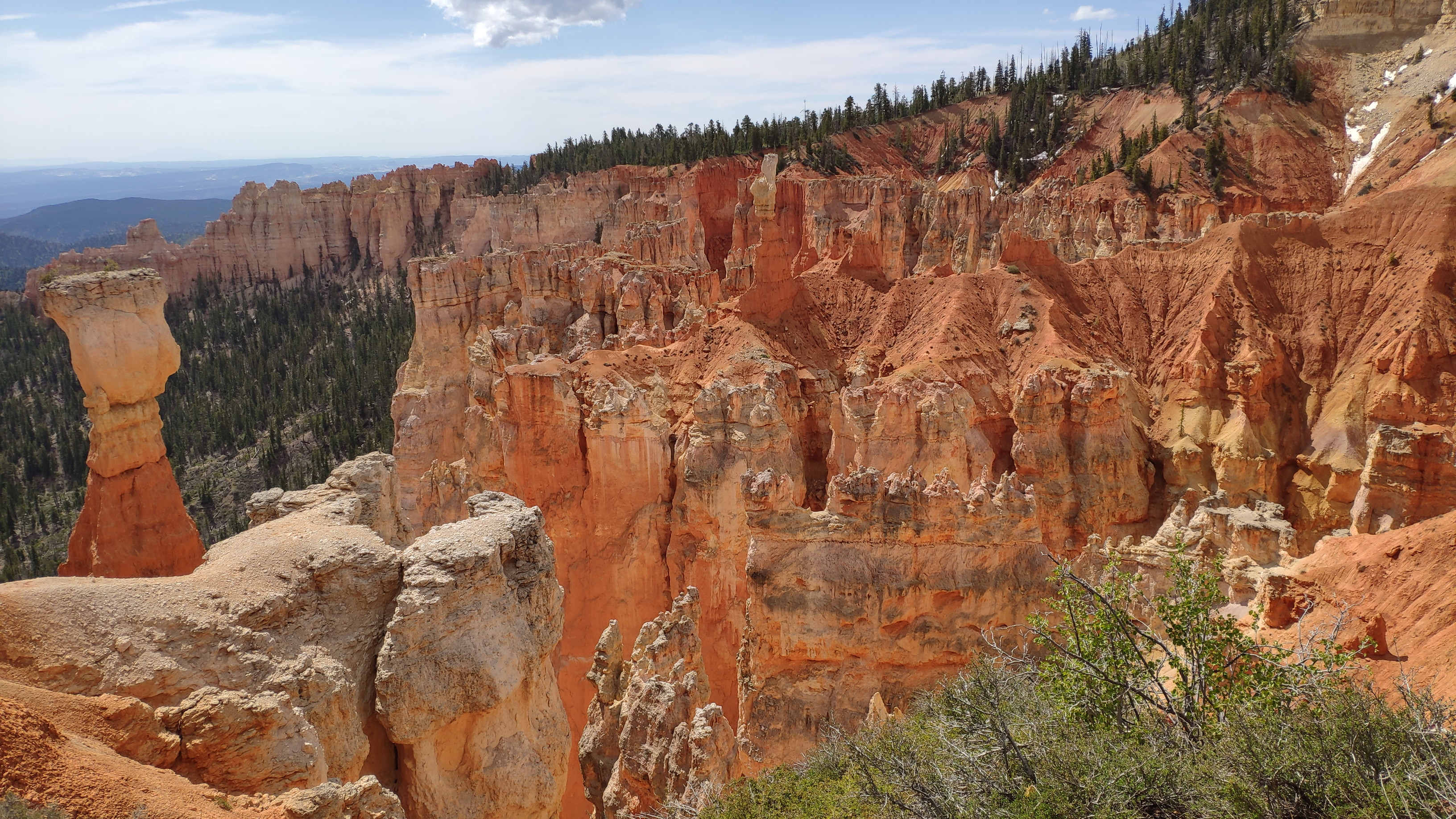
Of course I start the day by riding that 33 kilometre cul-de-sac into Bryce Canyon. I remember how breathtaking the scenery is from
my 2007 visit. What I had however completely forgotten is that the
National Parks Service has placed a couple
of Highwaymen at the entrance that relieve me of 30 dollars
to get in. 2.5 million visitors per year has the canyon, so that's
a lot of money - for what? The canyon isn't man made, it's a product of mother nature. Sure that 33 kilometres of road are now
paid for a hundred times over by the millions already raked in? To take money without providing any goods or services in return is the dictionary description
of a defrauder.
Never mind, maybe they use the money to upkeep some parks that are not so generously funded by Joe Public. Decide for yourself when looking at these
two pictures I shot there today:
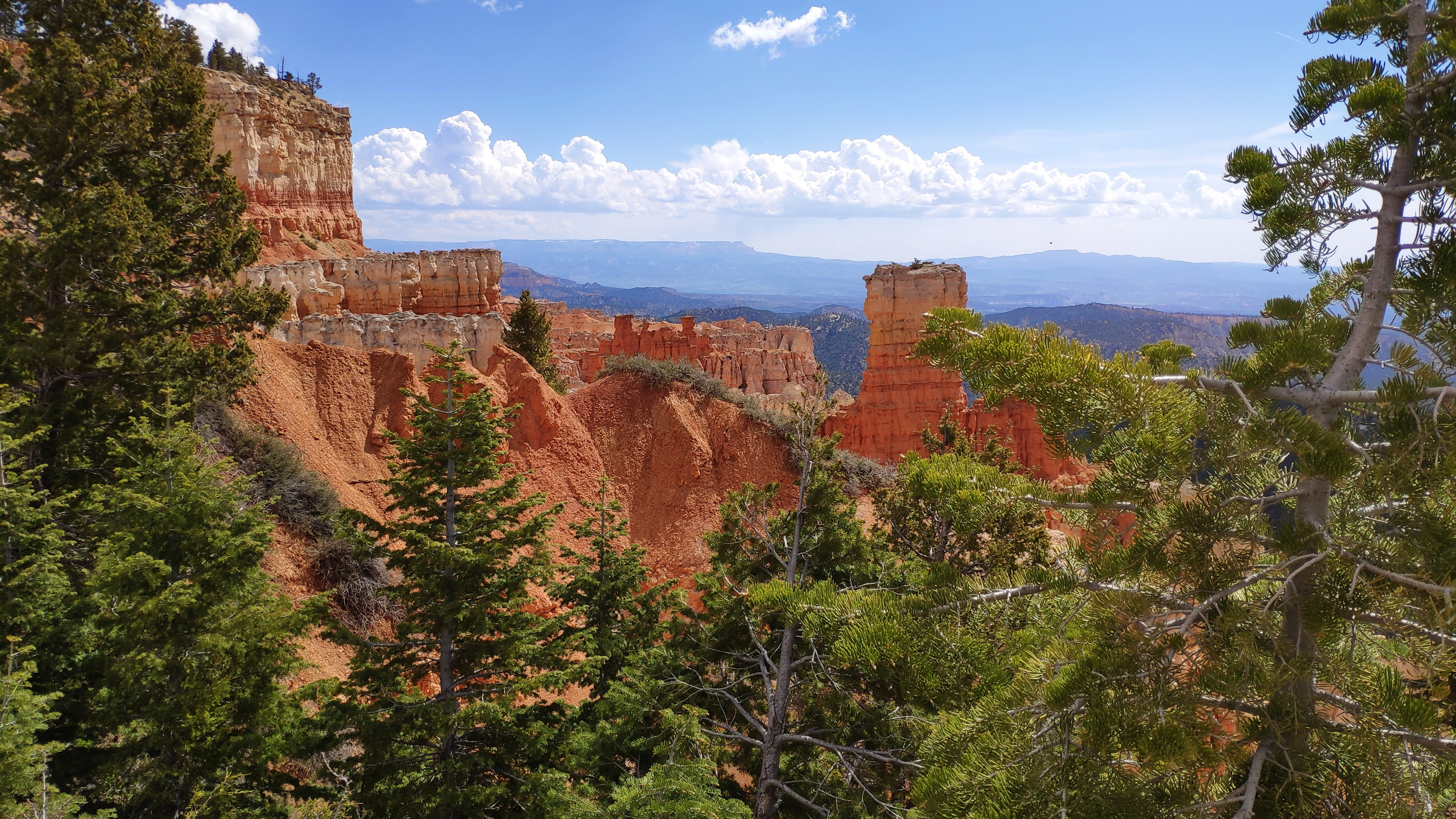
But even more fun is the glorious ride from the canyon to Ely
via highways 12,
89 and
21. Every turn reveals another great view. And all day
I am riding between 1600 and 2600 metres of altitude. The temperature at those altitudes is absolutely perfect for motorbiking, though
a few thunderstorms are blooming over the mountains and once I get a bit of a sprinkling.
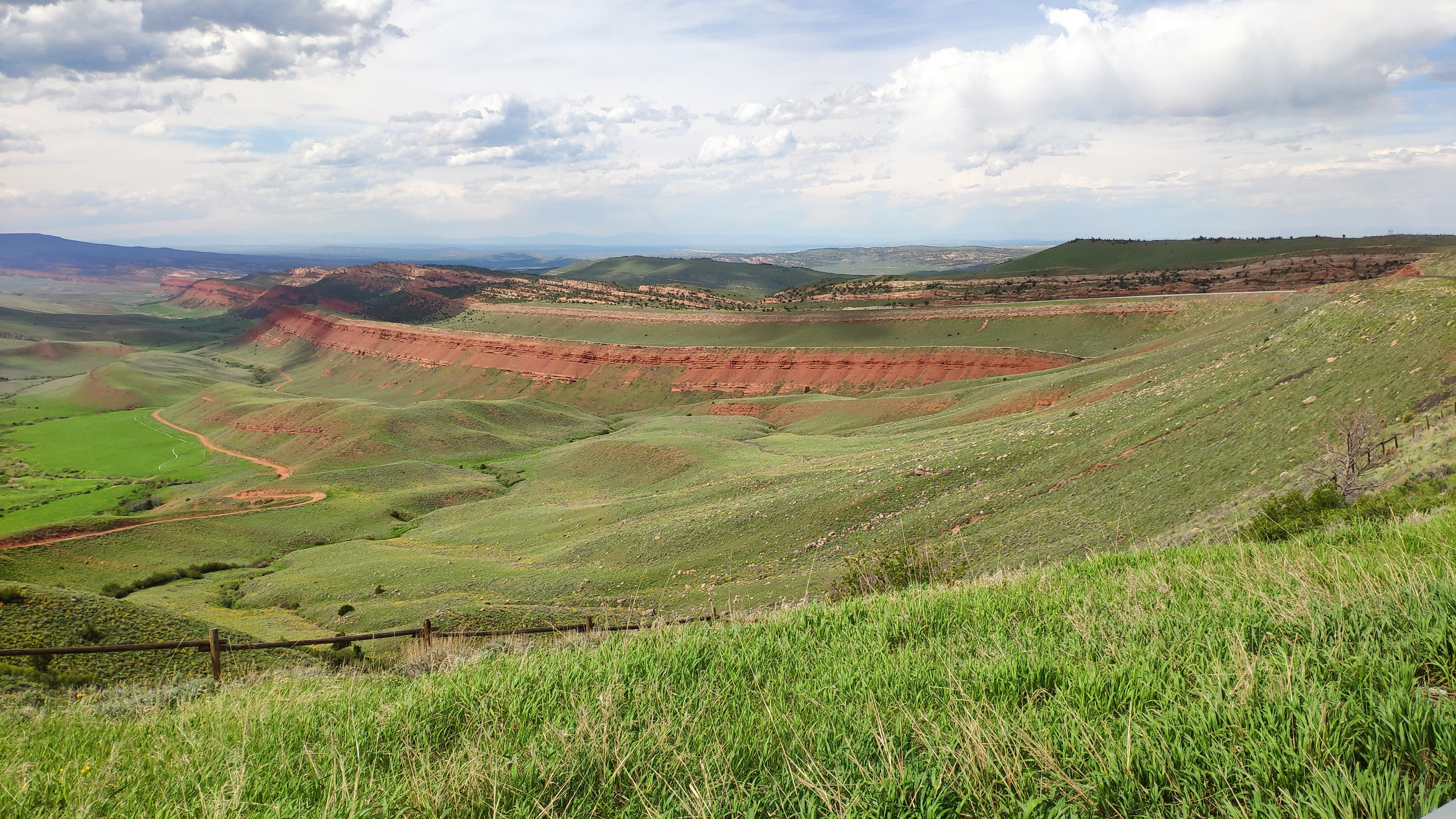
Here is an impression of the roads these lucky people have out here in the
Wah Wah Mountains:
There is no traffic, distances between villages are often over 100 kilometres - but supposedly this is not yet as desolate as where I am biking tomorrow. After 460 kilometres I arrive in Ely. What a great day. The motels internet is down, so I use my mobile phone again to connect to the web.
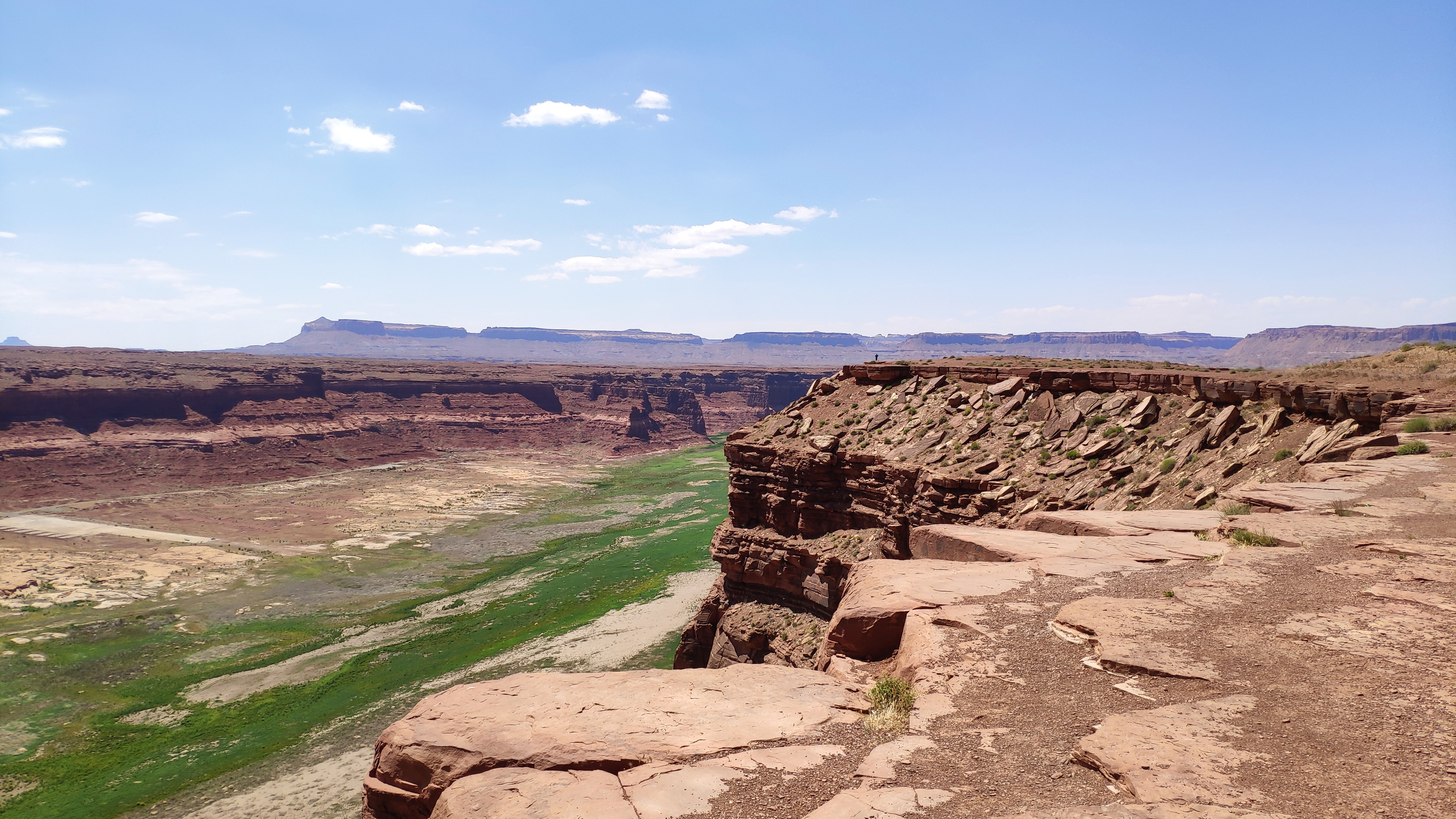
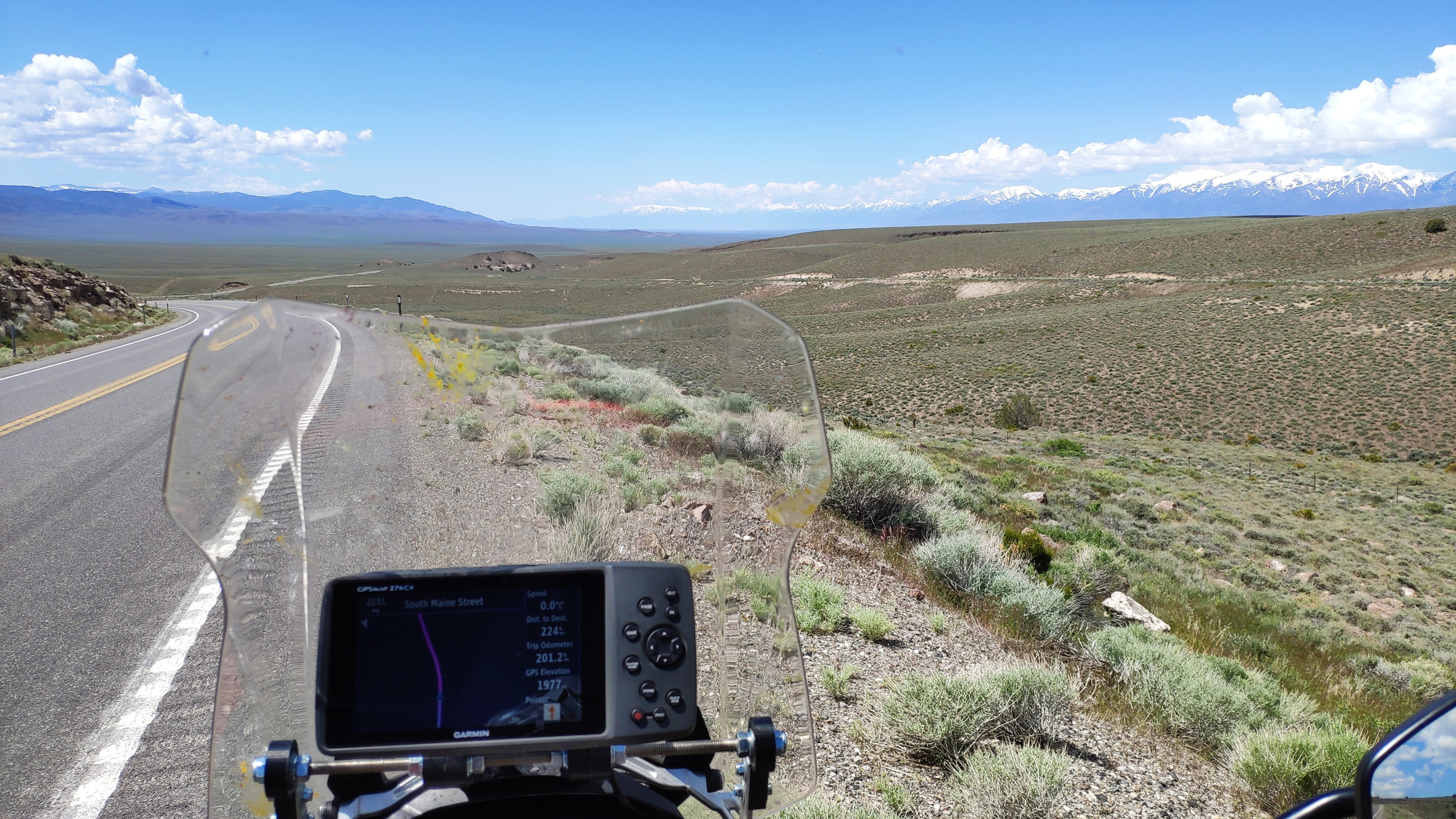
I am up early and leave Ely at 0830 hours. At the end of the town this sign explains the next 400 kilometres:
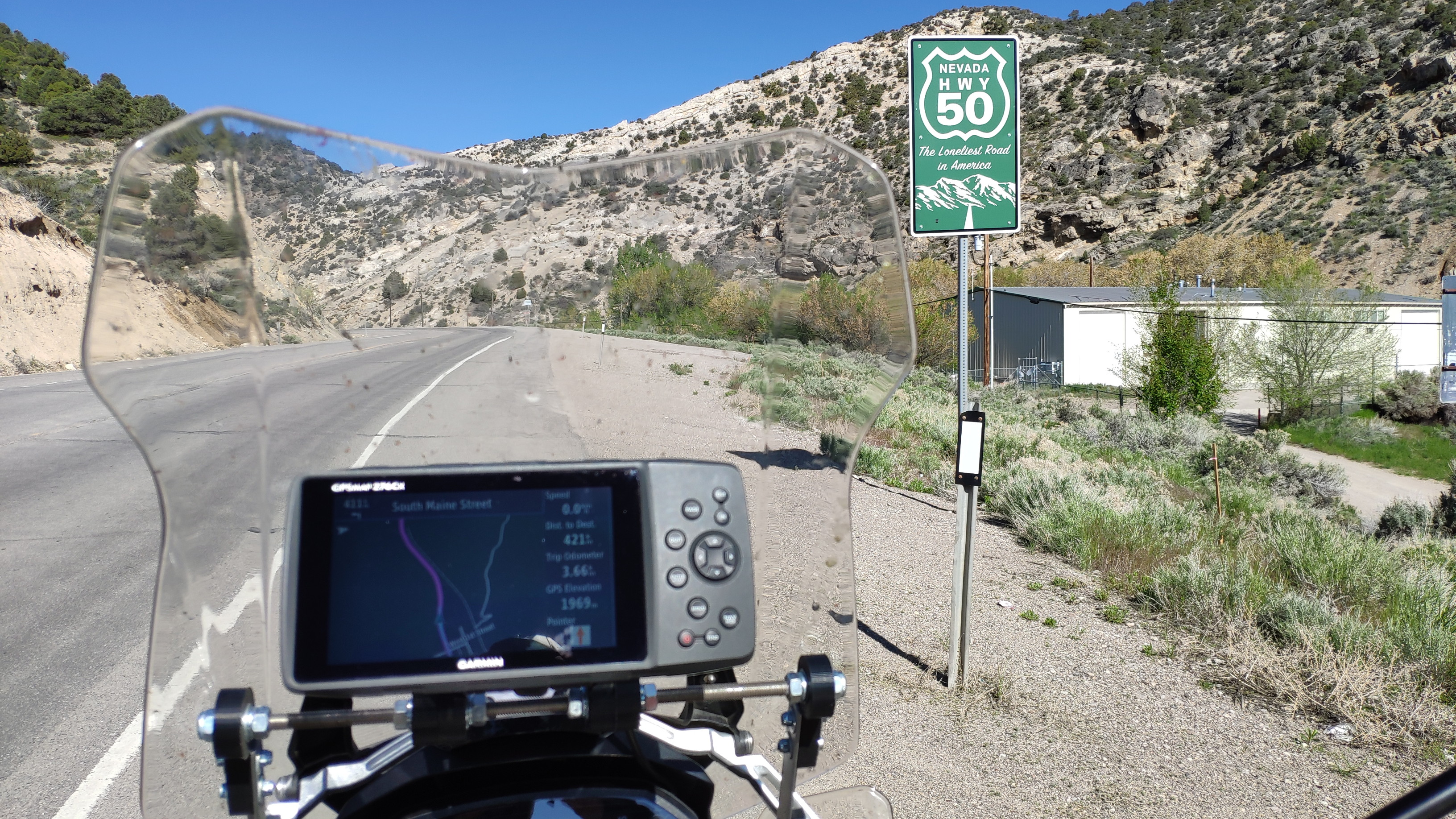
The synonym "loneliest road in America" is of course nonsense, as I have been on really lonely roads up in Alaska. But the desolation and the absence of any signs of civilisation makes this a fascinating ride. New scenic views open around every bend. The road is mostly straight as an arrow, but also contains a few twisty sections. Here is a place with a view:
Out here it makes sense to have a refuelling plan. It certainly is not a good idea to ride until the low fuel light comes on and then
start looking for a petrol station.
Ely is 2000 metres above sea, so it was 15 degrees centigrade when I started. But the road winds down to 1200 metres when I reach
Fallon five hours later. It is 32 degrees there. From Fallon I
continue north on highway 95.
25 kilometres on the builders of Interstate 80 "buried" highway 95 under the interstate, so for 150 kilometres I ride that fast road
until I call it a day after 625 kilometres at Winnemucca.
The day ends as most often: petrol station, Subway, motel. Today I immediately see that this place is a mining town, when two burly,
bearded men park this next to my bike:
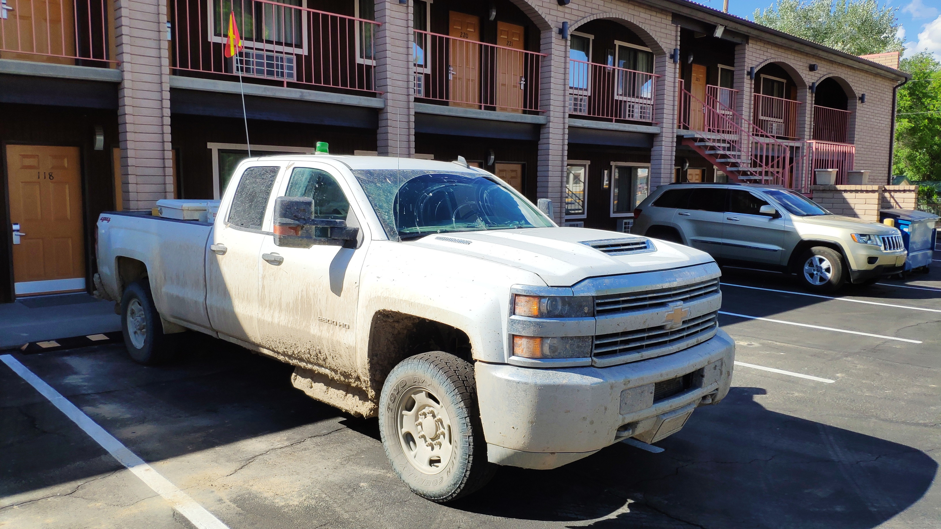
Note that red flag on that long pole on that truck. This flag must be carried by "normal" vehicles in open pit mines so that the mega-trucks that can carry up to 140 tons of ore and where the drivers cabin might be five metres above the ground can see that "tiny" truck from their elevated cabins.
Today I can bike on a proper highway again. Highway 95 runs
north-east towards the Oregon border.
Right at the border on the Nevada side is a "family cafe". Great, I fancy a break, so I stop there. Inside there is a small cafe, but 95
percent of the space looks like this:
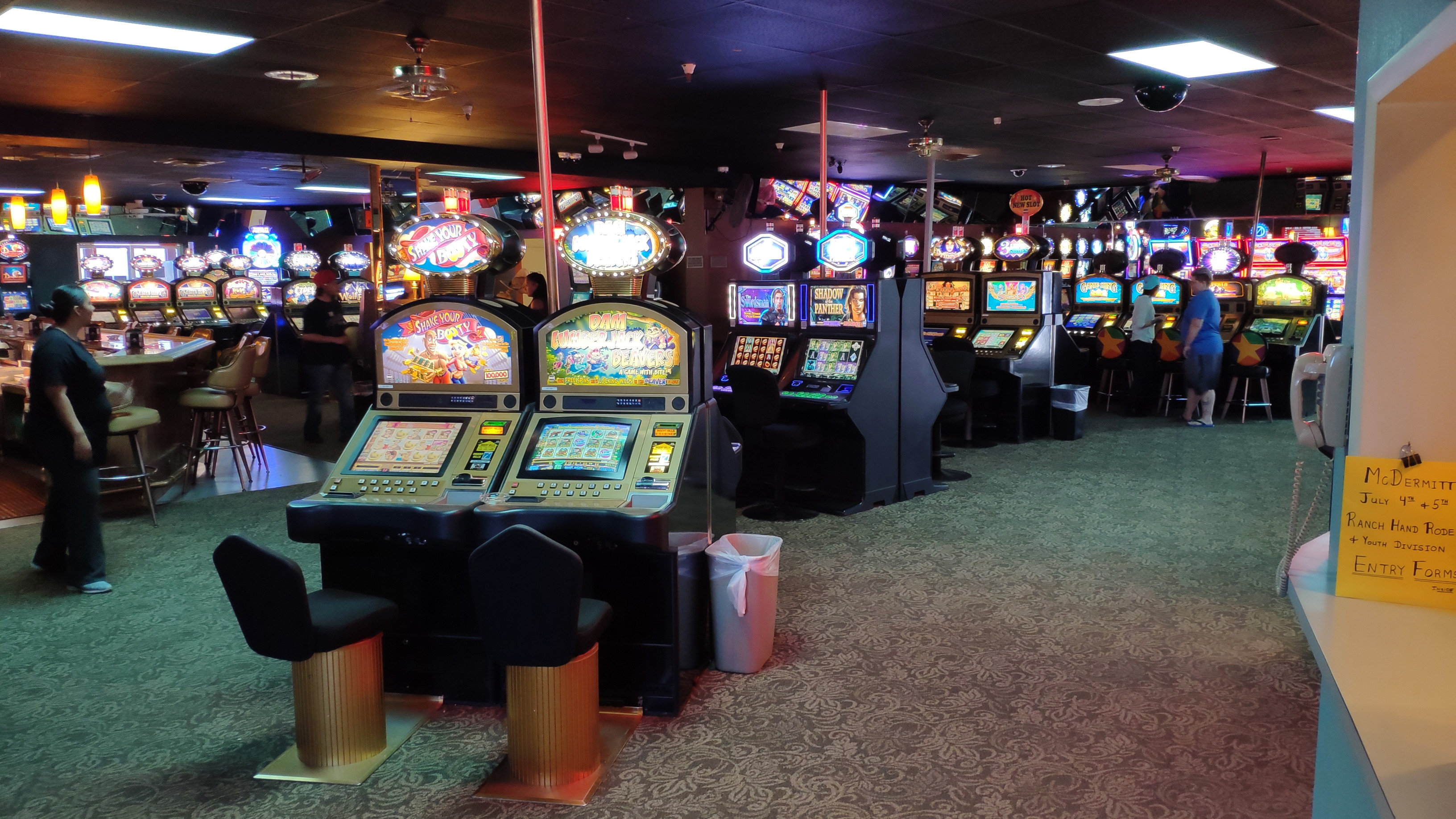
I will never understand what strange mental defect a human being must be suffering from if he feeds these machines with money. If I stand
on a planet with positive gravitation and drop a hammer, then I do not need to see if it falls to the ground. The same certainty applies
to a machine that is programmed to return only 60 cents from each dollar it receives. But obviously many of the gamblers in here are
waiting for that hammer to gently rise towards the ceiling.
I continue my ride through Oregon and then into Idaho. Here is another
scenic view along that way:
However, as you can see from this topographical map, my route (the thin red line) goes from 1300 metres altitude to 700 metres altitude into the valley of the Boise river.

This fertile valley is home
to nearly 750000 people and biking through it is urban mayhem. Due to the low altitude
the temperature rises to 33 degrees. The humidity is very low, so the heat is bearable. But the highly inefficient U. S. intersection
system with traffic lights that are unsynchronised is driving me nuts. The invention of the roundabout has completely bypassed this
part of the world. People would save tons of time, pollution and money if they would introduce 21st century traffic technology from
Europe out here. And the city would save millions on the upkeep of those thousands of (then obsolete) traffic lights.
It takes over two hours to pass through this mayhem until I reach
highway 21 which leads back uphill into the mountains.
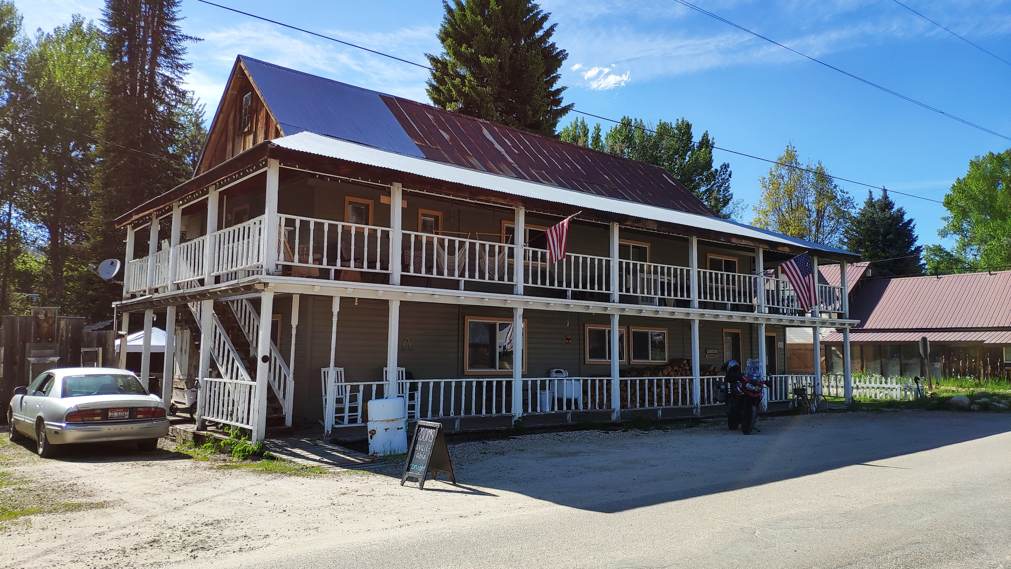
I end the day after 485 kilometres at Idaho City. You may think
"that must be the state capital", but in reality it is a tinpot little village with less than 500 inhabitants. Here is a picture of my
motel, and that is one of the best kept buildings in town:
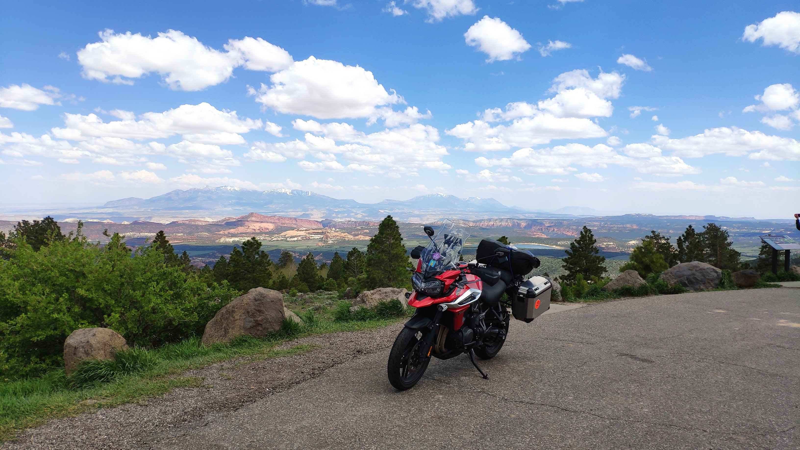
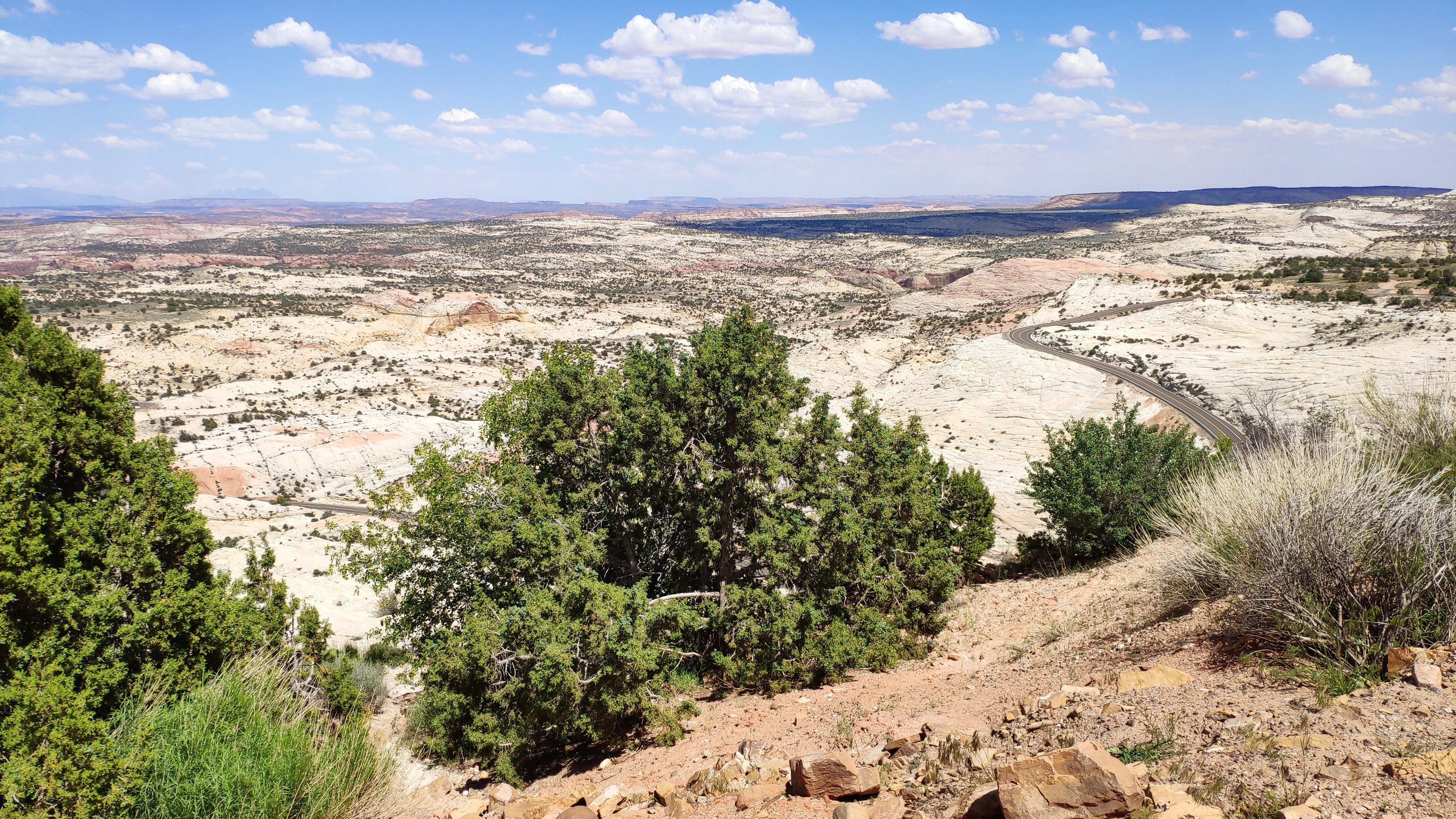
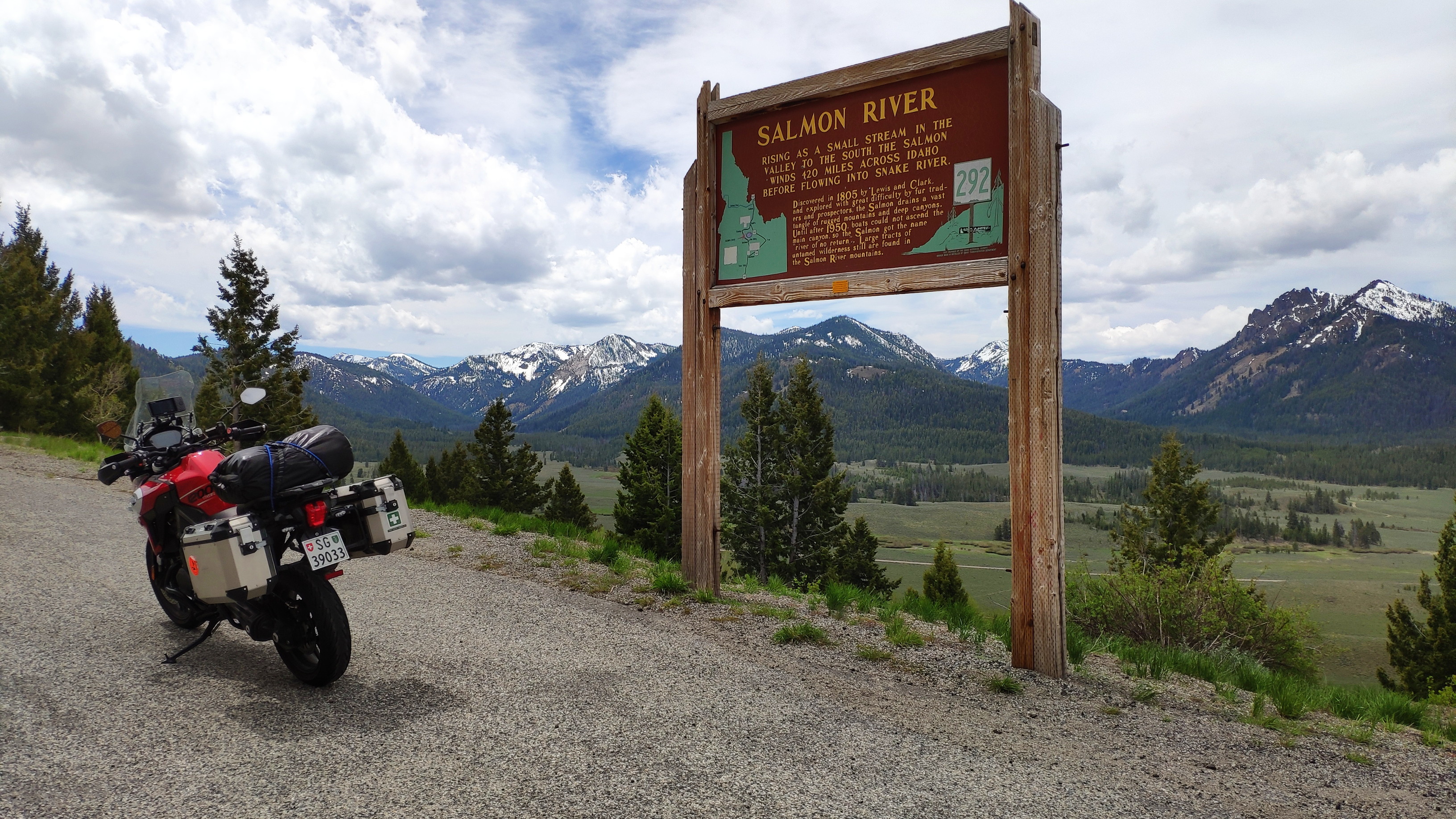
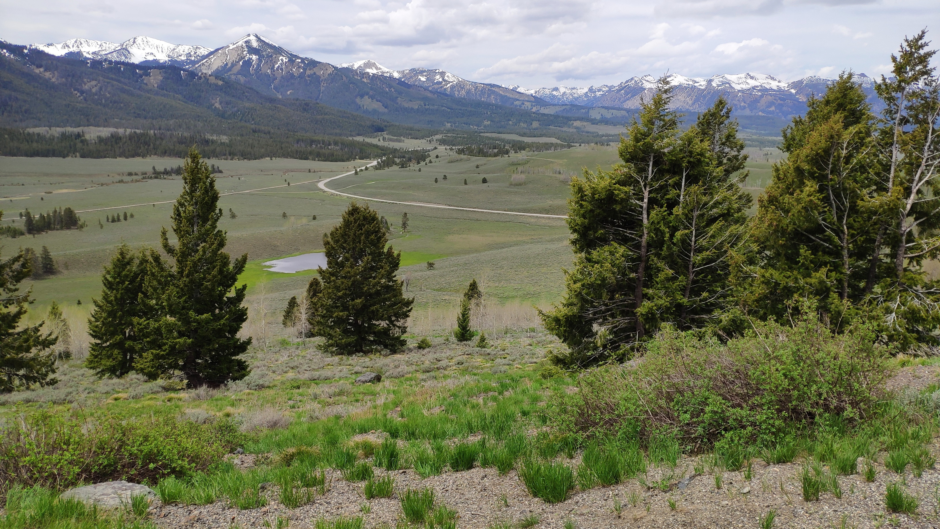
This morning I continue on highway 21, which soon rises to over 2000 metres altitude. It is a bit fresh here, so having heated grips is a great feature of my Tiger. Here are a few impression of today's scenery:
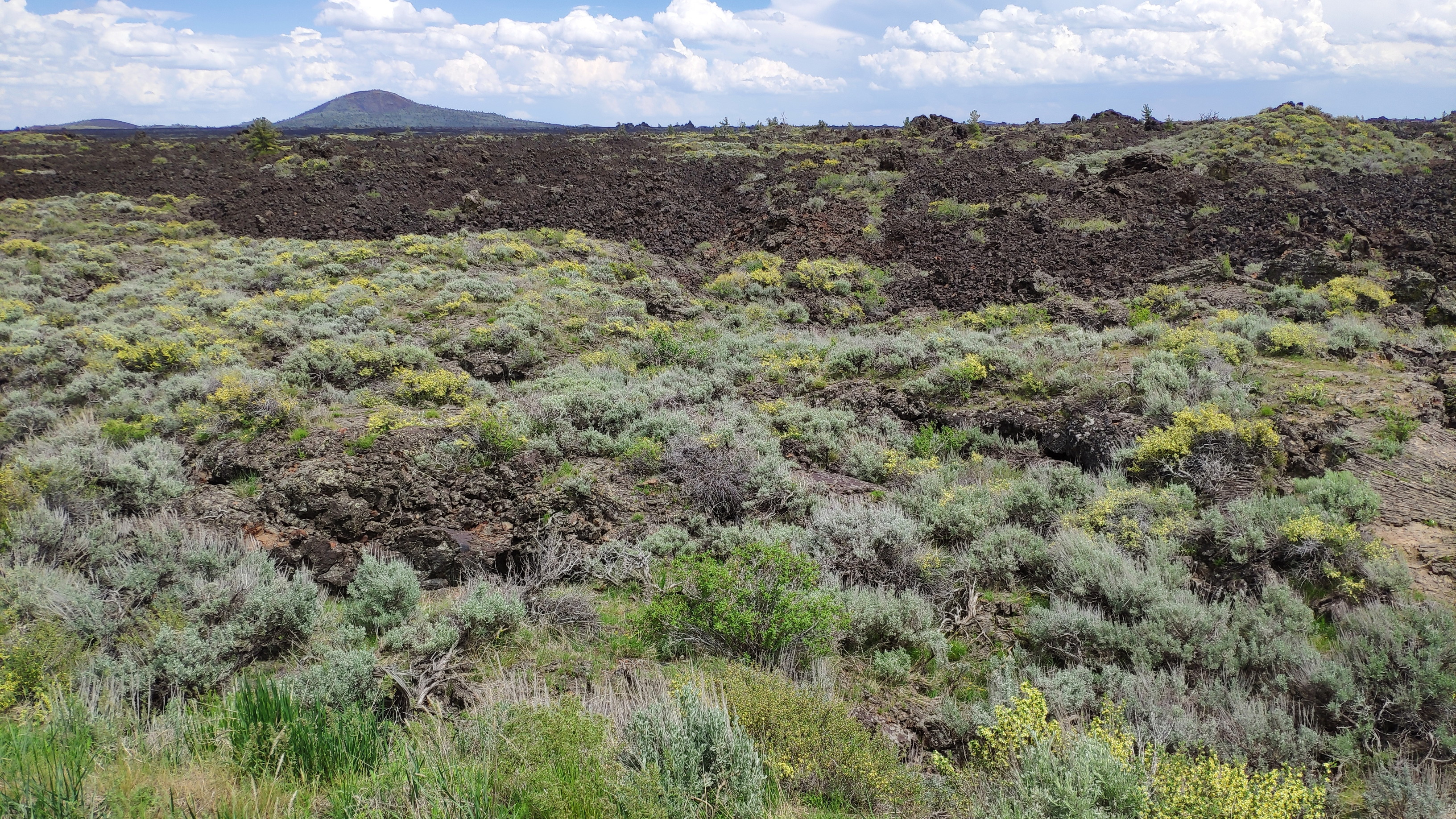
At Stanley I turn south again. The very high mountains are ideal during today's hot temperatures, but tonight a cold front will pass through and tomorrow it should be 15 degrees colder than today, so I am heading into the lower ranges. Highway 75 brings me south to the intersection with highway 26, which heads out westwards towards my destination for today, Idaho Falls. The route passes the Craters of the Moon, which are weird to look at. It is some volcanic basalt that can't store water, so vegetation can't grow on it. Here is an impression, though the Wikipedia pictures are much better:
50 kilometres before reaching Idaho Falls a thunderstorm roars in from the south and passes the road ahead of me. I stop in a lay-by and wait for it to pass:
However, this thunderstorm is followed by a true monster-storm; the entire sky towards the south is pitch black. I check the weather radar and find that the storm is heading straight for me and will cover the entire area from here to Idaho Falls. I may have half an hour before it arrives, so apologies for not taking the time to take a picture, but instead I jump onto my bike and set cruise control to the allowed maximum speed of 112 km/h. I make it into the city without getting wet. No food, no petrol, I have to find a suitable room first. I manage to get a room with some cover for my bike. When I place it where it is in the picture below, the first big drops of rain start to fall.
Soon all hell breaks loose, rain, thunder and lightning. My room neighbour arrived from the south on interstate 15 and told me that the entire road "was inches deep under water". I clearly had a lucky escape. 30 minutes later the storm has moved northwards and I can show you why the town has the name that it has:
A nearby Mexican restaurant offers "half portions" of each dish. Unfortunately a half portion is still a plate the size of a wagon wheel
and far too much food for a single person. I do my best, but find it impossible to eat more than half of it.
However, all in all this was a pleasant day with great roads and lots of things to see.
It is 9 degrees outside this morning, so clearly today for the first time during this journey I will have to get my cold weather gear out. The first 100 kilometres are fine, though chilly. Slowly the temperature climbs to 14 degrees. However, at Alpine, right on the border to Wyoming, this view greets me:
It is not nice of Wyoming to greet a foreign biker like this. I have to add my wet gear on top of my cold weather gear. For the
next two hours heavy rain is my companion. I turn west at Hoback Junction.
When I yesterday said that I am trying to keep low, then out here that is relative. The road climbs to 2400 metres and another passing shower drops
a layer of snow onto the tarmac - it is seven degrees.
While approaching Pinedale clearly something is afoot on the weather front. It
is getting warmer all the time and thunderstorms are blooming up. While filling up in Pinedale one such storm moves past just to the north of me
with a firework of thunder and lightning:
If you think that after rain, snow and freezing temperatures Wyoming is finished with abusing me, then you have another one coming; the
weather seemingly improves, the sun comes out and a wind of 110 kilometres per hour springs up from the west. If you look at my tracklog,
then you can see that my route is heading exactly southward. Experienced bikers already know what that means. Nothing is more uncomfortable
then riding a heavy, loaded bike in a storm-strength crosswind. Having my right cheek hurting from the storm pressing so hard against the right side
of my helmet and biking a left bend in the road while leaning over to the right are novel experiences - and believe me, dear reader, I have
had some during my riding career.
For 100 kilometres I have to bike southwards, while the bike behaves like a Bavarian brewery horse with a colic until I turn east
at Farson and have the wind now from behind. And that is how
I know that it blows with 110 kilometres per hour - until reaching that speed I have the breeze still blowing from the rear.
I won't allow Wyoming from preventing me to reach my destination of Lander
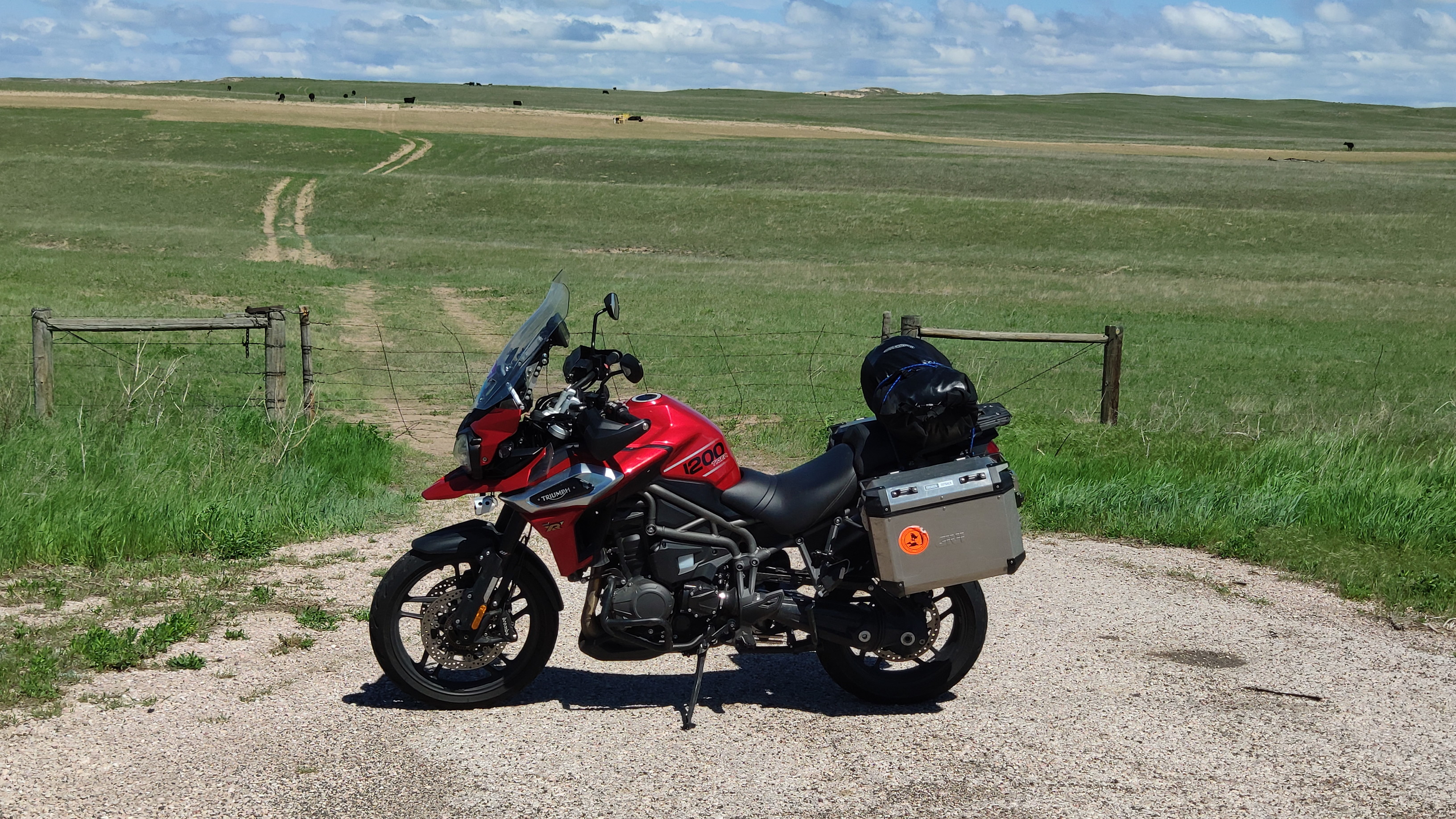
today. I even manage to take a snap of the local countryside, though the wind nearly blows me off the bike:
I am quite astonished how full the Subway in Lander is. The reason becomes obvious when I look for a room; they are having a brew-feast in town and all the beer fans from far and afield have come to town. As room prices in the U.S. are flexible (a room that costs 70 dollars on a weekday might cost twice as much on weekends if the place is in a location frequented by weekend warriors). My room costs 184 dollars, which is the priciest by far due to this beer swilling competition. Wyoming, you and I somehow don't like each other very much, and I start to understand now why in this state bestiality is still legal and a rapist can sue his victim for custody of children resulting from that rape.
When I wake up I can hear the storm howling around the motel building. The weather also looks rather dodgy, with thick clouds towards the north. I
follow highway 785 in a north-easterly direction, so the wind is hammering me again. I believe Wyoming is the least densely populated state of
the Union. I fully understand why so many pioneers of the olden days had a look at this treeless, barren and windswept land and then said
to themselves "Let's quickly get to Oregon". I find it astonishing that anybody at all decided to homestead here.
At Shoshoni the road turns directly eastwards and the wind is all
from behind. I suppose I could set a sail and then switch off the engine, as it blows again with over 100 km/h. But this northern routing has brought
me under the rain clouds and it starts to drizzle, followed by a longer wet stretch where an earlier shower has doused the road. Here is an
impression:
But other than this wet stretch the weather holds together and sitting in a dead calm while steaming east at 112 km/h is something one must
have felt to believe it.
While biking east the wind veers slowly and nearly imperceptibly north. That is fine by me, as the last 100 kilometres from
Lusk to
Torrington head due south. Lusk with 1500 inhabitants is the county seat of
Niobrara County, which is the least densely populated county
of the least densely populated state in the U. S. - why am I not surprised? Here is an impression of what the people of Lusk do; cattle ranches:
The picture was taken near the ghost town of Jay Em, and I notice
that the wind is easing off a bit. For the first time it really is fun to bike in Wyoming.
At Torrington I have some trouble finding the well hidden Subway, but by 1700 hours I have found that eating place and a nice motel - all is well. Only looking at
the bike and my biker outfit shows the scars of the battles fought during the past days. Everything is crusted with dead bugs and dirt. As
tomorrow I will probably meet Bob, I use the coin laundry of the motel to get my kit into a civilised condition again.
I am heading south from Torrington on highway 85. It
is breezy, but not so much that it affects the ride. Soon I reach the state line to Colorado - and the wind drops to next to nothing.
Wyoming has some weird weather, that is for sure.
Just before Greely it starts getting busy on the road. Soon I am
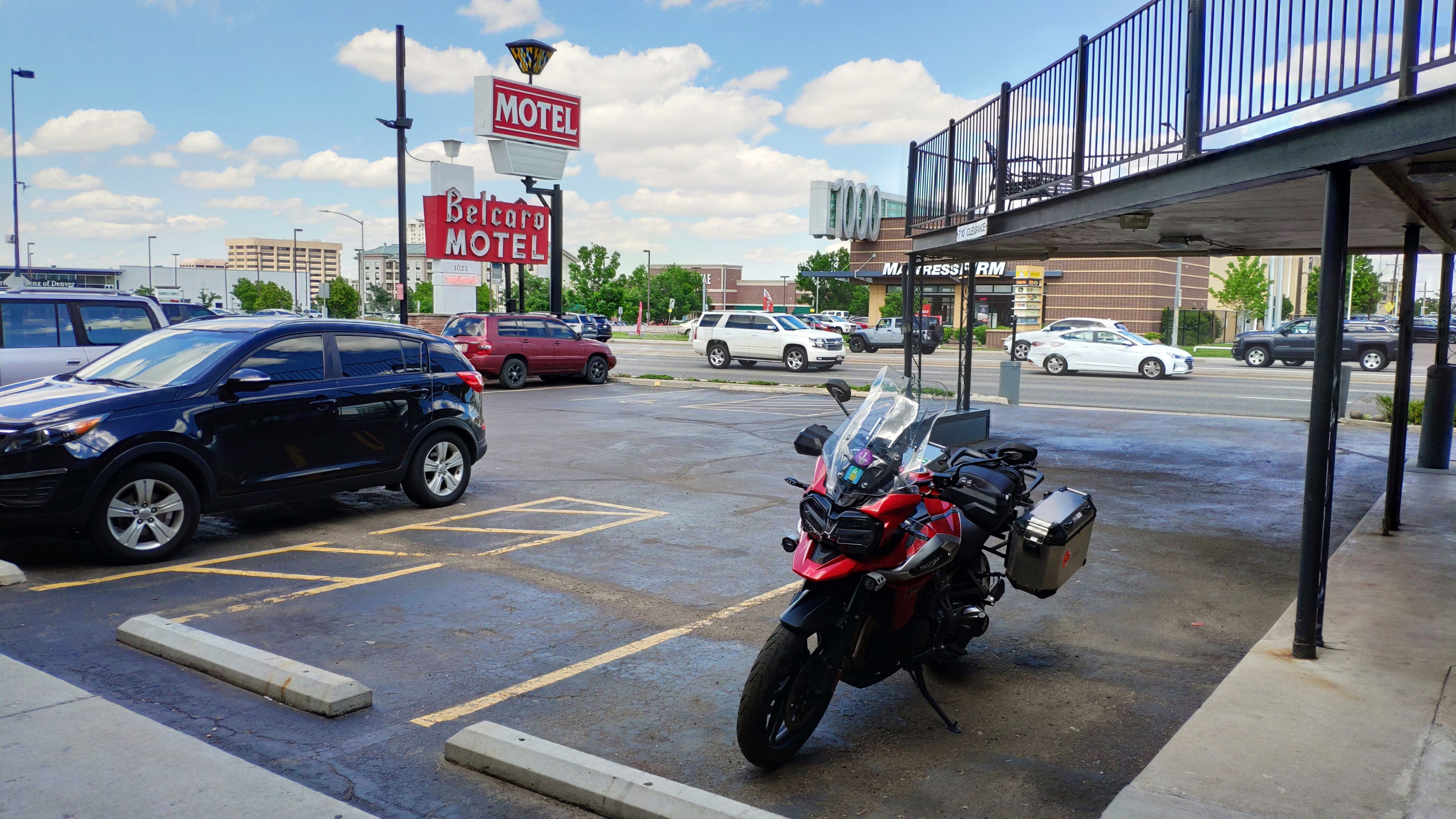
in the urban mayhem of downtown Denver at the motel where I will stay for two days.
Bob comes to visit me and we have a meal and talk bikes. Tomorrow we will have new tyres fitted on the Marsupilami and an oil change performed by Bob's favourite mechanic, Steve.
At 1030 hours we are at Steve's place, who proves to be a capable and quick mechanic. In less than one hour the new tyres are fitted and balanced and oil and oil filter are changed.
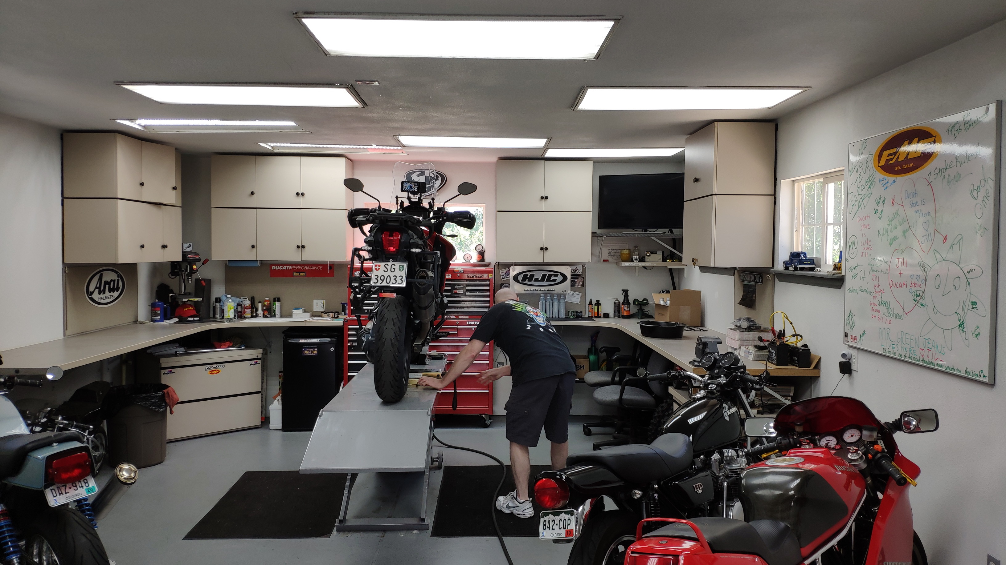
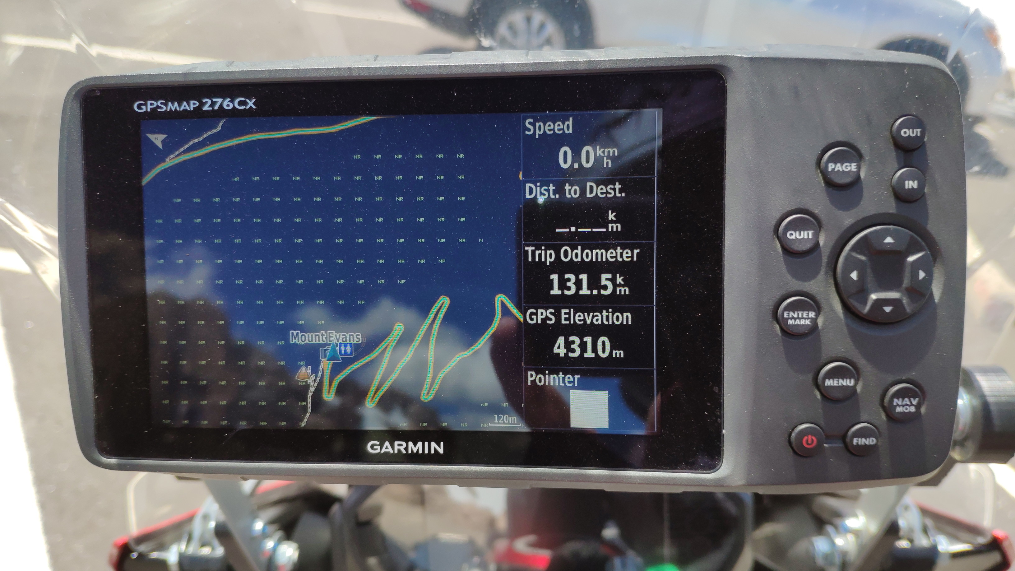
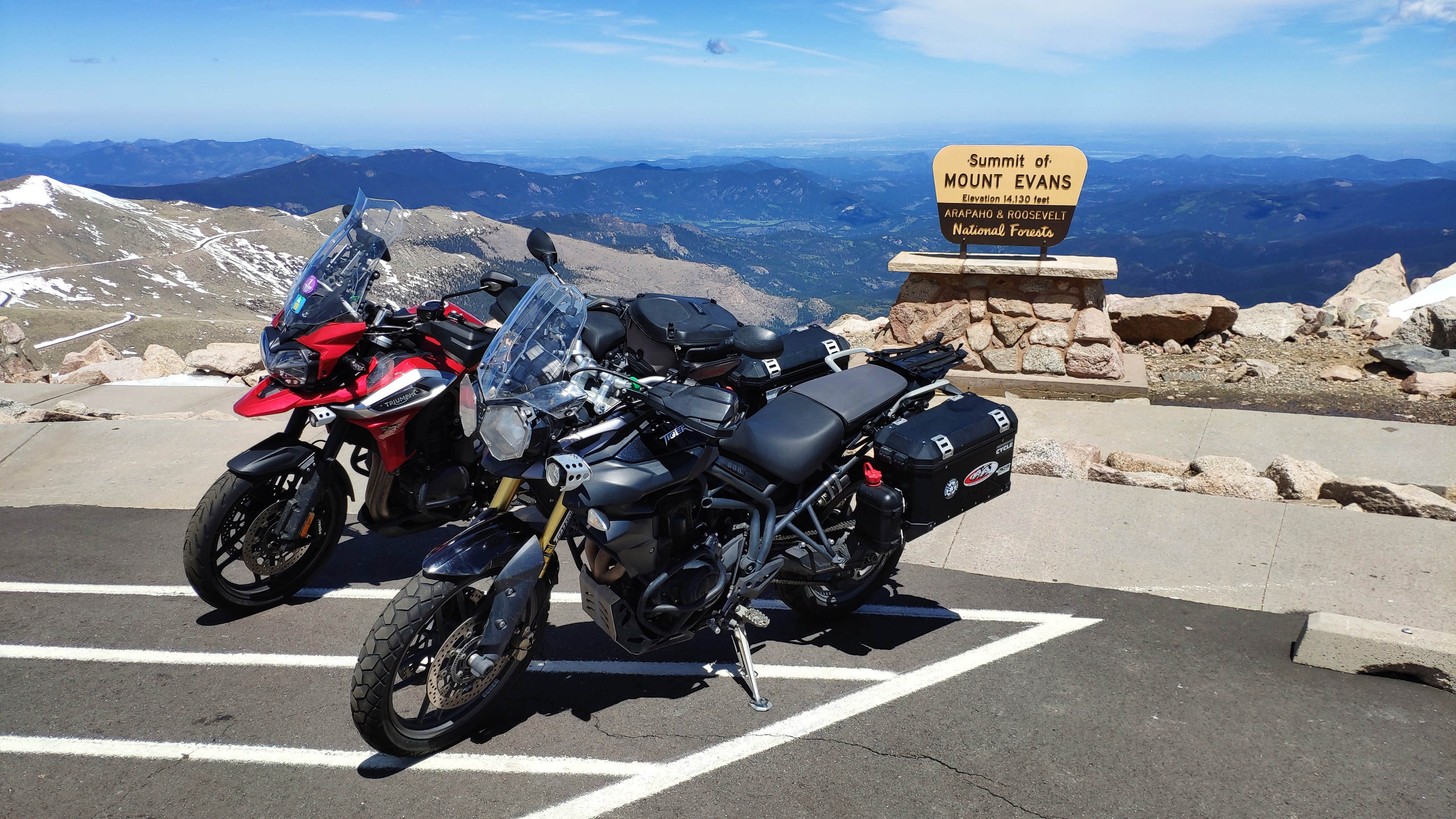
So before noon the bike is ready for twisting mountain roads. What better than to ride some, so soon after Bob and myself are on the summit of Mount Evans. Dear reader, if you have done some biking in the European Alps, then you may want to carefully read the elevation on my GPS screen, just so that you know in what league we are playing out here:
The views from up here are not bad, either:
We have lunch at a BBQ in Idaho Springs and in the evening Bob adds his routing knowledge to my route planning for the next couple of days. What a great biking day this was.
Below is the usual map with my GPS tracklog.