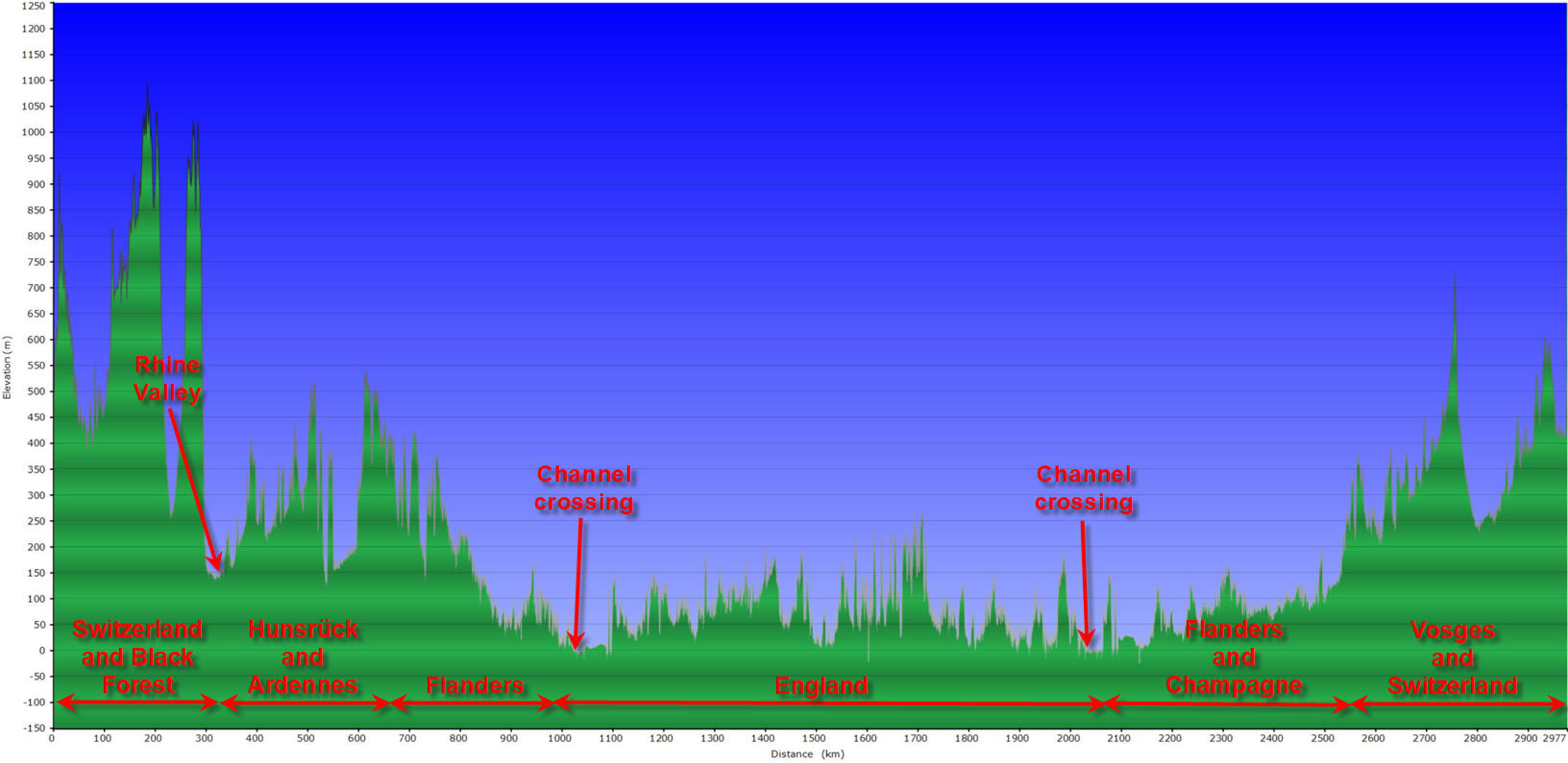
Here is the topographic chart of the week long visit to Brexistan:
Here is the altitude profile of the ride:
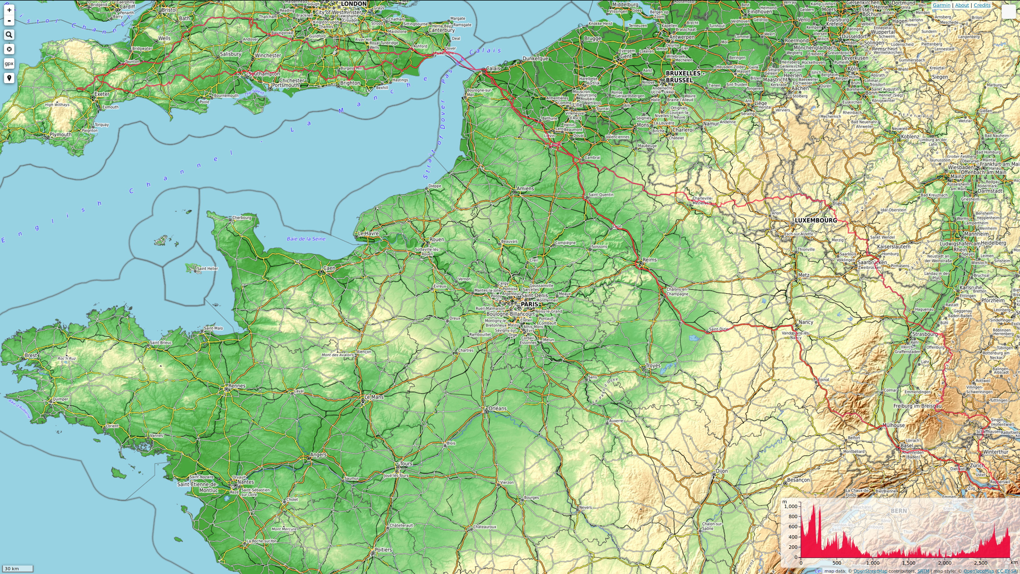
Here is the entire tracklog of the 2977 km journey to Brexistan and back. This tracklog has about half the resolution compared to the individual tracklogs on the previous pages: