- 160000 km on the bike
Two days ago the Canadian Met-office predicted a 20 percent chance
of rain for today. Yesterday they reduced that to 10 percent. In
reality there were heavy thunderstorms yesterday and it continued
to rain all night. Large puddles of water are on the parking lot.
Because of the storms I wake up at 6 am and can't get back to sleep.
So I surf the web for a while, reading about the unprecedented flooding
that is currently ongoing in England.
I also find a website, where I read that we tourists can actually
claim back the sale
tax we paid in Canada, if we are not residents here - but then
I read on and apparently this tourist-friendly scheme was abandoned
as per April 1st this year. Murphy's
law.
By 8 am the rain stops, and by 9. 30 am I am under way on a nearly
dried up road. I am heading due north, direction towards Edmonton,
through a maze of byroads and farm roads. The entire area
between Calgary and Edmonton is well populated. But once I have
crossed the North
Saskatchewan River near Drayton
Valley the scenery changes entirely.
The roads look like drawn with a ruler - I suppose you can see
here who is coming to visit you in two hours by just looking at
the far horizon. I also notice even more oil wells and many trucks
with a sign saying "oil pump collection". This is the
Canadian oil region.
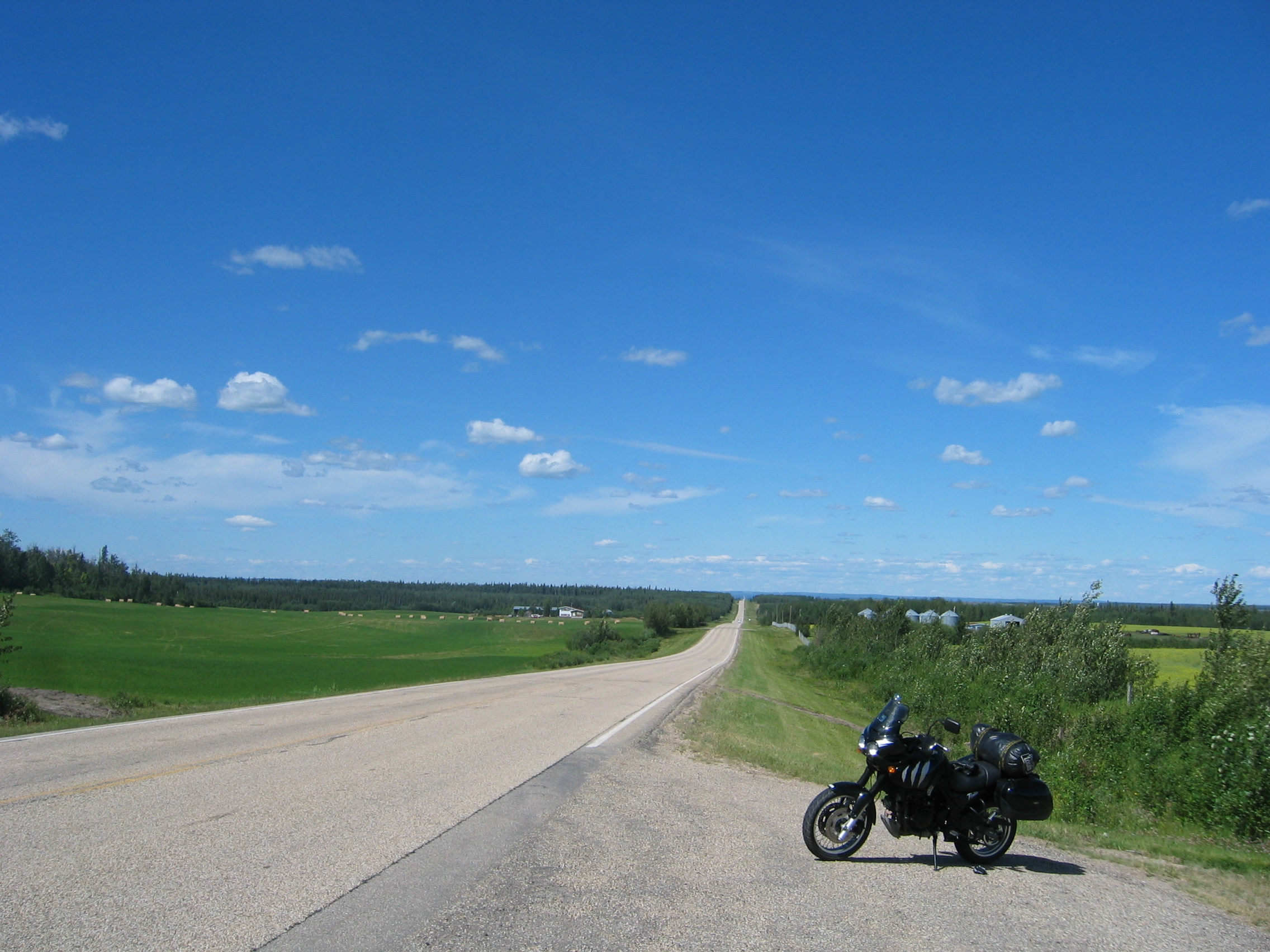
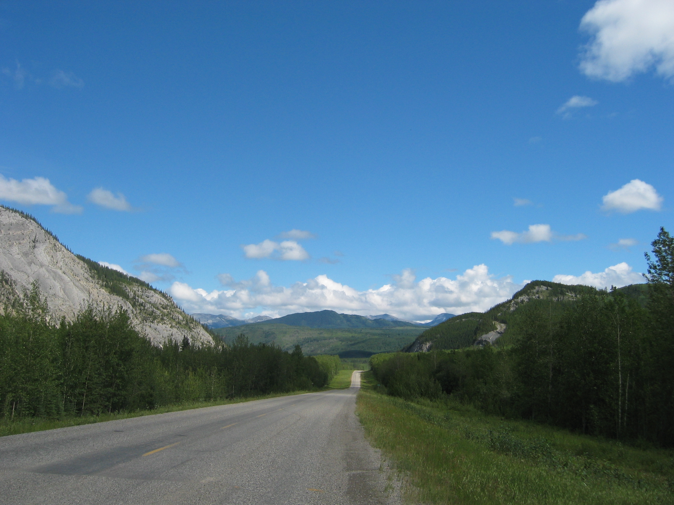
Finally I reach highway 43 at Mayerthorpe
and turn westwards. Highway 43 is currently one of the most dangerous
highways around, because of the amount of traffic and the large
building sites along it - at least for Canadians. I find the ride
sheer bliss and stop after 500 km at Whitecourt.
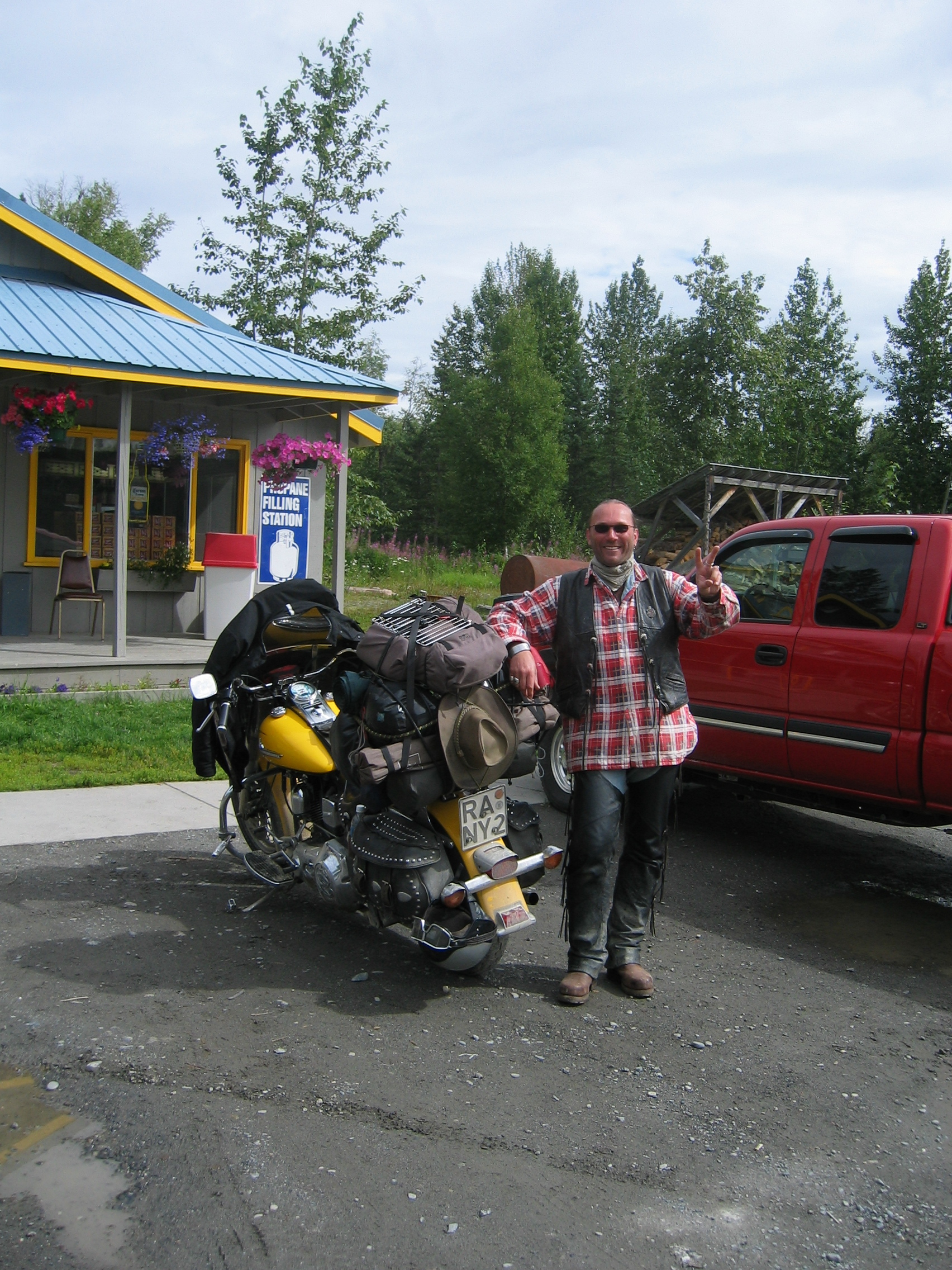
I have been asked what I am doing in the evenings and what a motel
room looks like inside. Here is how it looks - usually quite comfy:
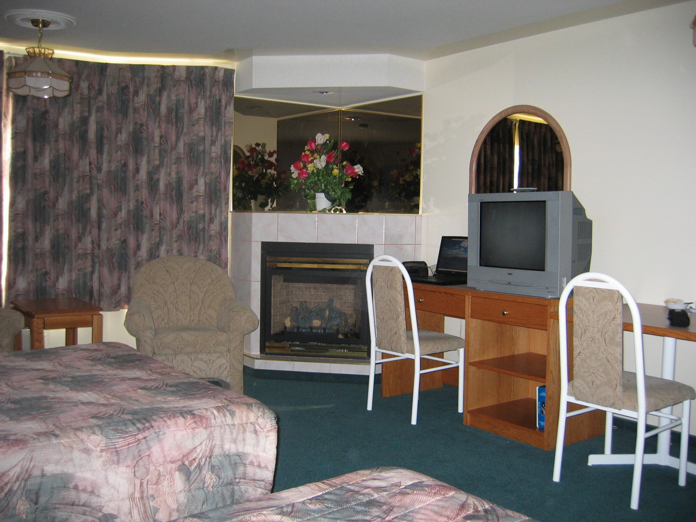
This is the one here in Whitecourt where I am tonight. For Canada
the price of 80 Canadian dollars (about 55 Euros) for this room
is quite reasonable. I have a large bed, a gas-fired open fireplace
in the corner, a kitchen with oven and fridge - lots of things I
don't need. But you see my laptop already set up and connected to
the Internet - that is something I usually enjoy in the evening
(if there are no other bikers around to have a beer with instead).
The television set has about 70 channels, but most of them are crap,
so unless I find a decent movie to watch that thing usually remains
off.
I meet another biker outside the motel having a smoke. I light my
pipe and we chat about biking. The guy is an oil worker, with 35
years experience. One can tell from the excitement in his voice
that he expects the current oil
rush here in Alberta to make everyone here rich as Croesus.
- 160500 km on the bike
After getting up so early yesterday morning I have slept tonight
like a rock and wake up as late as 8.30 am. By the time I set out
it is 10 am - and the weather is absolutely splendid; about 18°
Celsius, light winds and blue sky.
I leave Whitecourt, cross the Athabasca
River and head deeper into western Alberta. It would be futile
to show any pictures - they would just look like the pictures I
took of yesterdays ride.
But very noticeable is the prosperity that the high crude oil prices
have brought this area; everywhere they are erecting new oil storage
tanks. Big iron derricks are being erected everywhere to drill holes
in the ground. Here is a sample:
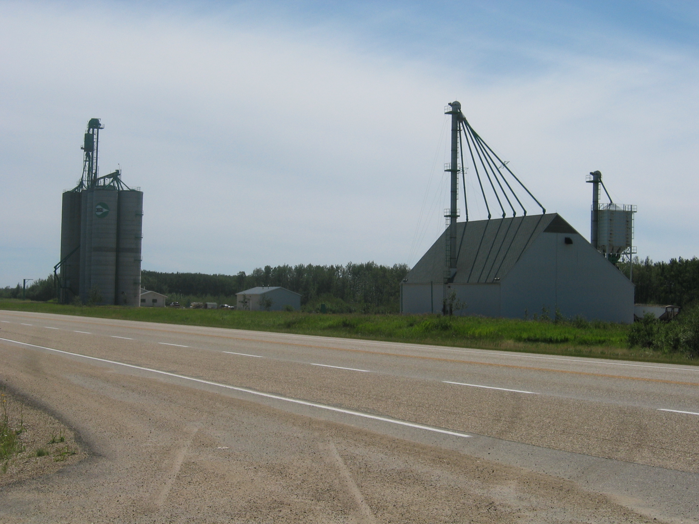
All the equipment, all the tanks and vehicles look brand new -
a proof that this oil sand bonanza in this area has just begun in
earnest.
After 250 km I reach Grande
Prairie at about 1 pm - the place is really full of dust, in
spite of the light winds. Lunch at a Pizza Hut, then I refuel the
bike, and minutes later the last sizeable town for the next 1000
miles disappears in my rear mirrors.
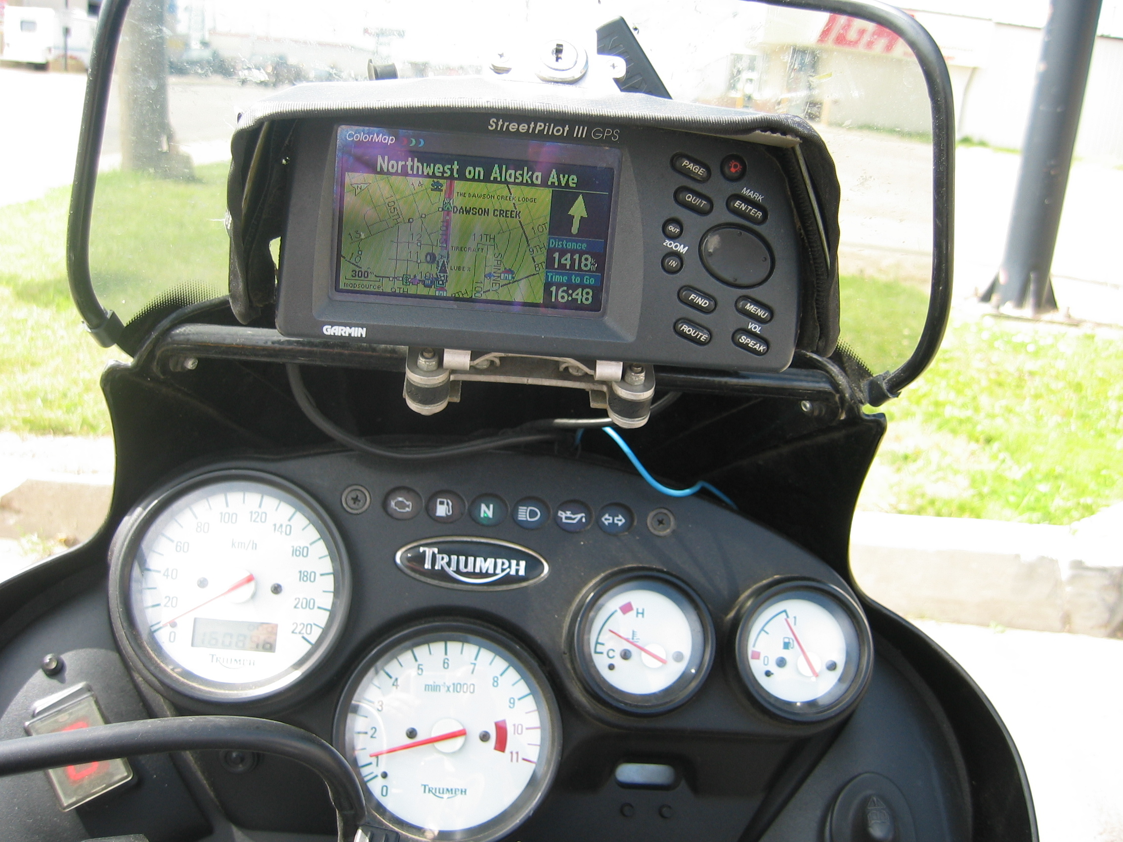
After another 100 km on highway 43 I cross into British Columbia and on to Dawson Creek. This city is the official starting point of the Alaska Highway, so called "Mile Zero City". When I turn onto this highway, Sally (my outdated GPS) gives me a very memorable driving instruction: "Drive onethousandfourhundredandeighteen kilometres north, then turn right". You are probably thinking that I am making this up, so here is the proof:
It is time to get my bearings right here; I am about to reach the end of the farm country. Any further north and I am too far up for farming, so the land will be deserted. A look at the GPS reveals that there is one more civilized place further north, the small town of Fort St. John. After that there is nothing but outback until I reach Whitehorse. It will probably be difficult to find a place to stay tomorrow, so I decide to make it easy today. I ride on to Fort St. John and after another 500 km today book myself into the "Caravan motel" there, run by a very friendly Korean ex-pilot. The motel is about 30 years old and I like these old buildings where each unit has an individual door to the parking lot. Modern motels can only be accessed through the lobby. They do this for the extra security, which the paranoid North Americans apparently need. The old style however allows me to park the bike under the verandah, i. e. protected from the elements.
- 161000 km on the bike
It did rain a lot last night, but again it stops early this morning.
I like this country, it always rains at night and never during daytime.
I set out at 10 am. Within 10 minutes of leaving the town, the last
fields disappear and the forests of the Taiga
take over the scene. This section of the Alaska
Highway, officially called highway
97, is great biker country, though sadly many of the original
winding stretches have been eliminated by cutting through hills
or building new bridges.
I see a couple of dead moose and deer along the road - the smell
which their rotting carcasses emit is phenomenal. The Canadian road
builders have cleared the boreal forest on both sides of the road
for about 100 feet, but the carcasses are proof that one can still
hit these animals.
I stop for fuel at Prophet
River, an Indian village. I see to my surprise that they only
sell regular "gas",
but no premium quality. Apparently high quality fuel is only available
in the larger towns. My heart is bleeding when I have to pour seven
litres of that stuff into Kitty to get me to the next town - it
is like giving pig fodder to an English racehorse. The 87 MON octane
shown on the pump are roughly equivalent to about 91 European RON
octane. Such low quality fuel is not even sold anymore in most European
countries. Any European vehicle in the U.S. must be fed with the
finest they have over here - as the finest U.S. fuel is just as
good as the lowest grade on sale in Europe. If your vehicle needs
European "Super" (98 or 100 RON octane or 100/102 MON)
then you are screwed in North America. The best I have seen here
are a few petrol stations on the east coast who sold 93 MON octane
(97 RON), but west of the Mississippi
91 MON is the best they sell.
Luckily there are no steep mountains here and I take it easy on
the throttle, so I hear no pinking
from the engine.
Opposite the petrol station is a restaurant where I get some lunch.
I meet two Harley bikers, Don and Anna from Florida, who are heading
north as well.
We talk some petrol and the time flies by, so I ride on two hours
later. By 4 pm I reach Fort
Nelson and finally fill the bike to the brim with what goes
around here for "Premium" petrol. I have done only 350
km today, but beyond here there is just pure Taiga for the next
500 or so kilometres. There are a few tiny Indian reservations,
but what kind of accommodation they have on offer is an unknown.
So I call it a day and book myself into the local Super
8 motel. Super 8 is branded as a budget chain, but the rooms
here cost 160 dollars. I am not surprised, as my previous research
has shown that up here everyone charges what I call the "outback
surcharge".
This town is also in the oil and gas business. A large gas
processing plant and oil drillings surround the entire area.
Given the fairly high room prices here and the fact that for tomorrow
the target is already dictated by the location of the next village
down the road (which is just a piffling 525 km away) I do some research
on the web to find something cheaper and book a room in advance
at the old Airforce
Lodge in Watson
Lake.
- 161350 km on the bike
I'm off at 9.30 this morning. It is dry, but big, black clouds
loom ahead and within 15 minutes of leaving Fort Nelson it starts
to rain. But the temperatures are moderate, so wearing the wetgear
is no problem.
Initially the road follows the Muskwa
River westwards, but after a few miles the river turns south
towards the mighty Mackenzie
River, while the road continues westwards.
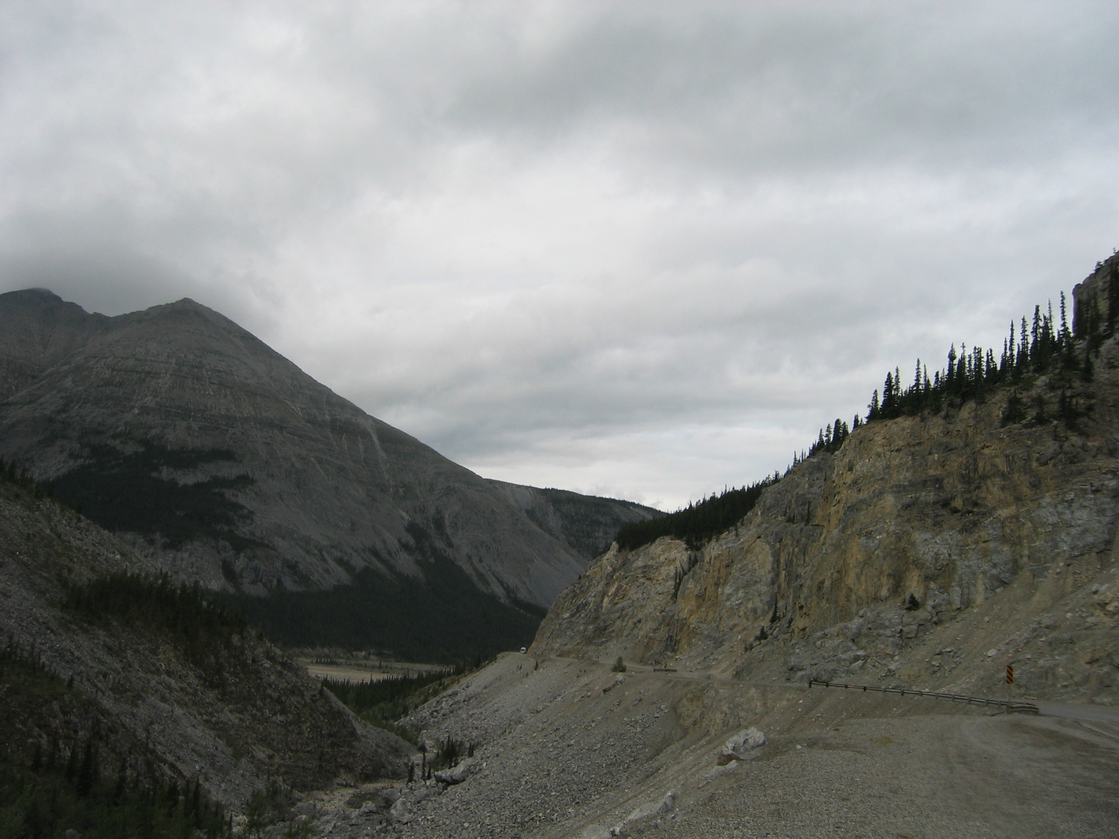
The scenery out here is breathtakingly strange - I have never before biked through the Taiga. There are just a few tiny Indian reservations around and the odd supply village, like e. g. Toad River, where I add another eight litres of revolting regular petrol into Kitty's tank in order to make the 500 kilometres to Watson Lake, and also have a surprisingly tasty lunch. I also meet there a BMW biker from Windy City who is on his way back home, and naturally we exchange route information. I am in for 200 km of bad roads. They are repairing the worn out surface using "gravel patching". They spray hot tar on the surface, cover it with loose gravel and let it there for a few days, then brush off the excess. Of course, while the loose gravel is on the road, every oncoming vehicle or truck turns itself into an automated shotgun, firing gravel like missiles around.
I get hit a couple of times quite badly. I am going to find a few
bruises this evening, but luckily there is no damage to the bike
except for a direct hit on the right indicator, which I can repair
with some tape.
Finally after over two hours I reach the head of the repair work.
A lady worker stops all traffic, as the crew is just moving its
equipment off the road and pack up for the day. She ensures me that
the gravel will be gone in 48 hours. I wonder how much more damage
that stuff is going to cause in those two days.
Sitting idle for 20 minutes out here brings the mosquitoes out in
force. To my relief I find they are related to European mosquitoes
and not to New Zealand mosquitoes; they just don't like my blood
and leave me completely unharmed.
Aside from the friendly mosquitoes I have today encountered mountain
goats, a not so wily coyote
and the biggest (though dead from an encounter with a motor vehicle)
moose
I have seen so far. There were also several buffalos
along and on the road. I always thought these animals were only
to be found in herds, but today I just see several single buffalos.
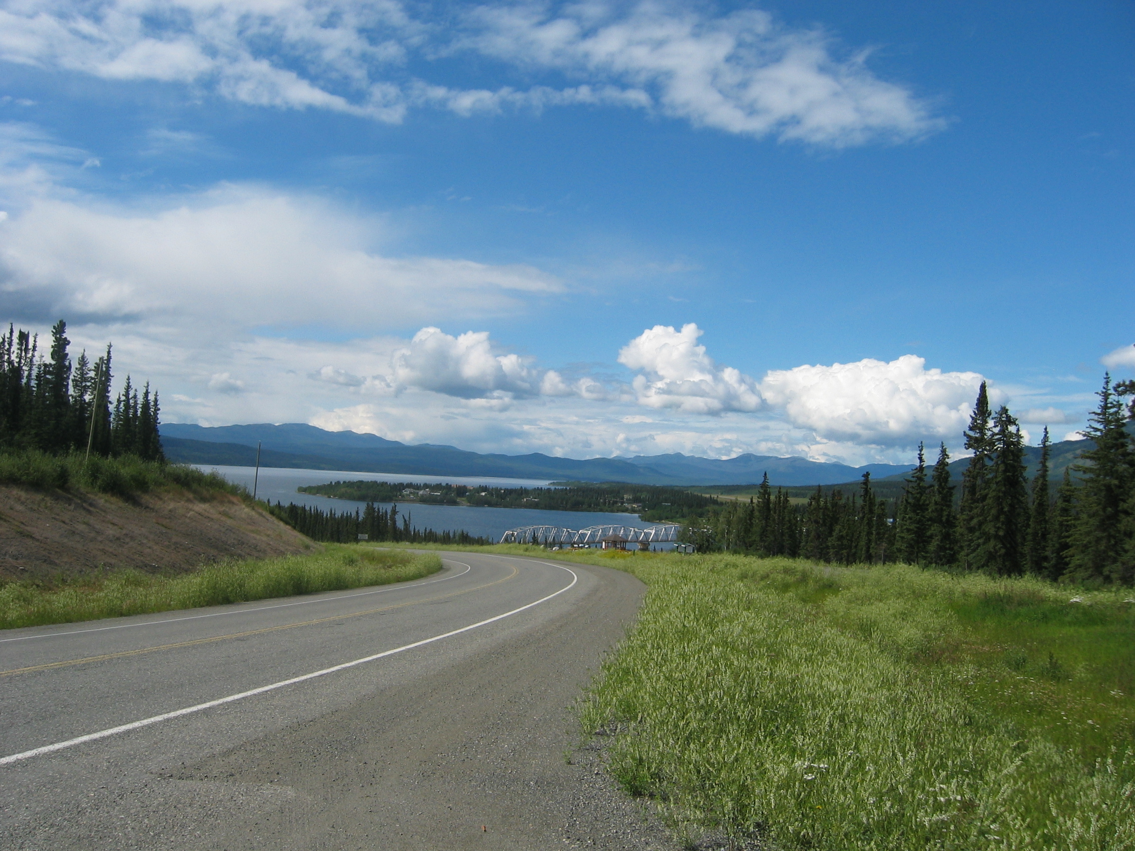
Just after I am through the roadworks, a road sign informs me that
I am now officially biking Yukon.
Unless you live here or have been here you probably have no idea
what that means. Let me put it into a simple sentence; Yukon is
five times the size of Portugal,
with a total population of just 30000 souls, of which 22000 live
in the state capital Whitehorse.
By 5 pm I arrive in Watson Lake and at my pre-ordered room (this time
for 58 dollars). This place is fairly rustic compared with the lavish
room last night, but all I need at the end of a day is a pillow
to put my head down upon.
A heavy thunderstorm starts later this evening. At about 9 pm the
landlord knocks on my door; apparently the rain has softened the
ground and the motorbikes outside are in danger of toppling over
due to the sidestands sinking in. He hands out solid aluminium plates
which we bikers (there are three of us tonight) can place underneath
the sidestand to spread the load - a very nice extra service.
- 161850 km on the bike
Next morning I set out at 10 am on the 450 km stretch towards the
"next village down the road" - towards the state capital
of Whitehorse.
I am just over the Liard
River when while having a short break a huge all-wheel drive
campervan with German number plates stops next to me. I have a chat
with the two owners, who explain that they shipped that monstrosity
to North America because they would now need a local guide if they want to drive
through the Sahara
desert in Libya.
Having just come to terms that apparently half of Europe has shipped
their motors over here this summer, a van with Zurich
number plates stops next to us.
This pastime of biking through Yukon is rapidly turning into a
burlesque. What good is it to be here, if Swiss-plated vehicles
are virtually running all over each other up here?
I am somewhat consoled when the retired Swiss couple occupying above
vehicle explain that they are on the road now non-stop for six years
- oops, I now understand; spending our kids inheritance. That's
a scheme I can support. We have a brief chat, then all three parties
continue with their various journeys. Mine leads me westwards to
the tiny hamlet of Teslin
on the lake of the same name.
Again I have to take onboard eight litres of regular petrol in
order to make it to Whitehorse
(well, I would have probably managed without those eight litres,
but out here you do not want to take chances). I also have another
surprisingly good lunch out here at the Dawson Peaks restaurant,
just 5 km out of the village.
In Teslin I also notice a very strange BMW motorcycle, featuring
a Chinese
number plate. I am intrigued, so I have a close look; the bike
belongs to Jack
and Janet, who set out a while back from China and have also
seen a lot of this planet.
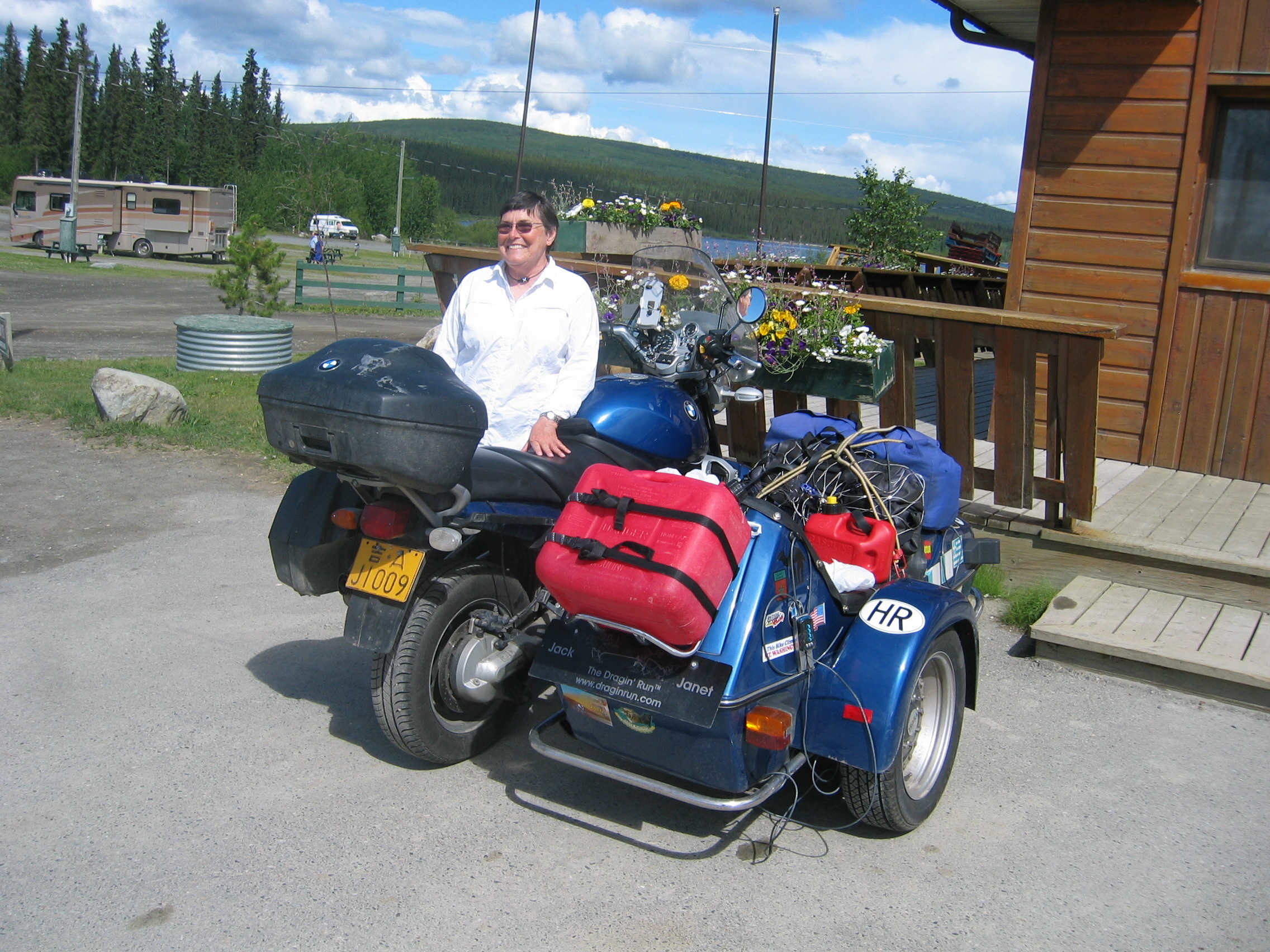
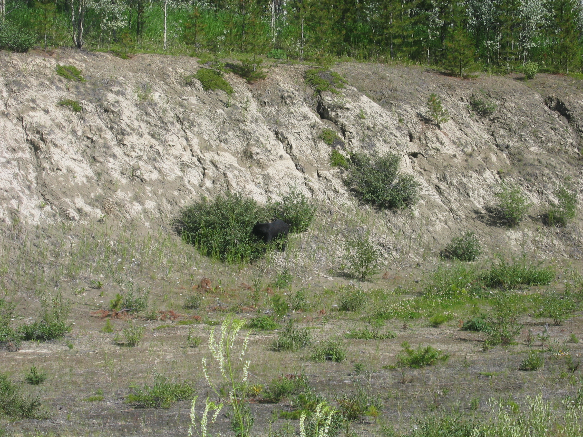
After a brief chat and shooting above picture I am off again. But this day of weird encounters is not yet over; a few miles on I see a Black Bear just off the road. The animal is completely ignoring the highway next to it, so I take the opportunity to stop the bike and take this picture (honestly, I did not copy it out of National Geographic, I took it myself this afternoon):
Finally by 5 pm I reach Whitehorse, where at the downtown Stratford
Motel I get all mod-cons minus Internet access for 79 dollars. My
room neighbour is called Paul, and he is up here on a Suzuki cruiser
out of Calgary.
I also meet my other neighbour, Dan from Pennsylvania,
up here on a large scooter. We go out for a beer together and talk
petrol.
Paul is planning to continue on the Alaska highway towards Fairbanks,
but by the end of the day I have him halfway convinced to divert
and bike with me up the Klondike
highway north and then take the Top
of the World highway into Alaska.
- 162300 km on the bike
It is obvious, that Paul must have found his optimism regarding
tackling the Klondike
and the Yukon
River with his bike at the bottom of his beerglass. When I wake
up at 8 am he has already disappeared.
I check the weather on the PC in the motels reception area. When
I want to tackle unpaved roads, weather is of major importance;
the road would ideally be just a little wet. This will prevent the
dust flying up in plumes. But it shouldn't be completely soggy either,
because it then gets muddy and dangerous to bike.
My research finds that if I ride up to Dawson
City tomorrow and tackle that unpaved section the day after,
then I should have ideal conditions. So I decide on the spot to
stay a day more in Whitehorse.
This gives me time to see to two problems on the bike; ever since
being bombarded with stones on that evil stretch of the Alaska highway
the front right indicator doesn't work anymore. And the rubber covering
my throttle grip has completely disengaged itself from the plastic
body below. This makes the throttle feel rather spongy at times.
I buy some glue and fix that problem. The indicator is also soon
fixed; a stone has cut through the feed-wire like a razor-blade.
The rest of the day I do explore the town and also buy a new cover
for the bike (you may remember, the one I had with me last year
packed up during my stay at Nick's barn). The new one is a typical US
American product: clunky, heavy and not really made very well, but functional
and well suited for the job.
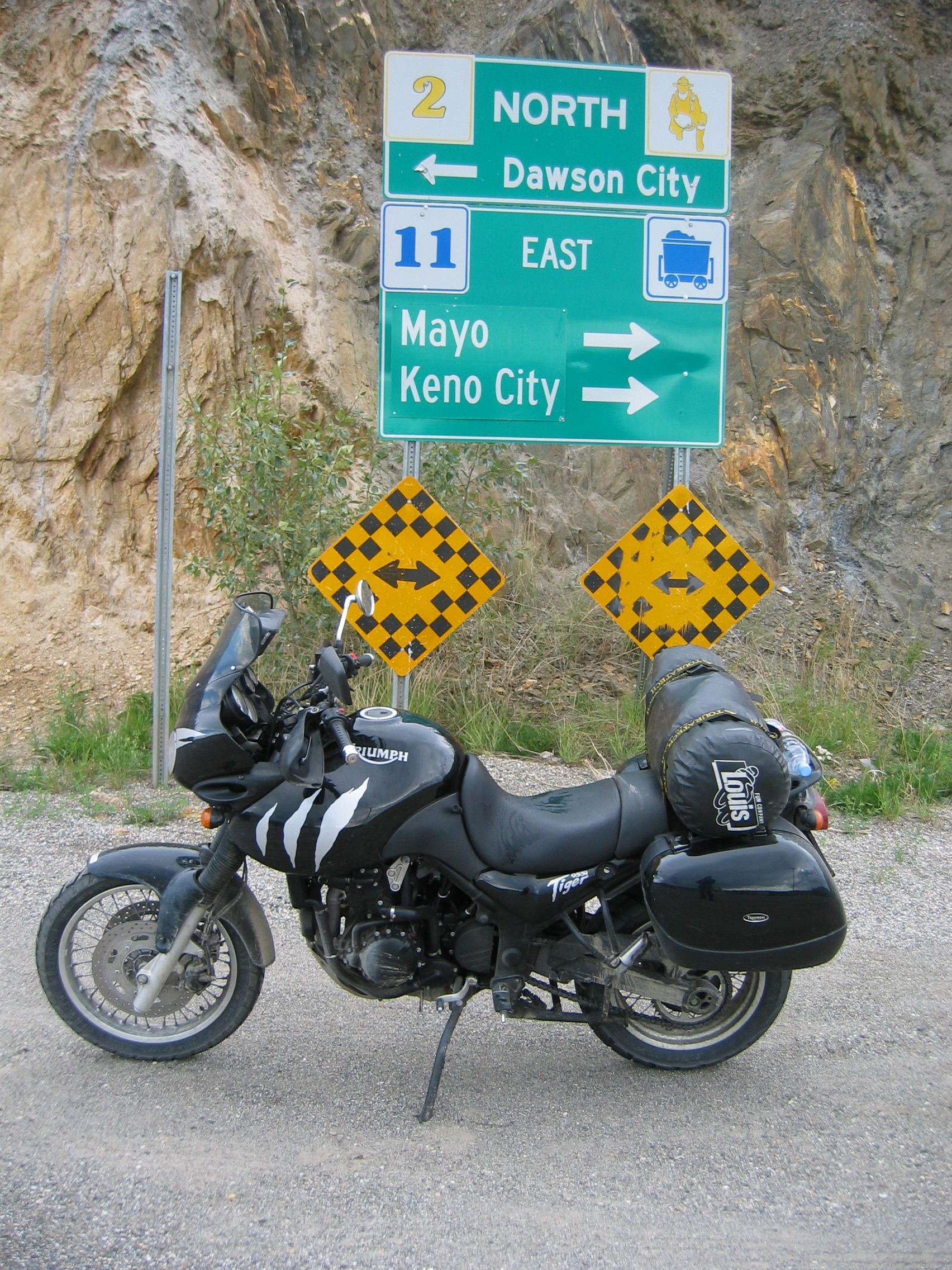
Next morning I set out due north, leaving the Alaska highway and head for Dawson City on the Klondike highway. The Yukon River takes a wide diversion eastwards, so I ride through unspoiled wilderness for two hours until I reach Carmacks. They have premium petrol there, so I stop and refuel. There is also a restaurant next door that serves a lunch special. A campervan with British Columbia plates stops next to me and the driver hops out and talks to me in French - with a heavy Swiss accent. He is in fact from Interlaken, but being retired he rather spends his summers up here. It becomes obvious that Switzerland must have at least twice the population than reported in the last census - just the other half is permanently globetrotting somewhere on this planet.
Crossing the bridge over the Yukon means that from here onwards
the road will follow along the river. The scenery up here is awesome.
By 5 pm I reach Dawson. It seems the place has not changed since
the days of the gold rush; western-style wooden buildings, mud roads
and wooden sidewalks.
I get a room at the Midsummer Sun hotel. The room is crammy and smells
odd. The building is "a historical landmark", I am told
by the landlady. Sorry folks, where I come from we do not list such
ramshackle junks, we just bulldoze them and replace them with buildings
fit for human habitation.
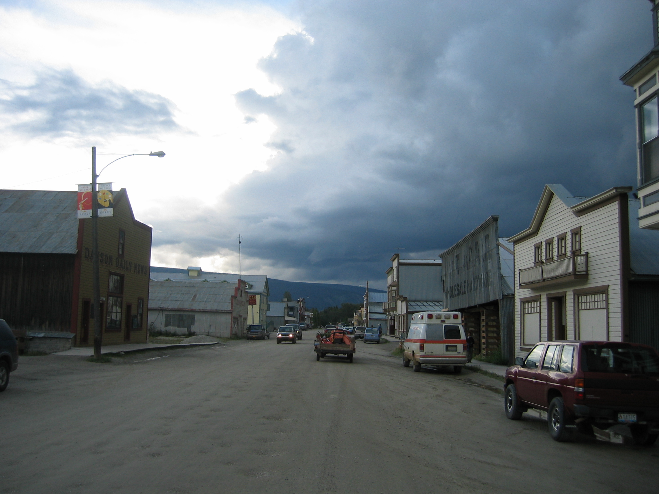
A stroll through Dawson in the evening reveals that my hunch was right; after plundering the treasures of nature the locals have now begun to plunder the pockets of the increasing number of tourists visiting the crumbling town. Not really my cup of tea.
- 162800 km on the bike
The thunderstorms yesterday evening should have left the road ahead exactly in the condition I like them best; slightly wet, but not too muddy. At 10 am I set out upon the Top of the World highway which heads out of town and over the Yukon via a ferry.
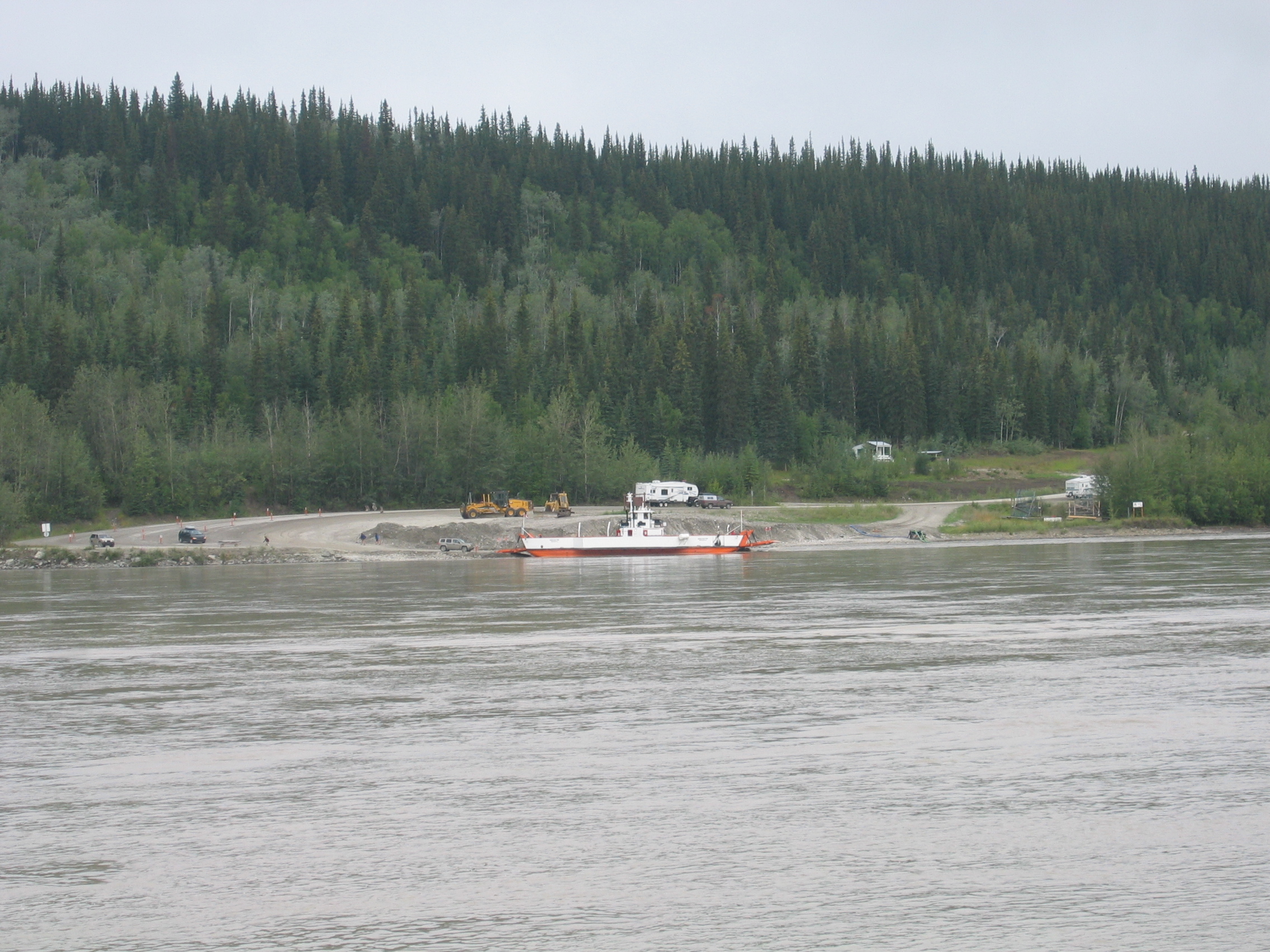
Old pictures in town show that a cable ferry used to operate here.
Why it was replaced with a diesel ferry is beyond me, particularly
as the river runs very fast here. One engine failure and the boat
will be halfway to the Bering
Sea before they bring an anchor down.
On the far side the tarmac continues on and off for a few more miles,
then the gravel road sets in for good. Again, the scenery and the
sights are breathtaking.
Soon I reach the border to Alaska. My visa waiver is still valid,
so it takes only 20 seconds to pass. There is a German-plated
campervan at the border in front of me, which apparently also
has seen some parts of the world.
At many places the boreal forest has been burned down by
wildfires. Conveniently there are signs on the road, indicating
how long ago the fire occurred. I am amazed to see that a forest burnt
down over 50 years ago has only grown anew to about 20 feet high.
Nature up here grows very slowly in these short summers.

The gravel section is about 110 km long, but due to the perfect
soil humidity and the good condition I am through it very fast.
My lunch today I have in Chicken,
a small gold miner town along the road. A few miles on I see two
large Caribous close to the road.
After 300 km I end the day in Tok. The bike is covered in dirt,
so I buy some cleaner and bring her back to her usual sparkle. Then
I am told by the locals that the sign "super-clean" displayed
by the Main
Street motel is to be taken seriously, so I book myself in there
for tonight.
You can download my route and the tracklogs for the last few thousand miles here.
- 163100 km on the bike
This morning I set out late at 10.30. The reason for this is that
I had to plot a new route for the GPS. However, that is an easy
task, given the scarcity of roads up here. I draw the route back
to mainland USA, and when done I see that this new route is nearly
5000 kilometres long - that should keep me and Kitty busy for a
while.
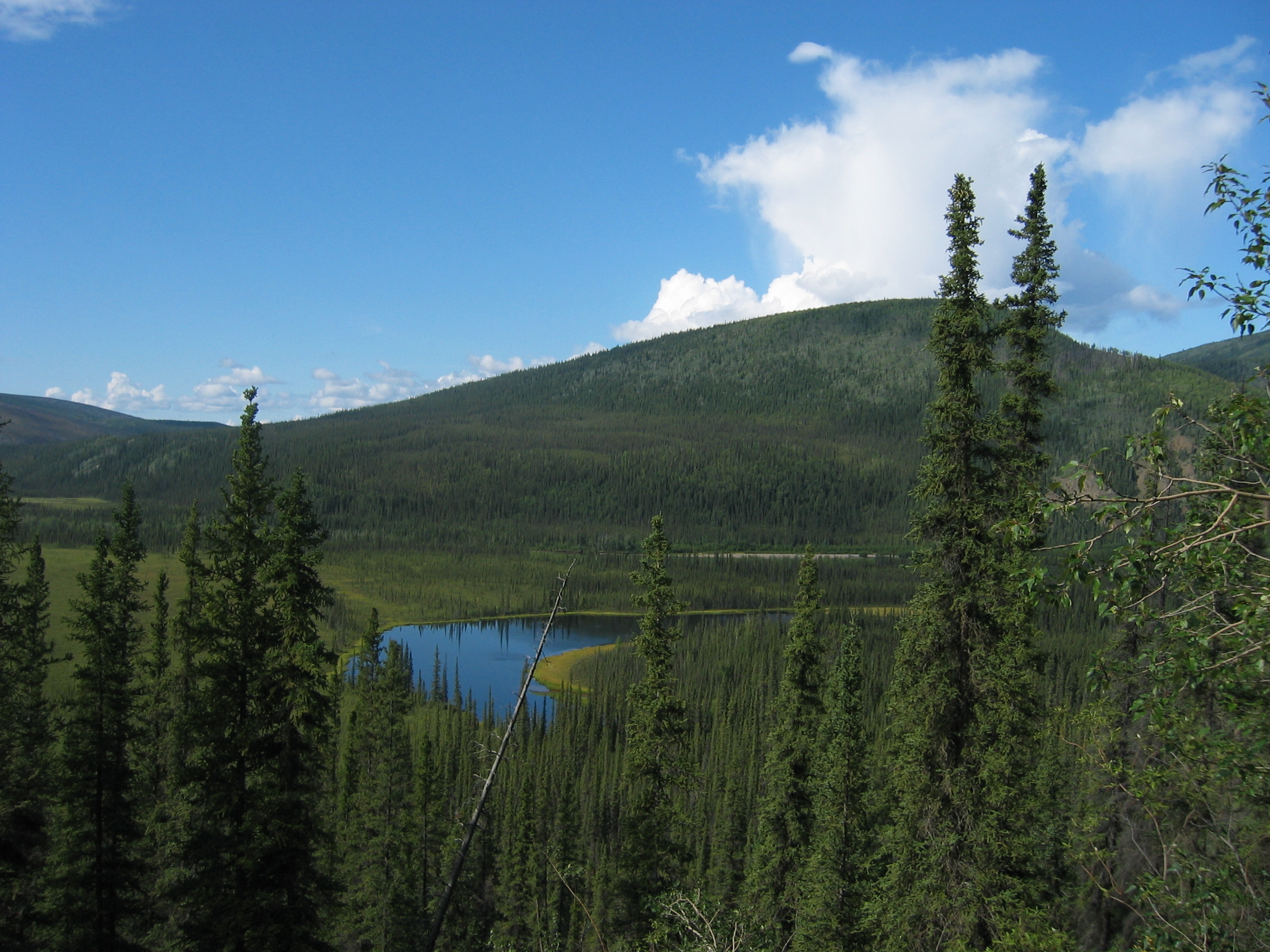
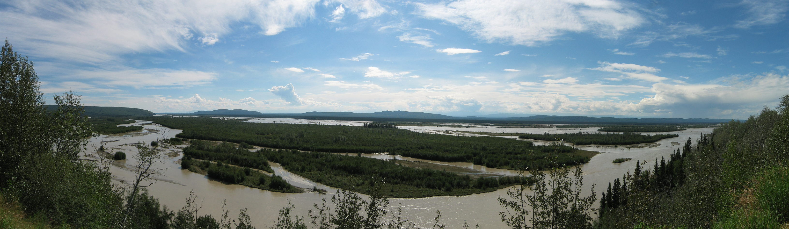
The scenery here in the upper Tanana
valley is glorious:
As you can see from the picture above the weather is also absolutely
brilliant today, which the locals assure me is definitely not usual
for this part of the world. Perfect weather, perfect temperature,
perfect scenery and a perfect bike for these roads - this is real
bikers bliss.
Approaching Fairbanks I pass Eielson
Air Force Base. Large signs prohibit vehicles to stop or anyone to take pictures.
But it is clear to me that the 354th
Fighter Wing occupies significantly less space on the base compared
to the numerous KC
135's of the 168th
Air Refueling Wing - the only refueling unit the US Air Force currently has at its disposal in this part of the pacific theatre.
The entire area around here is occupied by the U. S. armed forces;
the giant Yukon Command Training Site plus the neighbouring Fort
Wainwright plus the rocket nerds at nearby Fort
Greely cover together about as much land as all of Switzerland.
The second half of those 200 miles to Fairbanks
follows the Delta
River, which is less exciting because the road is straight ahead.
At the confluence of the Tanana and Delta River is the town of Delta
Junction. The town is surprisingly large, so I have my lunch
there.
Two hours later I reach Fairbanks. The town is just a big supply
depot for the Trans-Alaska oil pipeline and not very interesting,
so I am happy to just fill my tank and blast off southwards on highway
3, here called the Parks
highway. From Fairbanks the road turns out to be excellent for
motorbiking again. 55 miles further on I stop at Nenana,
a small, sleepy village and get me a room.
- 163550 km on the bike
Yesterday evening I watched the spectacular sundowner (which happens
at 11.30 pm this far north). This morning all is wet and drizzly.
Weather changes amazingly fast up here. But by 8 am the band of
rain disappears towards the north and when I set out at 9.30 am
the road is already dry. But it is fairly cool this morning, about
55° Fahrenheit.
The first few miles are fairly boring to bike, but then the mountains
of the Denali
National Park appear on the horizon.
This park is very popular with American tourists. Whole busloads
are being driven around, but it never gets really crowded. Unfortunately
these mountains are also acting as a weather barrier. While the
north side is clear and sunny, once reaching the peak I see that
it is drizzling on the southern side. That is no problem, except
that I am deceived of that supposedly spectacular view of Mount
McKinley, because everything higher than 2500 feet is hidden
in clouds.
At Trapper
Creek I fill my tank. There is a Harley parked outside with
a German
license plate on it. The corresponding biker is lazing in a
deck chair in front of the station building, having a smoke. His
name is Indy and we talk bike for about an hour.
He has simply used the DHL
courier company to ship his bike over here and has paid about the
same amount I paid using Motorcycle
Express. Other than that timid Yank Paul the other day, Indy
had no problem with taking his bike over the Top
of the World highway - and bike and biker look like it, because
he hasn't yet found time to clean her or his outfit.
At Wasilla,
about 40 miles northeast of Anchorage,
I turn north-east again, heading back towards Tok.
Wasilla is too big for my liking, so instead I try to find a decent
place in Palmer,
but have no luck there. This doesn't matter, as the scenery starts
to look promising again, heading back up into the mountains.
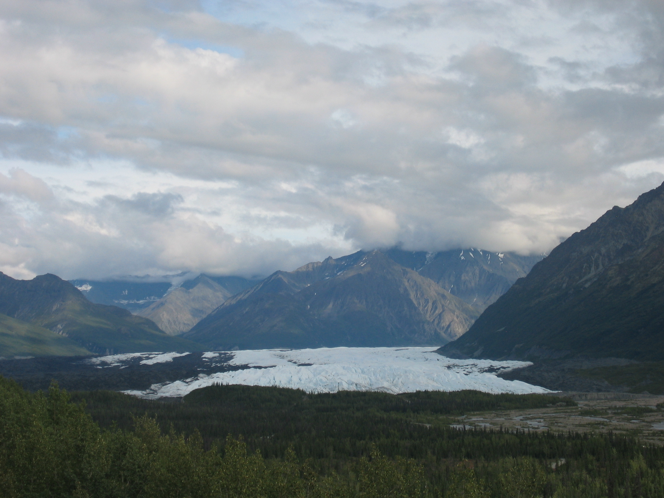
When I turn a corner, the mighty Matanuska glacier comes into view - and next to it a motel. So I stop there and manage to get their last room - and it really is a room with a view.
- 164050 km on the bike
The glacier is supposed to create a weather
hole, whereby the cold air lying above the glacier forces the
surrounding warmer air up the mountains and so preventing precipitation.
This morning that system fails - it is raining.
I set off at 10.30 am and 30 miles onwards the rain stops. I stop
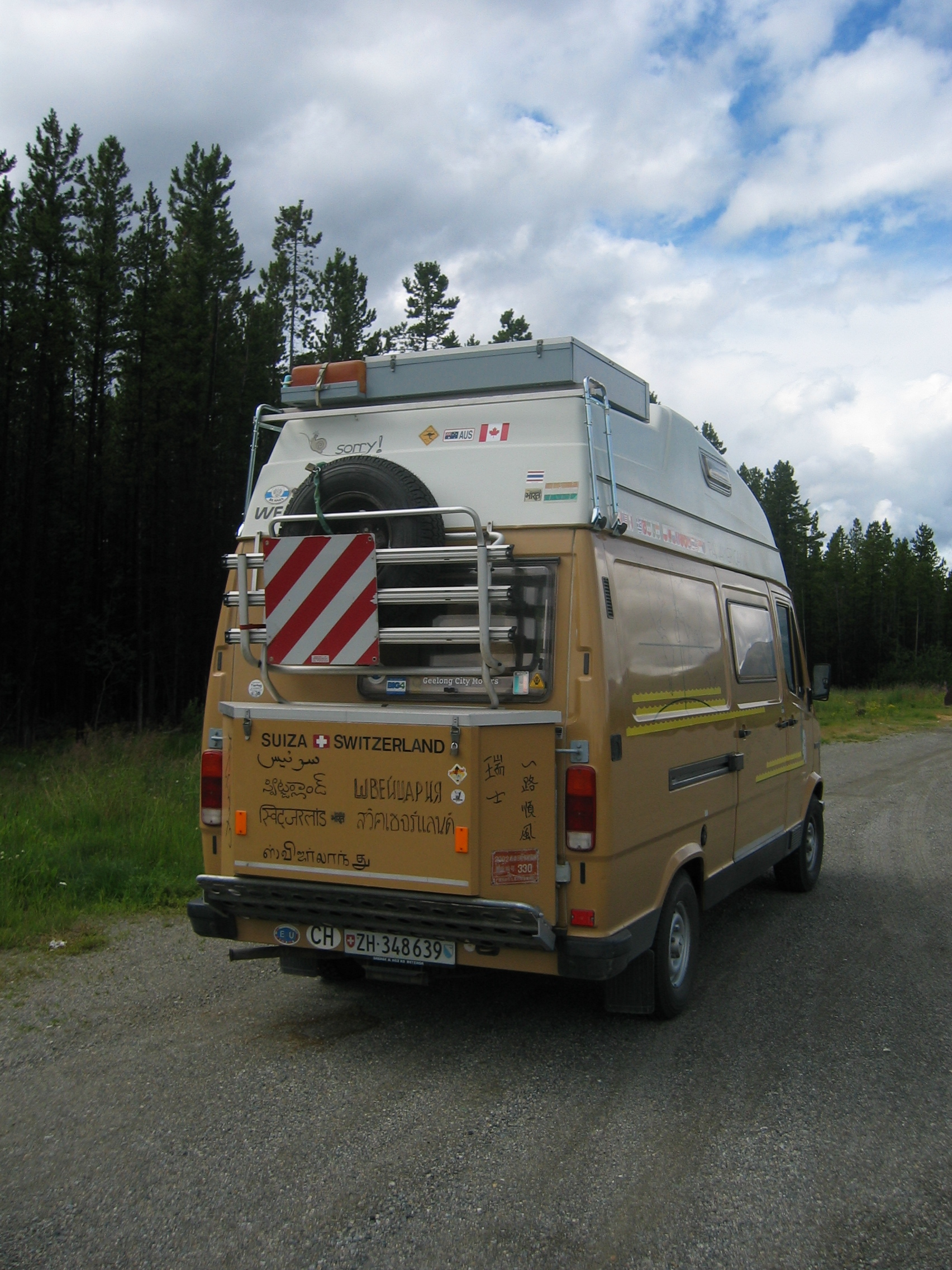
at the next parking lot to grease the drivechain. There I find this
18 ton monstrosity with Swiss
license plates:
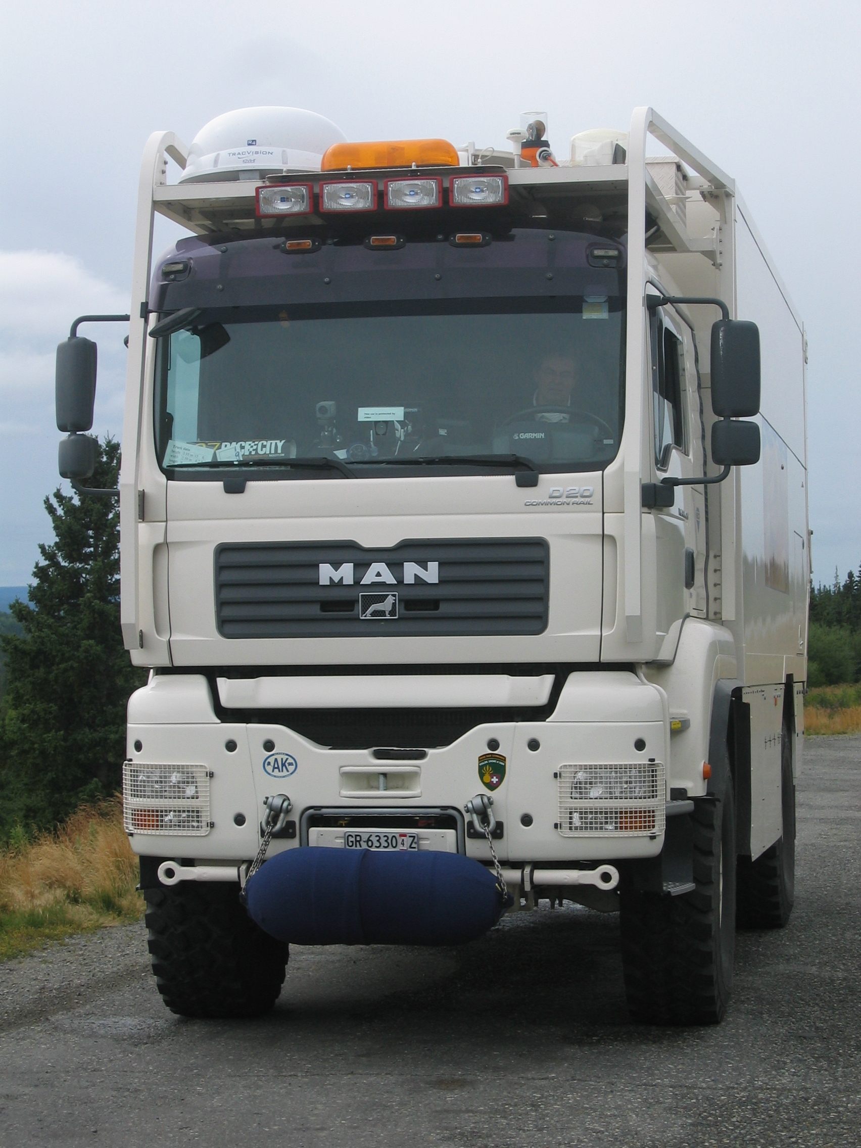
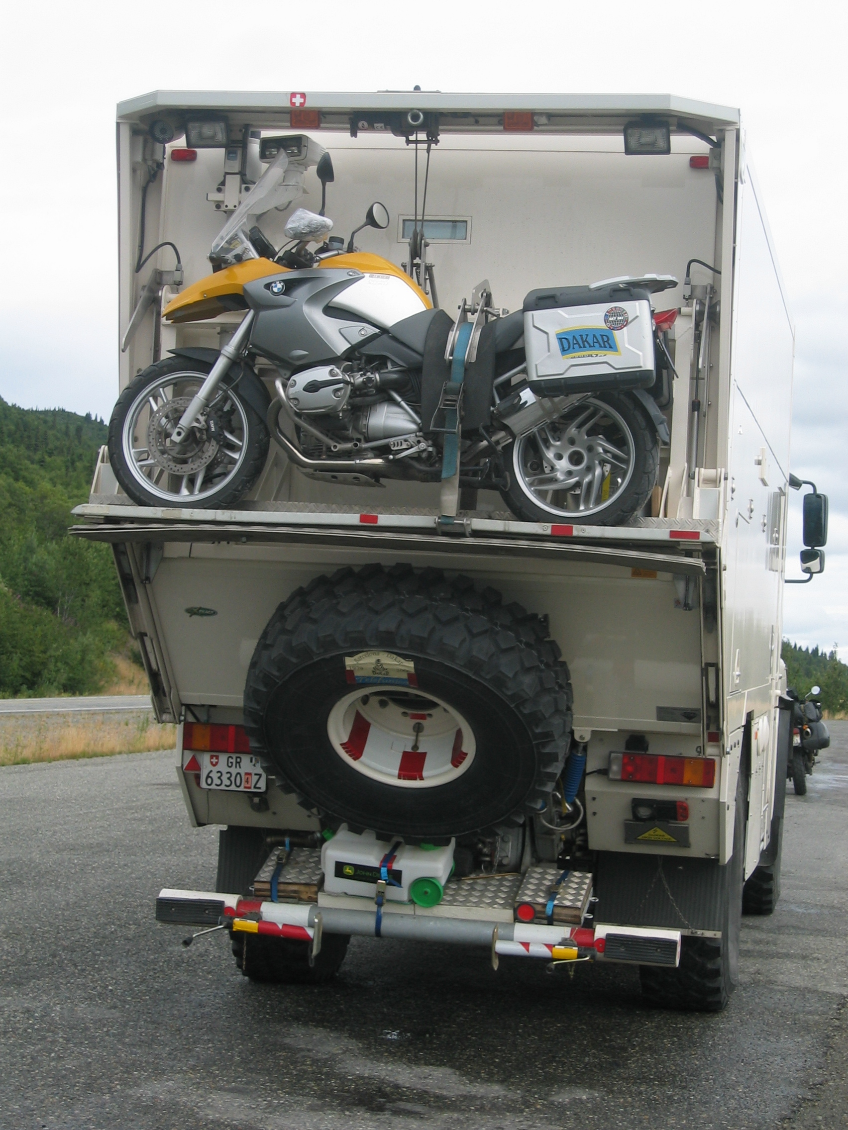
The guy in it is from Graubünden
- it seems that really millions of Swiss must be missing in Switzerland
because they are all touring around the world. How he manages to
keep that truck so spotlessly clean in this bad weather remains
mysterious to me. He probably has a pressure washer built in somewhere.
You will probably think I am making this up, but I swear this is
true; next a minivan with local number plates stops in the parking
ground. A woman jumps out and asks in perfect Swiss-German vernacular
if we are having a Swiss convention here - she is from the upper
Valais
region of Switzerland and works here as a tour guide.
I hereby officially demand from the Federal government in Berne
to demand from the Federal government in Washington
to cede Alaska to the Swiss Federation and incorporate it as the
27th canton
into Switzerland.
At Glenallen
I have my usual lunch and fuel stopover, and then head on. The weather
finally improves and by the time I reach Tok after 350 km the sun
is shining. I have fond memories of the Main Street motel, so I
book myself into it.
As usual you can download my circular tour
of Alaska plus my tracklogs here.
- 164400 km on the bike
I have perfected my use of the coffee percolators provided in most
motel rooms. They come with pre-packaged coffee powder, supposed
to produce on jug of coffee each. Simply use just half a jug of
water and put two or three of those pre-packed coffee powder bags
into the machine - the result is nearly as good as the coffee in
Europe.
When I set out at 10.30 this morning I am driving the same way I
came into Alaska - but not for long. After 10 miles I reach Tetlin
junction where I originally came in from the north via the Top of
the World highway. This time I do not turn north, but bike on straight
ahead on Alaska highway. Initially it starts to drizzle a bit, but
then the weather steadily improves. On my right is the Tetlin National
Wildlife Refuge.
At Scottie Creek I fill the tank for the last time for the next
2000 miles to the brim with cheap U.S. fuel. 5 miles on I reach
the Canadian border - and a massive queue waiting to get in. It
takes 40 minutes of stop and go traffic chaos to reach the checkpoint.
I am not amused by that delay. Three lanes with two custom office
booths are in place and only a single one is open. Immediately inside
Canada the road deteriorates to a potholed dirty track full of gravel
patches and dust - I can only say that I had nearly forgotten how
rotten the roads can be in Canada while biking the mint U.S. highways.
10 miles into Canada I can see about half a mile ahead another black
bear crossing the road. But this one is different; he sees me
coming, turns towards me and just stops in the middle of the road,
watching me approaching with 60 miles per hour. I am just in the
right grotty mood after that long delay to tackle a bear. If that
animal thinks that I will stop because he decides to block the road,
then he has another thing coming. I switch my headlights to high
beam, honk my horn constantly and shift from sixth gear into third.
The benign grumbling of the engine changes into that familiar warcry
of a Tigercat under full steam. The bear is impressed and clears
the road, but he does it in style; instead of galloping away panic-stricken,
he just walks majestically and slowly to the other side of the road
- where I whiz past him not 15 feet away.
From here the road heads steadily upwards until I reach the Kluane
lake. On the lake shore at Destruction
Bay I have a very late lunch. The road around the lake is under
construction and very muddy. But the scenery is nice with various
glaciers coming down from the mountains - it is these glaciers that
feed the lake. This also means that the strong wind blowing up here
over the lake surface is freezing cold - the icy glacier water ensures
that.
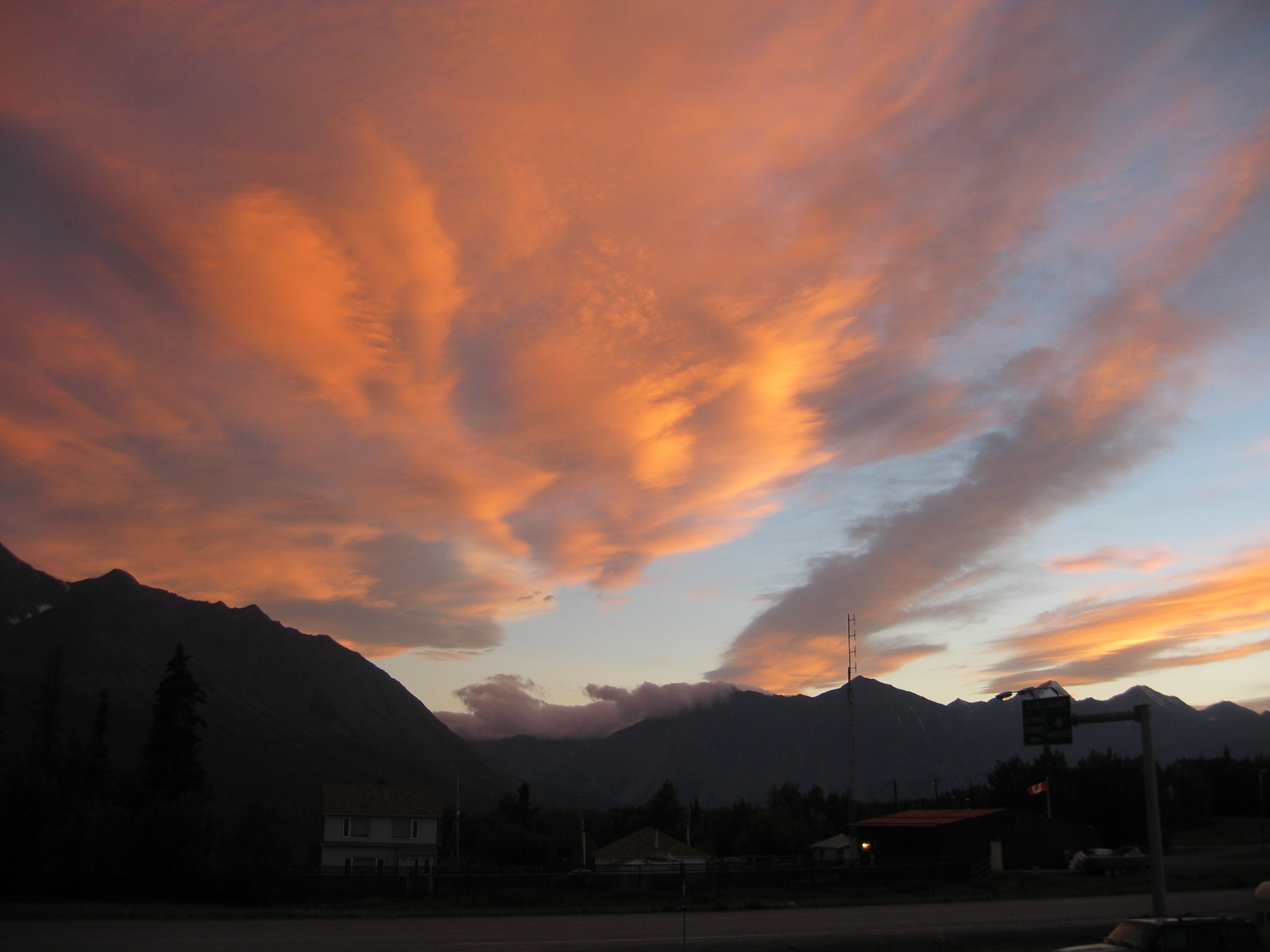
I continue until Haines
Junction, fill the tank and by 6.30 pm book me into the Alcan
motel. Here is a picture I shot at 11 pm of the local sundowner:
- 164850 km on the bike
I leave at 10.30 this morning and head on towards Whitehorse,
which I reach at noon. That's a good opportunity to use this last
outpost of civilization for a hearty lunch at Pizza
Hut.
From here on for the next 800 miles I have to bike the same Alaska
highway I came up on - there is simply only one single road into
and out of the wilderness of Alaska so do not expect too much from
me for the next few days - I've already been there, done that and
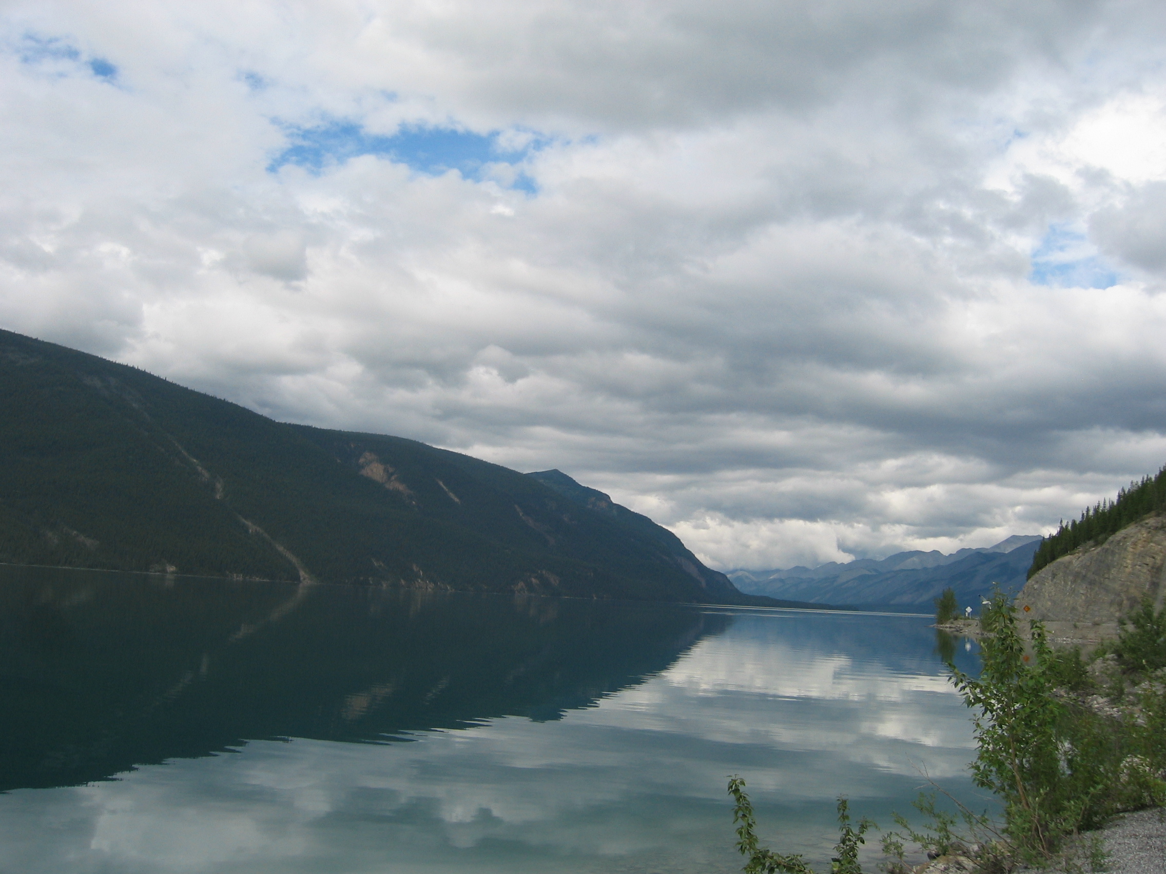
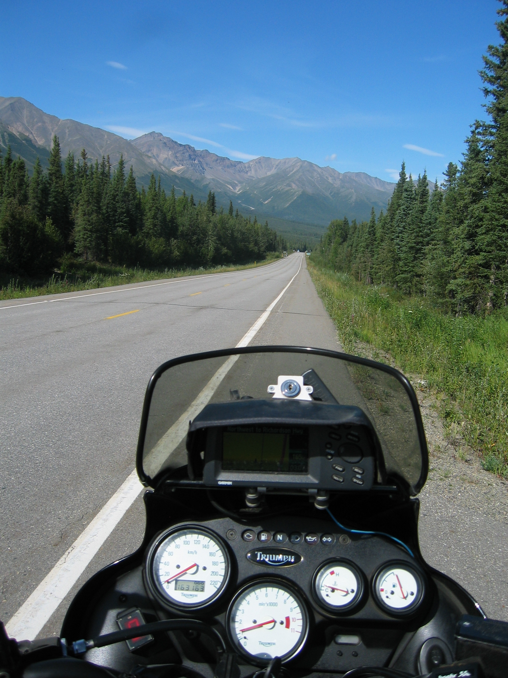
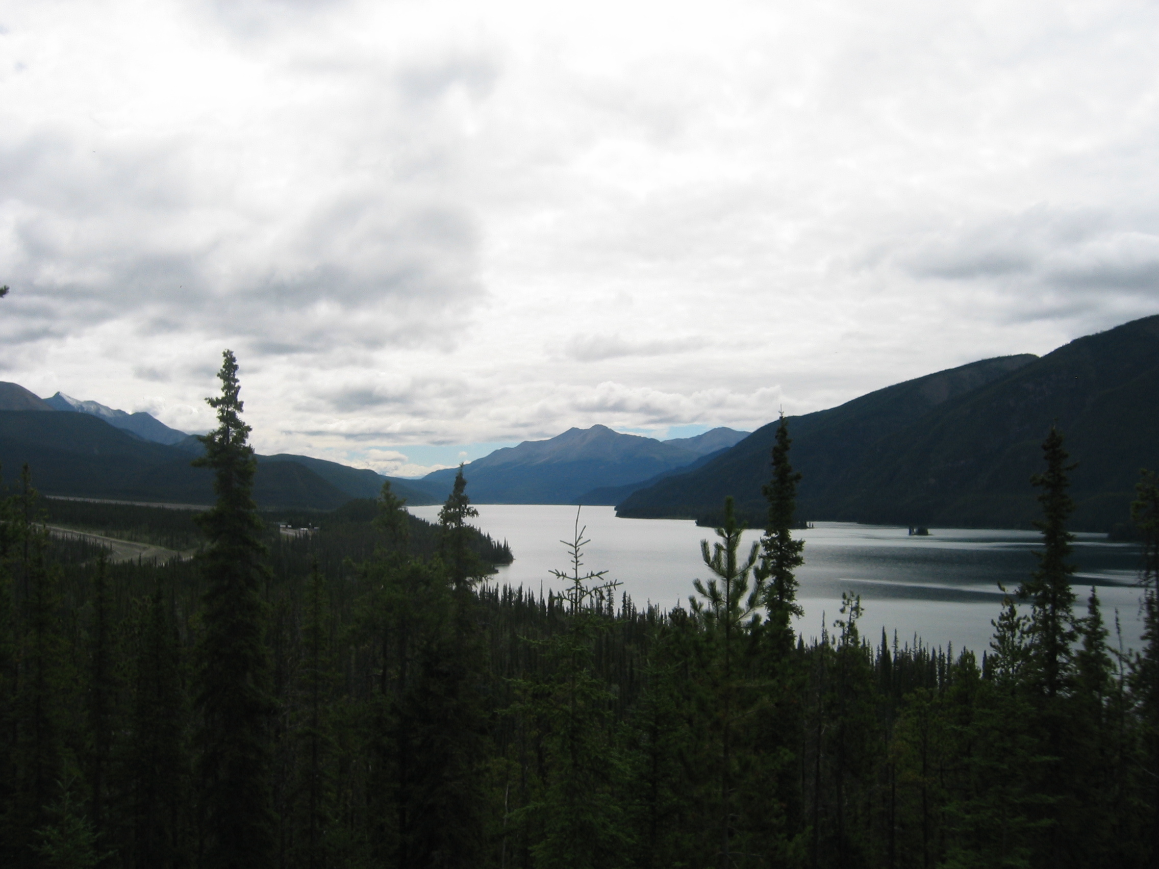
got the Tee-shirt. Here is a view of Swan Lake:
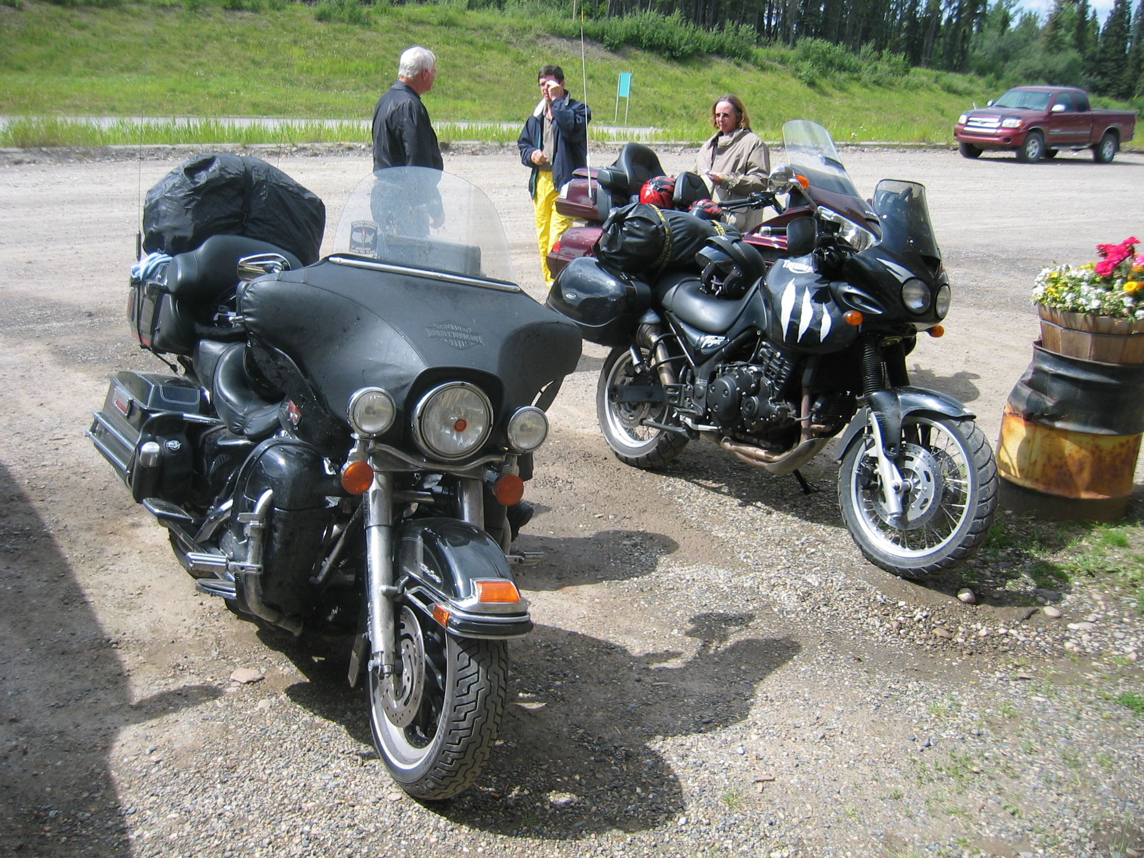
After an uneventful 600 km (just taiga, bears, wilderness and an endless road) I reach Watson Lake and book myself again into the exquisite Airforce Lodge. Tonight there are five bikes and two trikes parked outside. Two of these bikes belong to a Frenchman and his U.S. wife. When that guy was just out of school, he realized that he didn't like the French way of life, so he emigrated to Canada - but to the Yukon territory to be as far away from those French speakers in Québec as possible. We have an interesting chat all evening about life, the universe and all the rest.
- 165450 km on the bike
Next morning the rain is hammering on the roof. The Ex-French guy,
his wife and myself all declare the day a non-starter and extend
our stay at the lodge for another 24 hours. The day passes quickly
by chatting some more with other bikers, our Austrian
hostess and her German
husband. I stroll into town on foot and have lunch at a truck stop.
The place is quite cool; the walls are entirely decorated with pictures
of trucks that have crashed in the vicinity - most on slippery winter
roads.
Next morning the weather is cold, but sunny. The temperature up
here at 9.30 am is just 7° Celsius. I wrap myself warmly and
set out at 10.30, after having said good-bye to the Franco-American
biker couple.
When I came up this way, they were repairing the road using gravel
patching. That unpleasant stuff has all disappeared and biking is
great fun. However, the cooler temperatures must have some adverse
effect on the local wildlife; within one hour I have encountered
a caribou
in the middle of the road, then a confused moose
that gallops ahead of my bike on the road for a quarter mile before
seeking safety in the forest, then another caribou on the road and
finally another black
bear on the roadside, just admiring my motorbike.
Luckily I am in no rush and always manage to avoid crashing into these animals. After an otherwise uneventful 500 kilometres I reach Fort Nelson once more. Considering those excruciating 160 dollars the Super 8 motel charged me on my way north I am a bit wiser this time and check with the visitor information office; they recommend the Shannon motel, which is of classic design (i. e. every room has its own front door to the parking lot), but is clean and comfy at 68 dollars per night.
- 165950 km on the bike
I leave Fort Nelson just after 10 am. There is a warning sign at
the end of town, saying "no gas for 100 km". When 100
kilometres later I reach the next village, Prophet
River, the petrol station there is closed. That of course is
no problem with my Kitty and her 24 litre tank, but as the next
petrol station is another 110 km down the road I am certain, that
several crotch rockets are going to run out of fuel in the next
couple of hours - some bikes hardly manage 150 km on a tank.
After 210 kilometres the petrol station and a restaurant appear
out of the middle of nowhere. They have just regular petrol, so
I just fill in a few litres, then have my lunch. By 1 pm I am back
on the road. Now slowly the first farmed fields begin to appear
and the taiga slowly disappears. The area starts to look more populated
- and for the first time in many days there is traffic on the road.
Logging trucks and liquid gas tankers enter the highway from those
muddy tracks left and right and bring a lot of dust onto the road.
Luckily I am approaching Charlie Lake and the junction where highway
29 forks off from the Alaska highway.
There is a petrol station at that interchange, where I turn onto
the deserted highway 29 after filling the tank to the brim with
premium petrol.
I now enter the valley of the Peace
river. There appears to be a war ongoing in that valley, in
spite of its name.
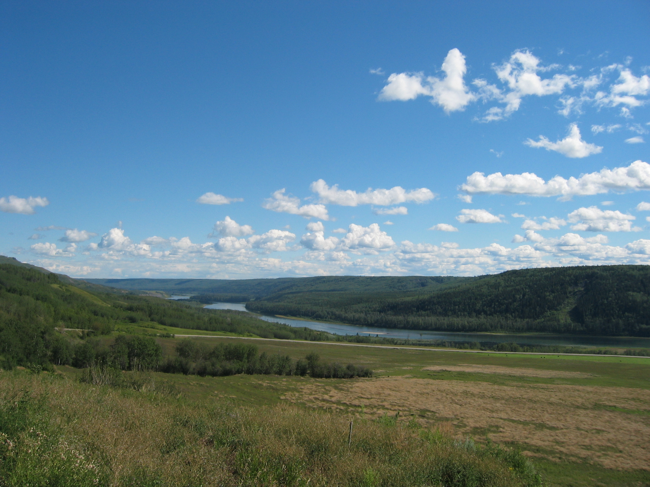
Farmers have erected signs everywhere, protesting against the construction
of another dam for hydropower, which would flood the valley. Their
slogan is "Keep the Peace".
I ride along that river and it really is good to see leaf trees
and fat meadows and farmlands after all that endless forest. After
another 500 km I end the day in Chetwynd,
where I also give the bike another cleanup. I am back in the civilized
part of the world after several weeks in the wilderness.
- 166450 km on the bike
Below is the usual map with my GPS tracklog and some trip markers.