- 166450 km on the bike
That I am back in "civilization" becomes even more obvious
at 4 am this morning, when a potential thief tries to lift off the
cover from my bike. Of course he triggers the alarm and the guy
disappears right away. One would expect such things in Big City
USA, but not in the Canadian hinterland.
But potentially being woken up that early was not bad; the motel
room is freezing cold. Maybe it wasn't such a good idea to leave
the bathroom window open, either. I am frozen stiff and my body
signals to me, that normally I would get a cold. What I mean is
that I never get ill, but if I do something stupid like sleeping
in such an ice cold room without using a proper blanket my body
at least tells me that he had to send the immune system into overtime.
I turn the heater up and go back to bed, well knowing that in the
morning I will be right as rain.
I leave at 10 am on highway
97 towards Prince
George. There is a sign at the end of town, warning that the
next petrol station is 172 kilometres down the road.
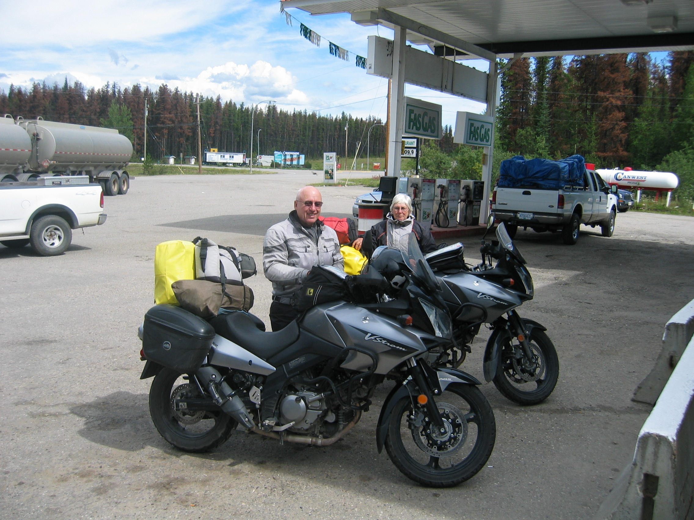
At a roadside restaurant I meet a couple from Florida on a pair
of matching Suzukis. I have seen them on the road already a couple
of times during the last few days.
We exchange a few biker stories over lunch. The two used to have
an RV,
but one sunny day they found themselves sitting in their air-conditioned
gas-guzzler and watching TV, and realized that this kind of "camping"
was not the real thing - they got rid of it and bought the bikes
instead. Good idea, I'd say.
Unlike me, they have seen a grizzly
bear; they were charged by it when passing one on the road,
but managed to get away in one piece.
We ride together into Prince
George where they want to do some shopping. I myself will continue
southwards on the highway. But first I need petrol, having driven
450 kilometres since the last refill. 21 litres fit in the tank,
showing that the bike runs excellent and very economical.
Prince George is another one of these places, where idiotic sets
of traffic lights drive me nuts. Even worse, they have zero electronic
sensors in the tarmac to make the lights react to traffic and also
haven't set the lights up to give "green waves". This
didn't matter in those tiny towns further north, but a town like
this with over 70000 souls suffers horribly from such gross traffic
mismanagement.
I press on south out of the city, where many thunderstorms are growing
rapidly, so after another 130 km I call it a day at Quesnel.
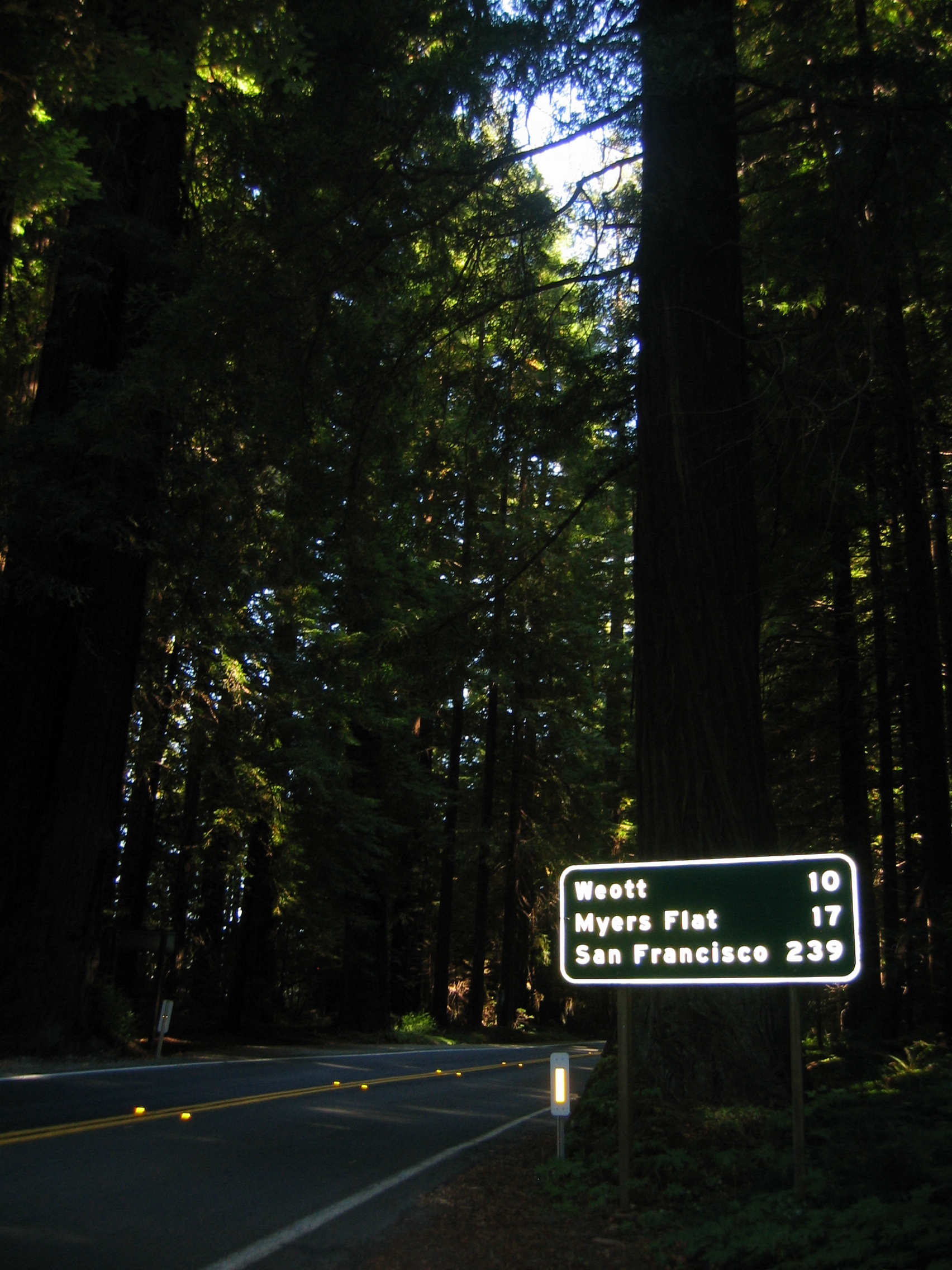
On my way there I find a signpost, stating that Vancouver lies 738
km ahead. If you consider that I am already biking for two solid
days south through British
Columbia, you get an impression of how big this place really
is.
- 166900 km on the bike
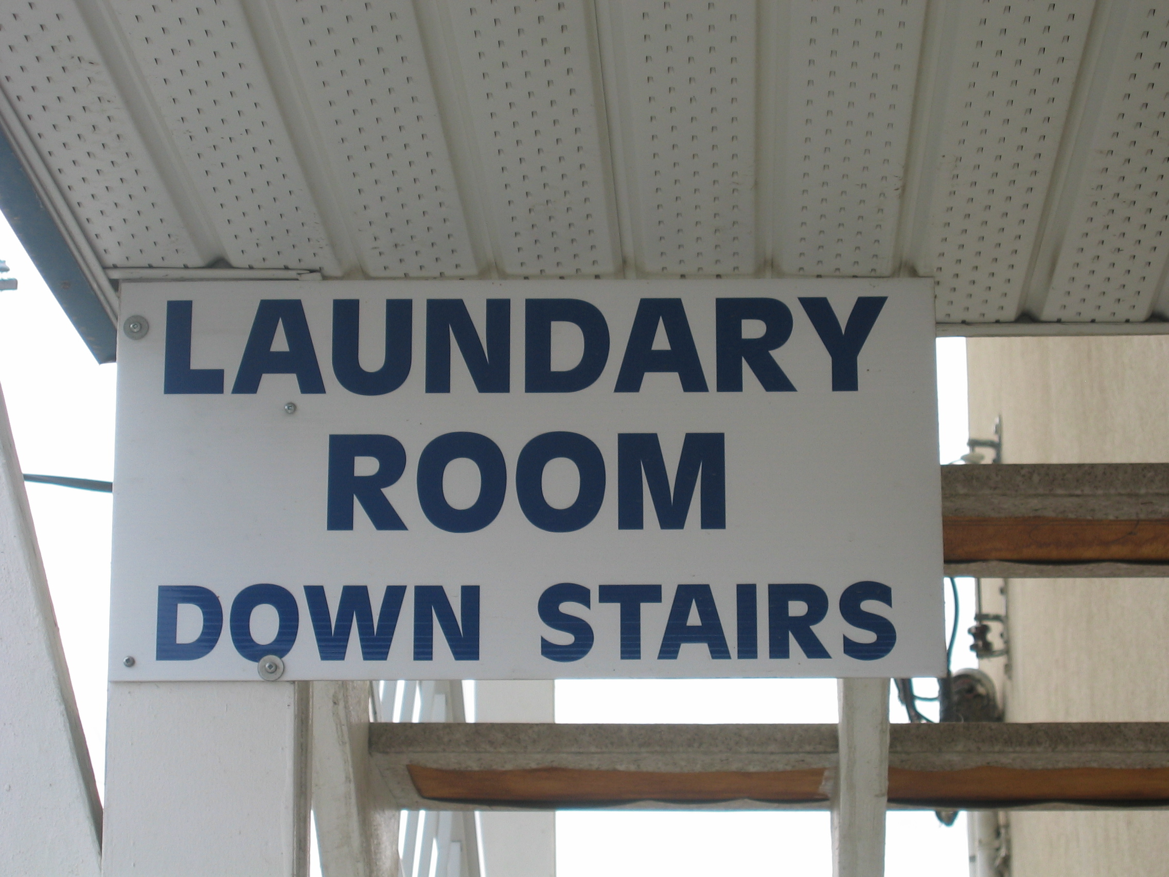
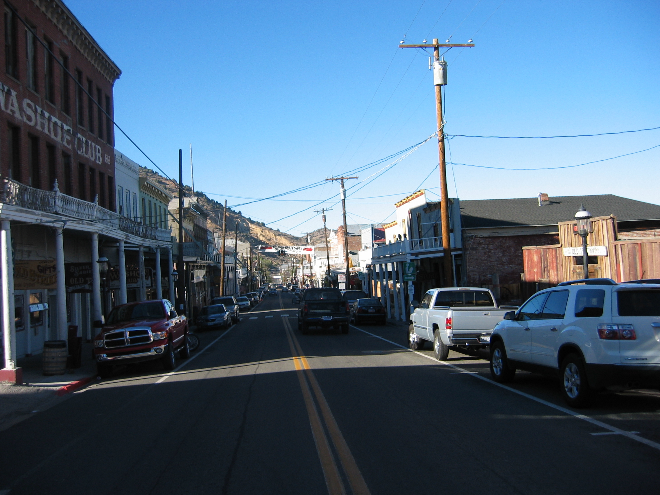
It is a truth universally acknowledged, that an Englishman in possession of a reasonable command of the language, must be in want of a place to dispose of all that. Canada definitely is such a place. Though Queen Liz is de-facto the head of state, the Queens English is rapidly turning into something resembling Pidgin English around here. That North Americans misspell a large number of English words is one thing, but that professional sign makers apparently can't be bothered to buy a spell checker is abominable. This is the sign above the laundry of the Econo Lodge here at Quesnel, where I stayed tonight
I am off at 10 am as usual. The road leads southward along the
Fraser
River. After about 100 miles I reach Williams
Lake, the next port of civilization along the road.
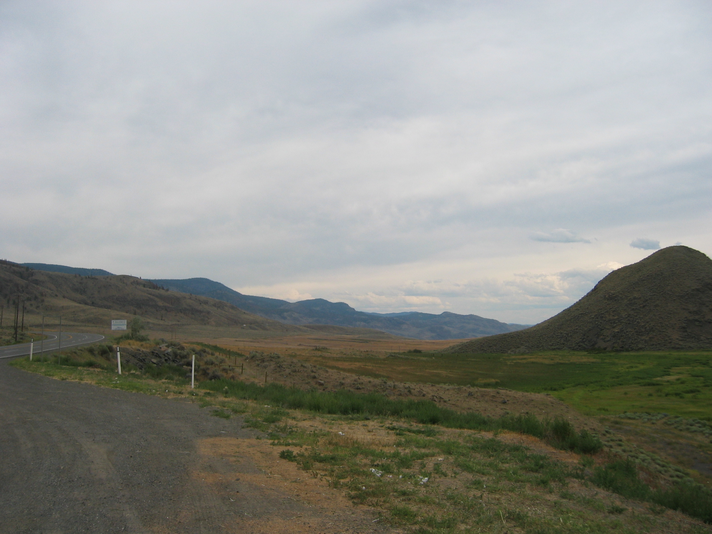
I find to my surprise that the heart of British Columbia is in fact
a rather arid area, and without irrigation nothing will grow.
After 400 km I finish the day at Kamloops. Down here it slowly starts to warm up, but seeing local bikers wearing shorts gives me the shivers not just because of the dangers when having an accident.
- 167300 km on the bike
My route today leads me initially from Kamloops westwards along
the South
Thompson River. But soon highway 97 heads southwards again towards
the U.S. border.
90 percent of the Canadian population lives within 100 miles of
that border. Having driven on nearly empty roads for the last weeks
makes the slowly increasing traffic even more of a nuisance.
Finally I reach Kelowna. It is Sunday today, but even without rush
hour the city is a traffic nightmare: traffic lights, building sites
and all 120000 citizens permanently on the road in their SUV's.
But that isn't the worst; at the far end of town is the Okanagan
lake bridge over the Okanagan
lake. The bridge is totally overwhelmed by the onslaught of
the traffic. The city fathers have realized that and the new
bridge is already under construction. The jam is monstrous and
it takes nearly an hour to get over the bridge.
I can see the 49th parallel approaching on my GPS - the border to
the U.S. And it is about time, the bike is running on fumes. Luckily
there is a petrol station right at the border. Yep, many things
are cheaper in the United States. Here is a sample overview of average
prices:
| Item | Price in Canada | Price in the U.S. |
| one litre of wine | 9 dollars | 2.20 dollars |
| one litre of premium petrol | 1.35 dollars | 0.83 dollars |
| one night in a motel | 90 dollars | 62 dollars |
| one lunch | 17 dollars | 12 dollars |
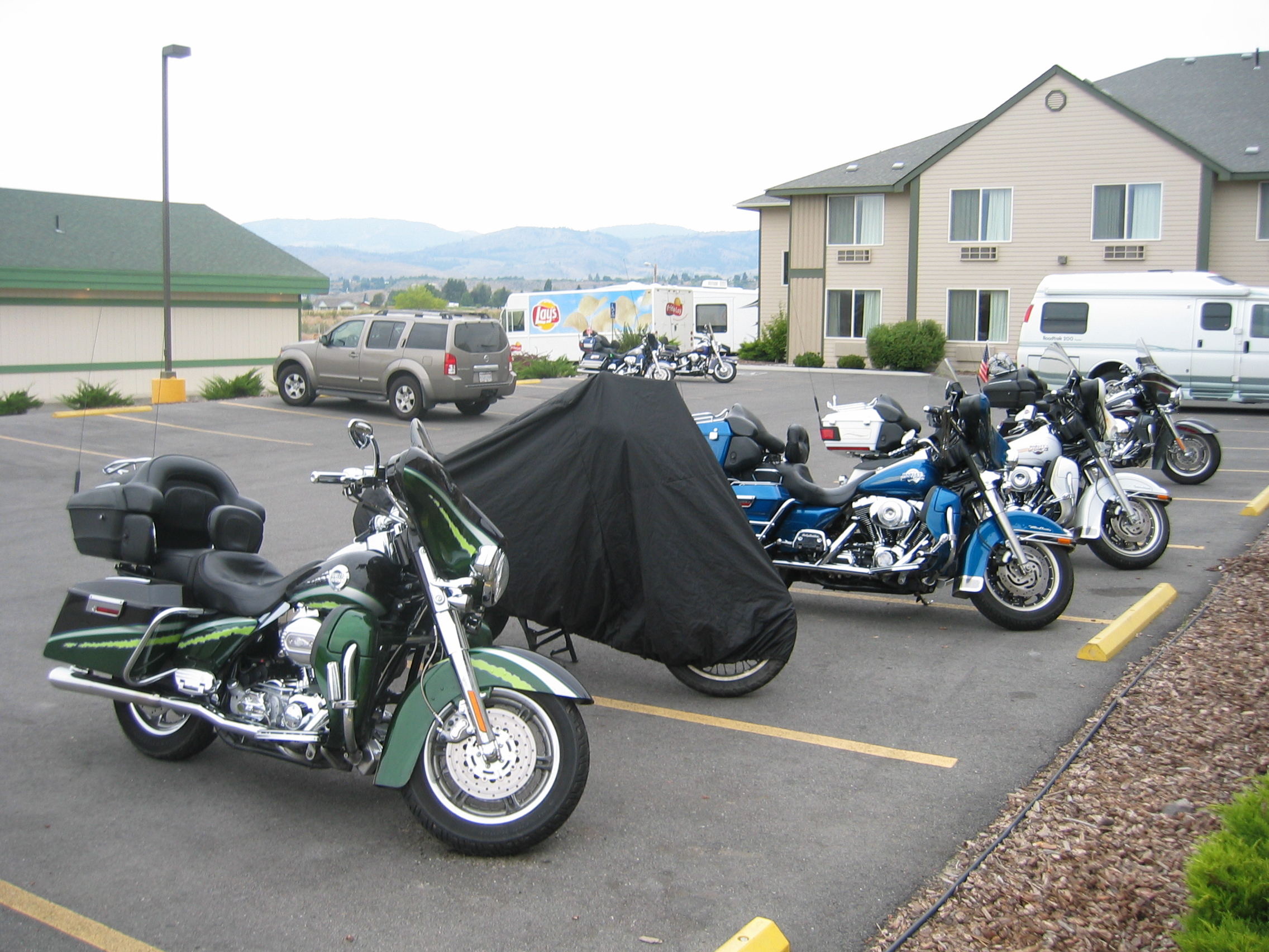
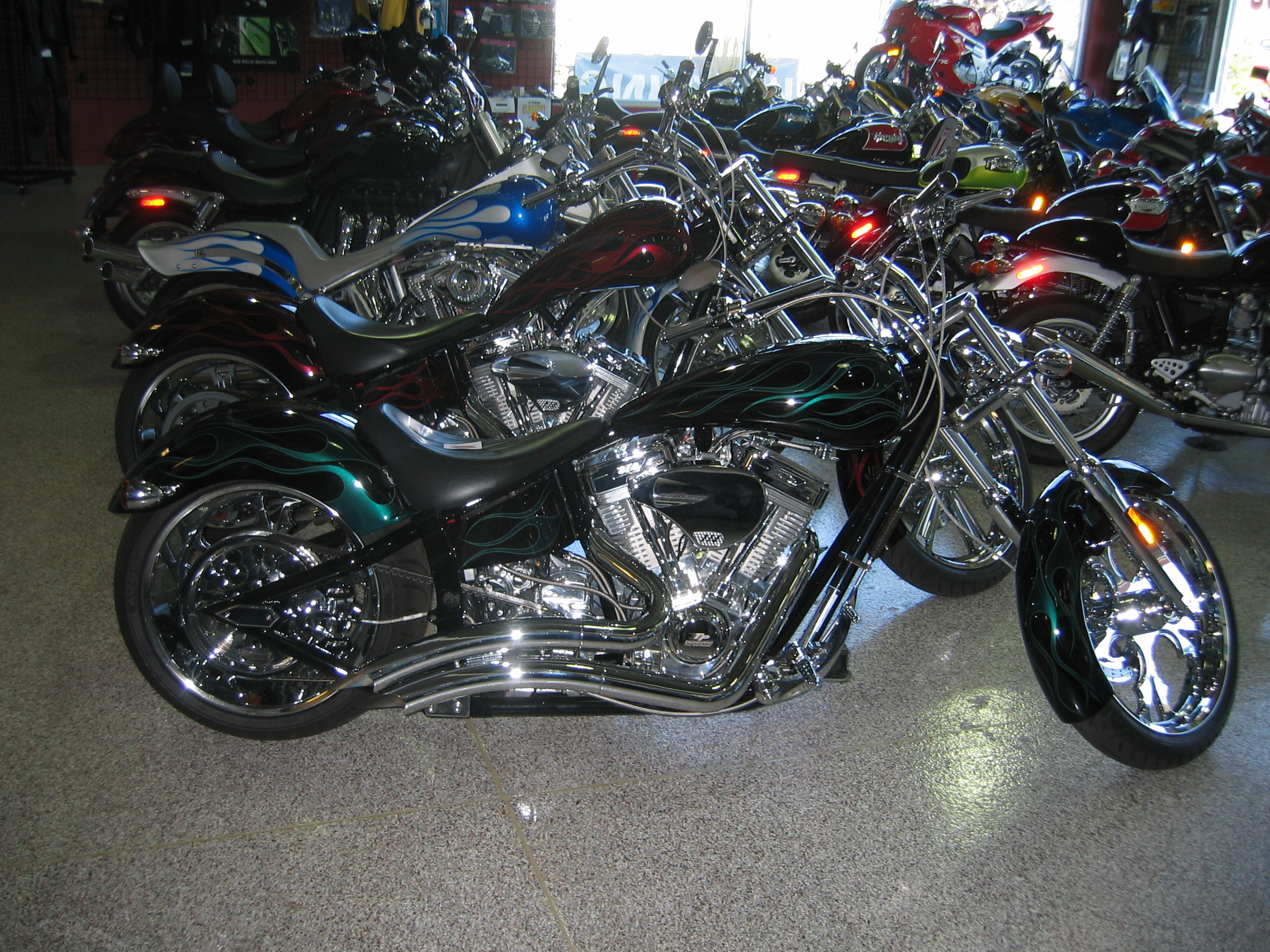
It feels good just to pay 15 dollars to fill up the tank instead of 24. I ride on until I reach Omak. In town the local folks tell me that the Omak Inn Motel is a nice place to stay - they are right. It appears that I timed my arrival very well; the annual Omak Stampede just ended yesterday - and apparently for the event all motels are booked out well in advance. That some fool who is frying popcorn in the microwave sets off the infernal fire alarm is just a little interlude. But as you can see in this picture, Washington is quite popular with bikers - it shows the motel parking lot tonight: seven bikes vs. two cars:
Now I know how long it takes from leaving Alaska until one reaches mainland USA again: seven days of hard biking, covering over 3400 kilometres (2100 miles). As usual, you can download my route and the tracklogs here. Note that the tracklog for the third day is missing - I stupidly forgot to save the file when I had it already deleted from the GPS.
- 167700 km on the bike
The motel serves a free continental breakfast,
and much to my surprise the corn flakes are not coated with the
otherwise usual thick layer of sugar, so I have some and some more
of that thin, brown liquid they call coffee around here. This morning
I also had to make a new route for the GPS. I have decided that
I am going to have a look at the Californian
Sierra. This time of year it should be lovely there.
I set out south from Omak on highway 97, but after just a few miles
I leave that highway and head into the backwaters of Washington
via state
route 17. Here is a view I took of Soap
Lake.
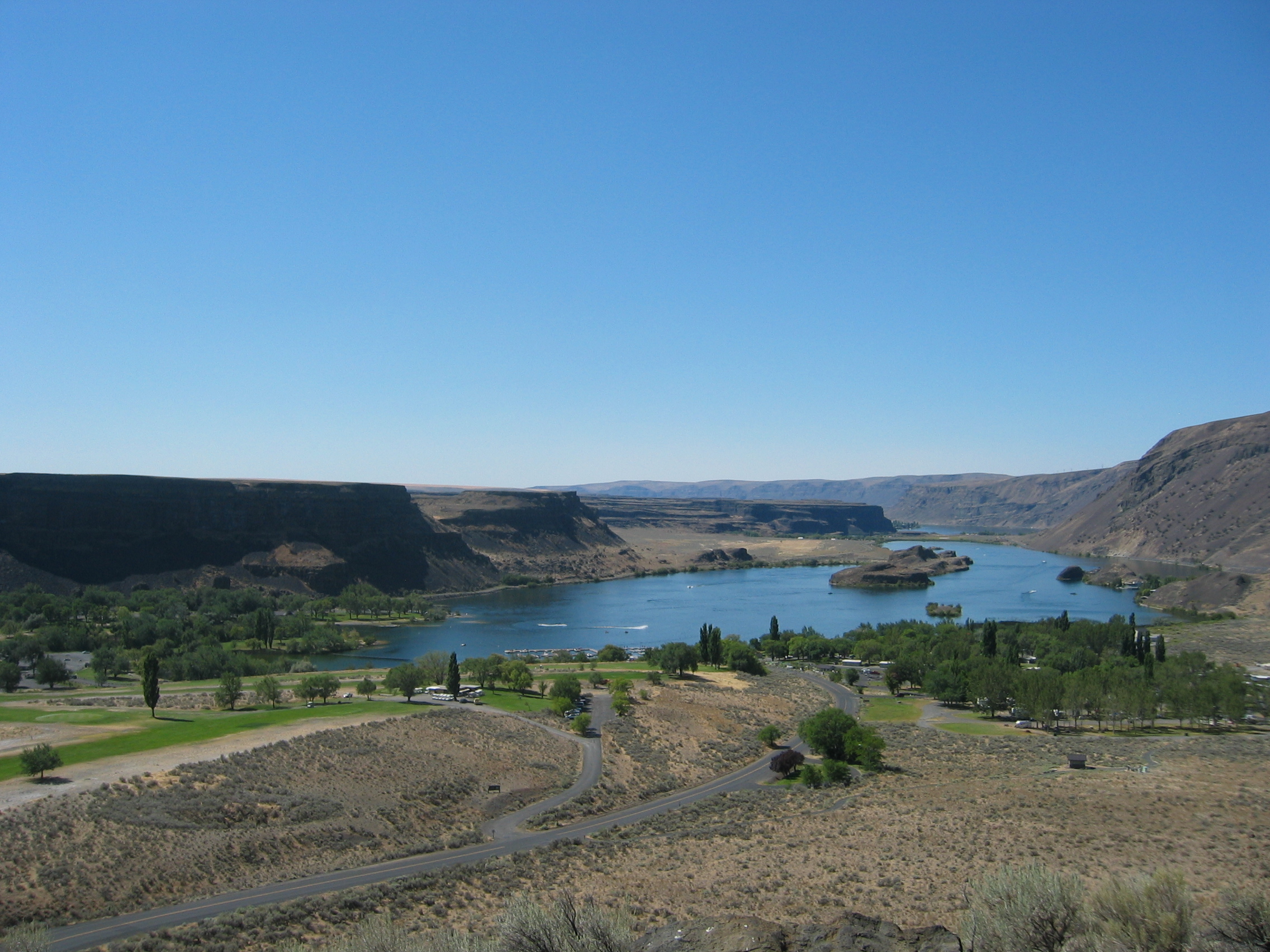
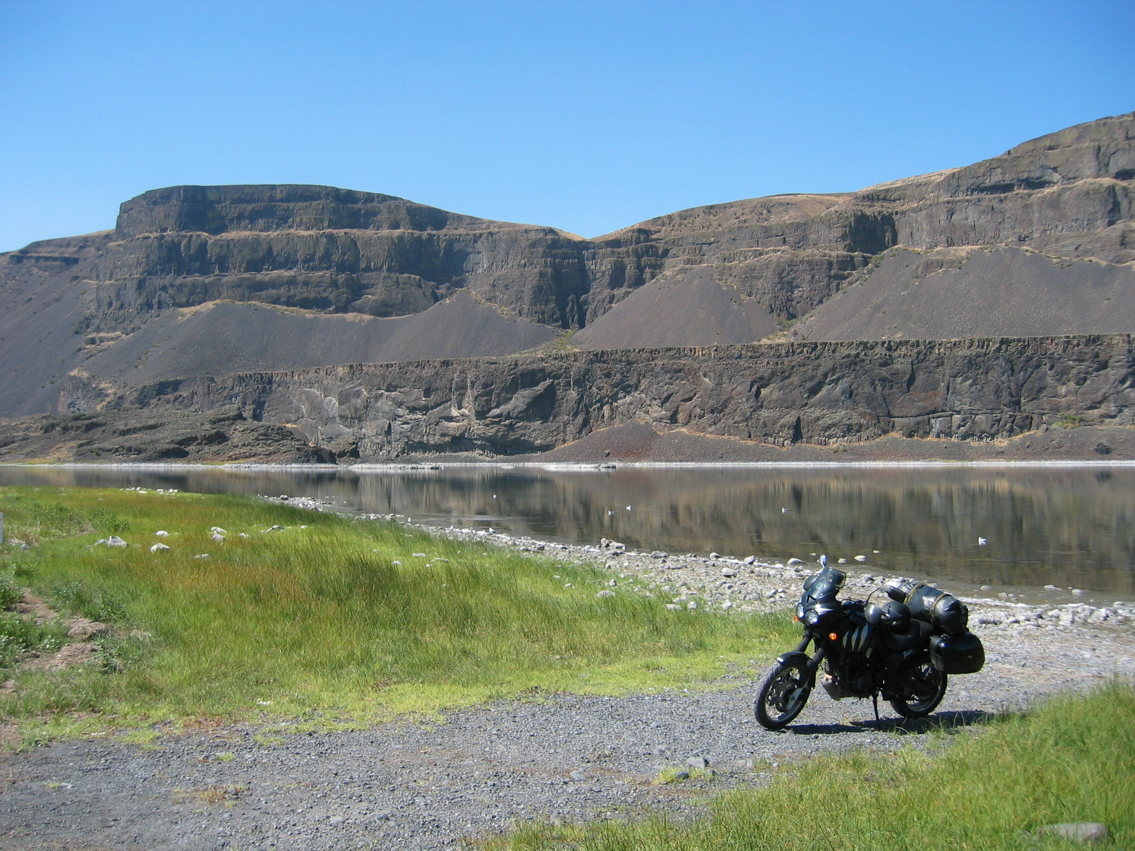
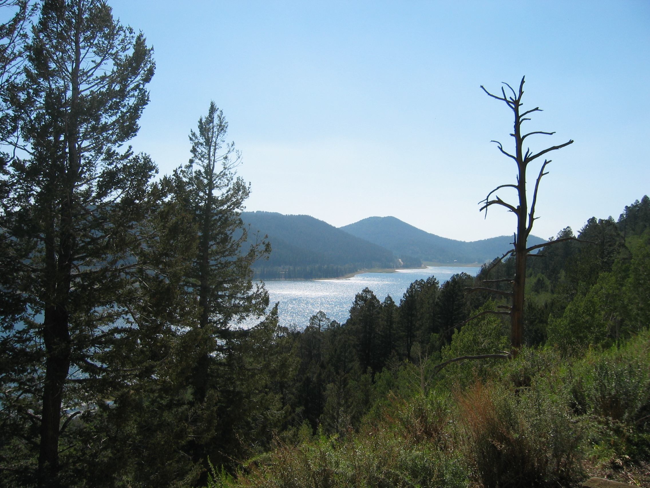
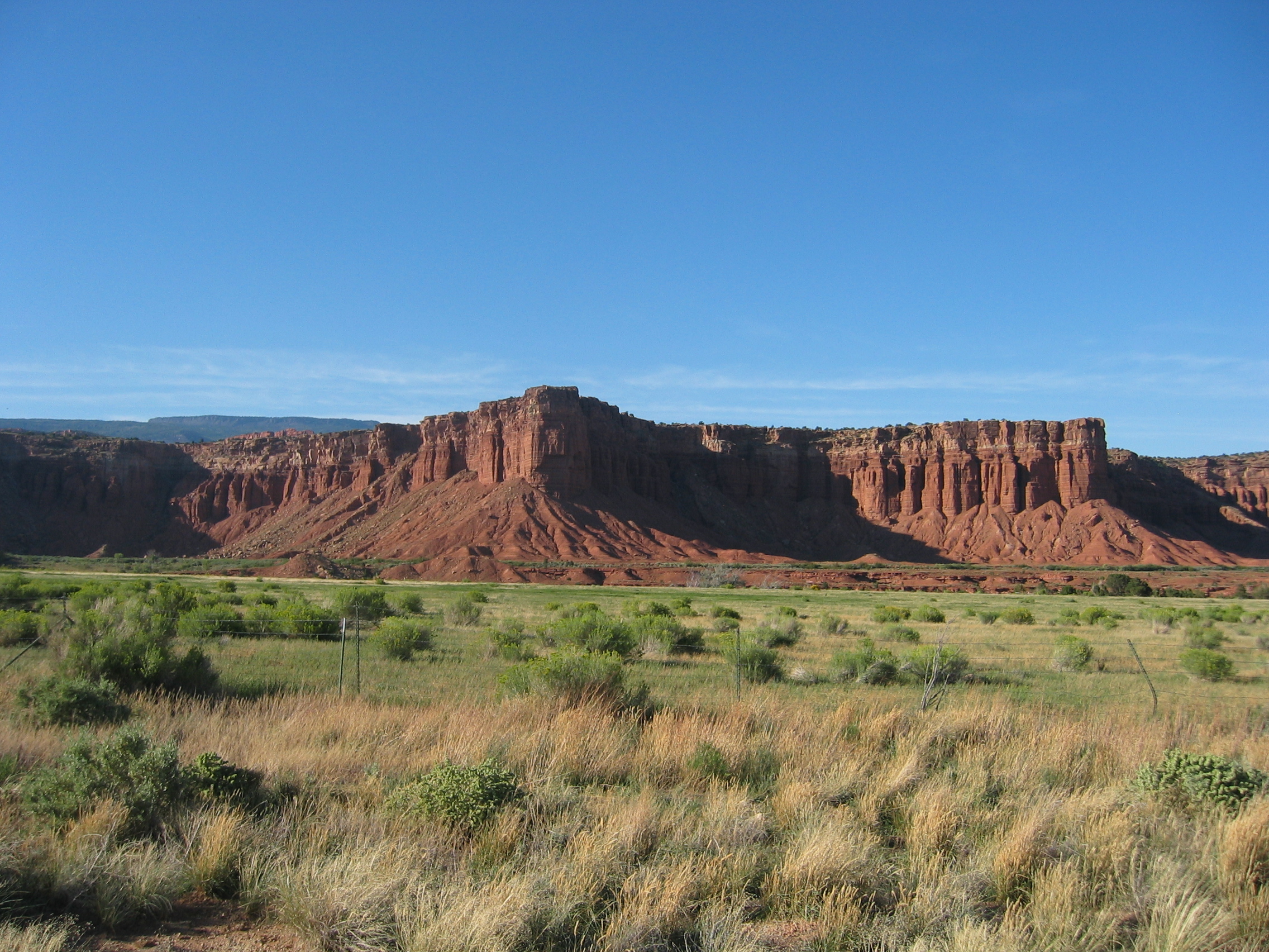
The weather is brilliant, as you can see, but it gets slowly very hot. Anything that is coloured lush green in this part of the world stems from irrigation. The natural, un-irrigated vegetation is greyish green. But whenever river water is available, the industrious Washingtonians have build dams for irrigation and electricity production. Here is a picture of Kitty on the shores of lake Wanapum.
Then I follow the Columbia
River until I reach the town of Richland.
Here the river forms the border to Oregon.
On my approach to that town I notice tons of garbage thrown left
and right along the road. This is weird, as usually the "Adopt
a Highway" scheme ensures that U.S. highways are spotlessly
clean. I stop at a petrol station - they want "pre-pay"
(i. e. pay first, then pump petrol), which I refuse out of principle;
if the petrol station owner assumes that I am a crook and demands
advance payment, then I do not want to do business with that owner.
But after three petrol stations I give up - and realize what is
going on. The entire area lives from fruit farming and vineyards.
Like in Europe the farm owners can no longer find employees in their
own country for picking fruits or vines. So Richland has an unusually
high percentage of Latinos living here to do that kind of work,
bringing with them the usual problems of ghetto formation, drug
abuse, crime and - pre-paying for petrol.
Once I am over the river in Oregon I take highway 207 into the glorious
Umatilla
National Forest. It is not that the forest is really impressive
- no, it's the winding road which even features a few rather tame
hairpin bends which makes this part of the Blue
Mountains so great for biking. However, I soon discover that
these wide, empty and winding roads come at a price; this is the
total outback, no villages, no amenities, no signs of civilization.
I check the GPS and find that the next village is in fact John
Day, which I find at 5 pm is still about 100 miles away. Well,
it doesn't matter, if the biking is such good fun. It is after 7
pm when I arrive at that village after 650 kilometres and nine solid
hours of hard biking without any lunchbreak - the corn flakes from
this morning are still doing a fine job.
- 168350 km on the bike
The traffic outside the motel wakes me up at 7 am. The place is built on a hill and 60-ton trucks are creeping up the hill with roaring engines and whining turbos. The trucks going downhill ignore those polite signs suggesting to refrain from using engine brakes and roar past on full compression brakes. For a sleepy town of 1800 souls in the American outback there is an incredible amount of trucking going on. The half inch gap underneath the front door of my room is not helping the noise either, it just helps these warmth-seeking creatures, warned about just outside the town, to find a free place for the night here:
The weather forecast predicts a high of 97 degrees
for John Day today - and this town is 3000 feet above sea level.
I decide to stick with my destination, but to change my route into
the Sierra Madre. Instead of crossing all of the deserts of Oregon
and Nevada,
I will divert and take the highway along the Pacific coast. I looked
up the weather forecast for that area, and for at least a week it
will never exceed 74 degrees there, while further inland it will
be over 100.
I set out at 9.30 am south on highway 395 into the Malheur
National Park. This way I can stay between 3000 and 5000 feet
AMSL for most of the day, where it is reasonably cool.
After about 100 km I reach the town of Burns
where I turn westwards towards the coast of the Pacific Ocean on
highway
20. At the tiny village of Brothers
they have a small country kitchen, where I have a decent lunch -
the corn flakes from yesterday morning finally did run out. Brothers
has a unique soil composition; it contains ground-down volcanic
glass, which drives away snakes. If snakes wiggle on that stuff,
it irritates their skin to such an extent, that they avoid the entire
area.
After finding my way through that maze of inefficient and un-managed
traffic lights in the town of Bend,
I reach the hamlet of Sisters.
The name is not really related to Brothers (which was named after
the numerous brothers once working that land), but instead the place
was named after a mountain range nearby.
My plan is to take highway 242, but a sign indicates that the road
is closed 21 miles ahead. There is a long diversion north available.
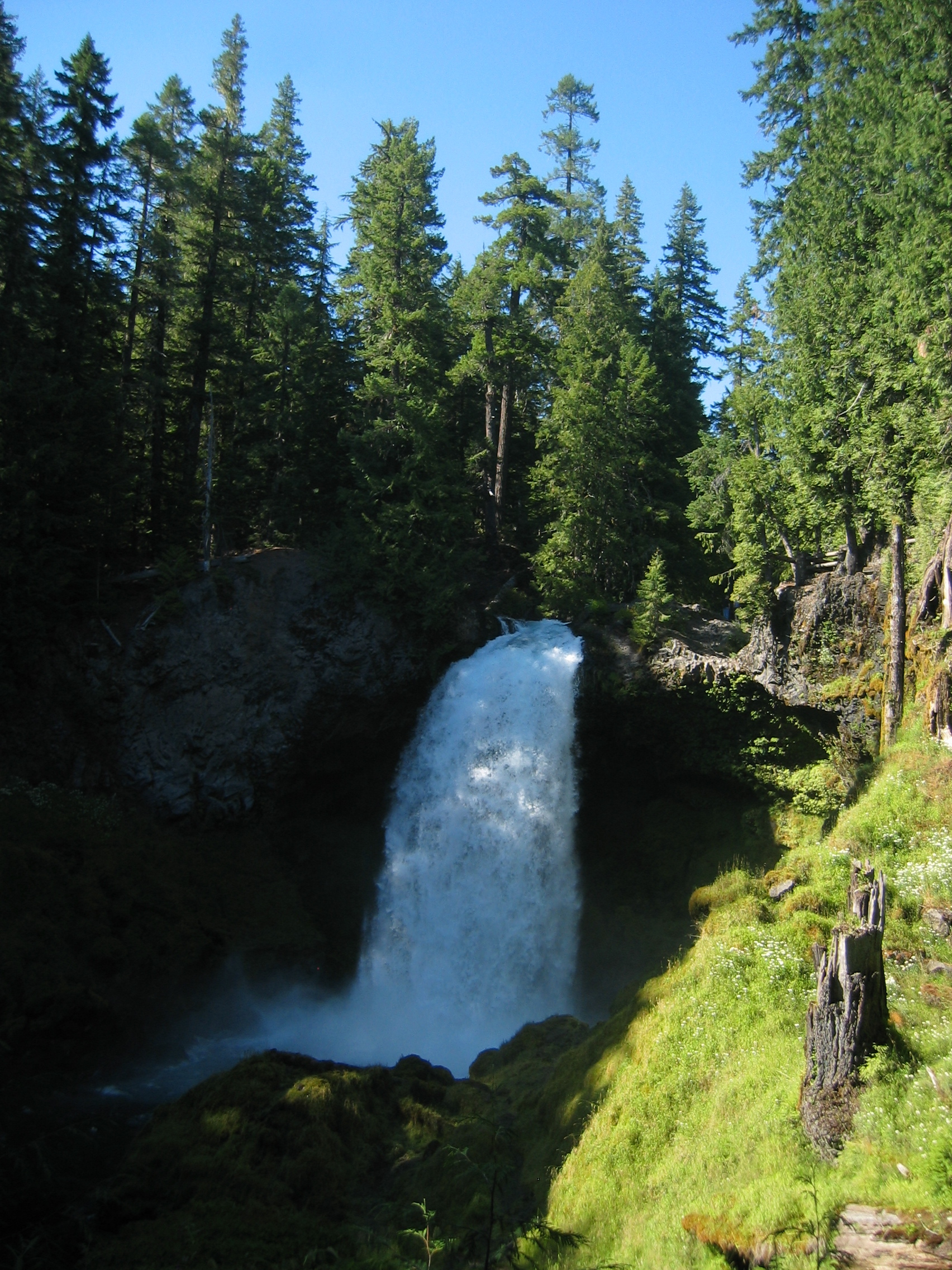
But that diversion has the advantage that I see the upper McKenzie
River and the beautiful water falls it features. One not unimportant
feature of the falls is that near them it is so wonderfully cool.
Like yesterday the whole area is thinly populated and I have to drive all the way to Springfield before I find a decent motel to spend the night.
- 168850 km on the bike
Springfield is just 400 feet above sea level, but soon after leaving
the town I enter the Siuslaw
National Forest, and there I can smell it; the sea is close
by. I ride on along the Siuslaw
River and instead of heating up it gets cooler by the minute.
At Florence
I finally reach the Pacific
Ocean at the mouth of the river, which I traverse on the Siuslaw
bridge. It is a nice thought, that just four month ago I was
on the other side of this very same ocean in NZ.
This part of the coast is famous for it large dunes
found in the Dunes
National Park.

I take in quite a few of those great sights like the one in above
picture. When I decided to take the coastal road I expected much
more traffic and less scenery, so I am positively surprised. The
temperature has fallen from yesterdays 100 degrees in Oregons High
Desert to about 63 here on the coast. Escaping the heatwave has
worked brilliantly. The only potential hazard out here is the morning
fog.
The road, highway
101, frequently runs directly along the rugged shore of the
ocean. How anyone could take the alternative, though inland bound
Interstate
5 and miss out on all these scenic views is beyond me.
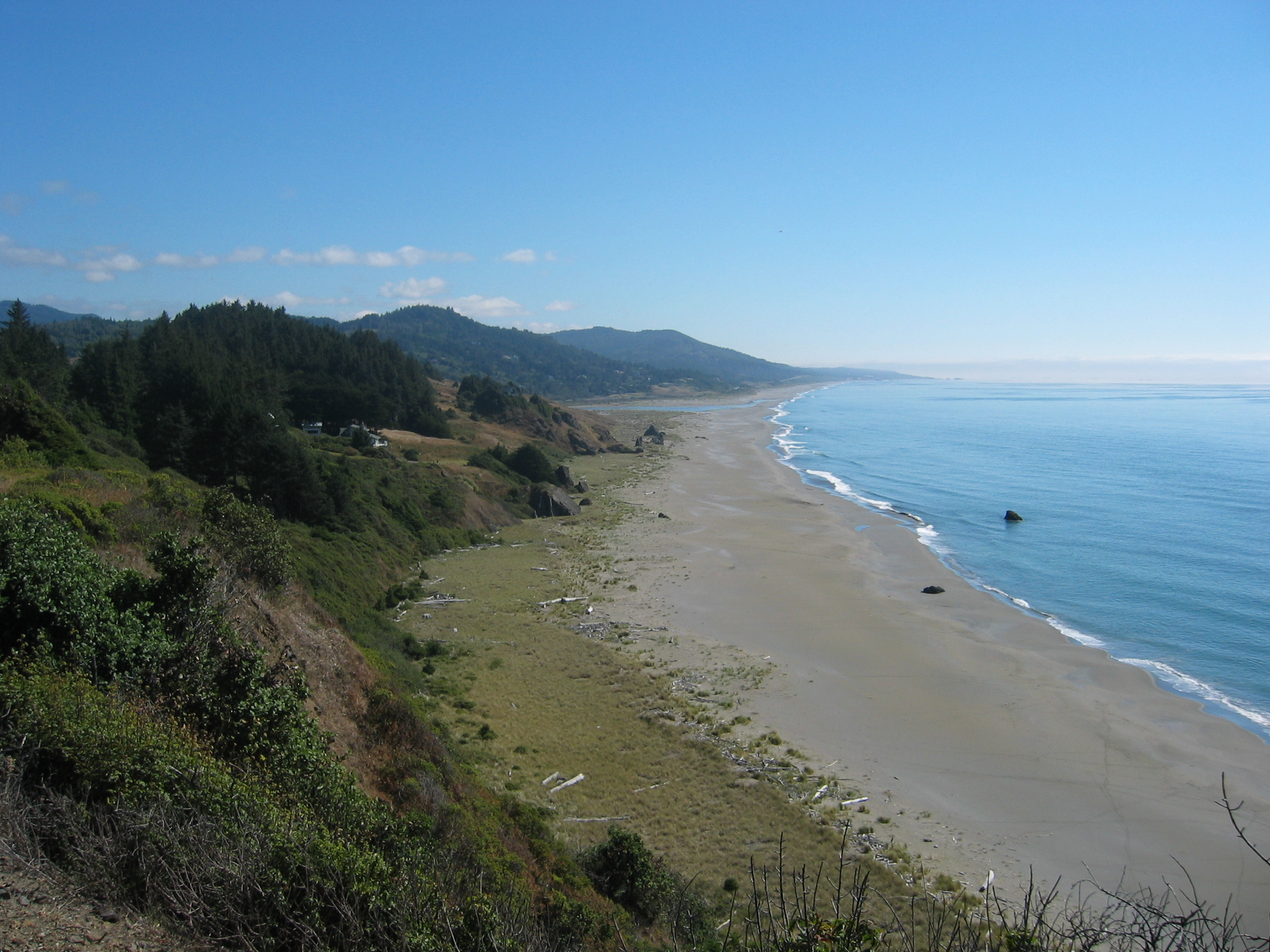
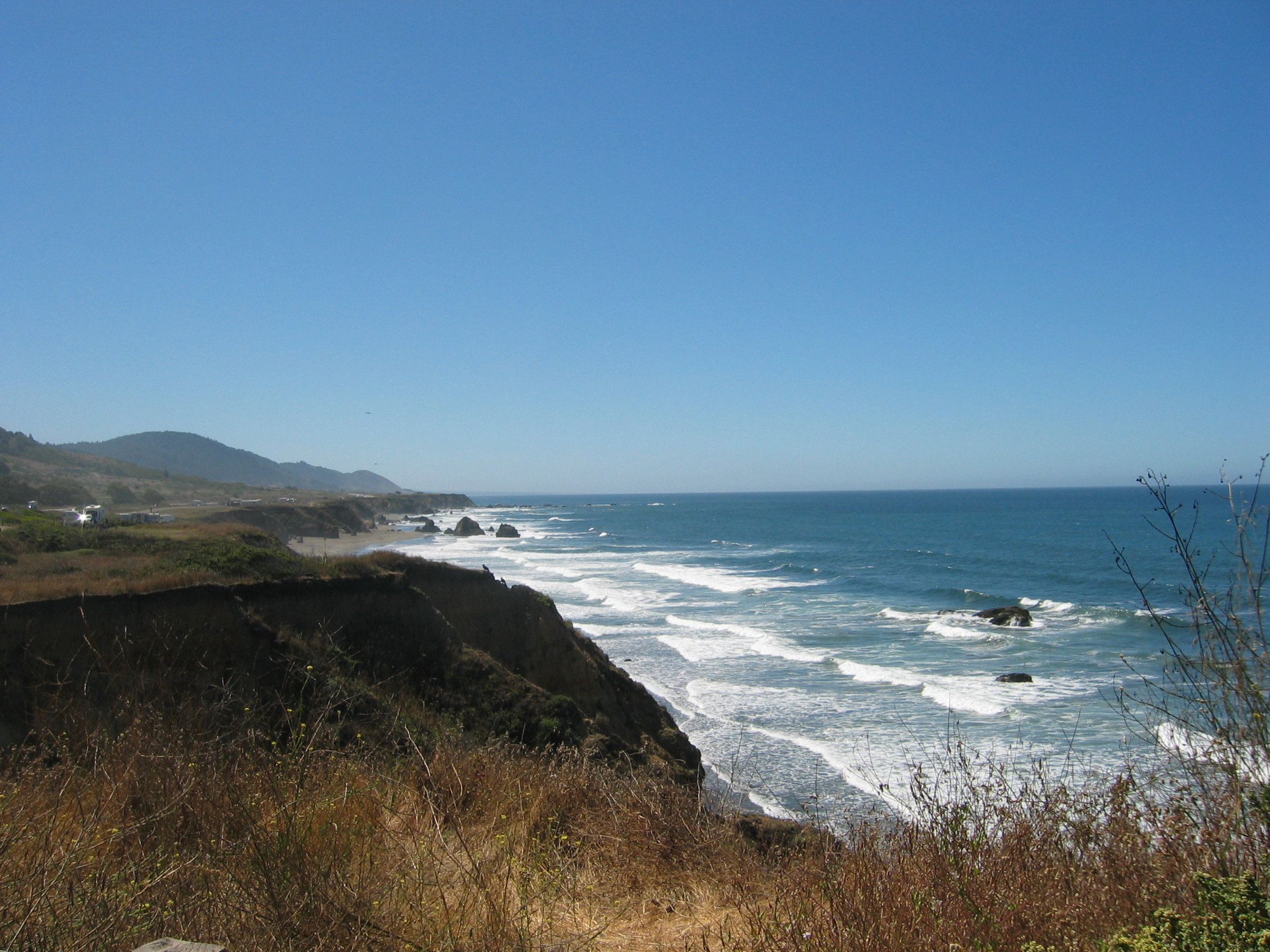
After just 300 km I call it a day at 4 pm at Gold Beach. I would like to go on, but I have again a few chores to do. First I need to do some washing. That is no problem, as all motels in the U.S. feature coin laundries. The second problem is that since Alaska Sally (my GPS) is no longer talking to me. Initially the right speaker in my crash helmet died, then it went completely silent. It appears that at the spot where the cable from the GPS unit to my helmet is routed between saddle and tank, some chafing may have occurred due to the slow wearing down of the rubber spacers. Knowing that for this type of German High-Tech I wouldn't get spares in a country where everything is oversized, under-efficient and clunky, I have brought a few spare parts with me for it. After two hours of wrestling with these German precision electronics, put in place by a Swiss mechanic equally precision-minded, I have the wiring working again. And the washing is also done, including my biker outfit, which was beginning to look as if it had been up to Alaska and back - hey, thinking of it, I believe it actually has...
- 169150 km on the bike
There was some rain overnight and the forecast predicted showery
weather for today. Instead the sun shines out of a spotless blue
sky, it is nice and cool and we did not even get any fog - it simply
couldn't be better.
I get somewhat stuck chatting with my room neighbours about the
state of the planet, the universe and all the rest, so I don't get
on the road before 11 am. The glorious ride along the Pacific coast
continues and is the same splendid fun as yesterday.
Most of the coastal areas are State Parks, and simply too many
to list here. After about an hour I reach the state line of California.
There are a few facts about that state you may or may not be aware
of: should these fairly liberal minded people of California one
day decide to secede
from the United States and its current
unpopular government, then it would still be the planets seventh
biggest economy all by itself. And it is big; from the border with
Oregon which I just crossed it is still over 350 miles to San
Francisco, the northernmost big city in the state.
At one stage of the road, sea fog is covering the land below me,
though I am only 400 feet above AMSL:
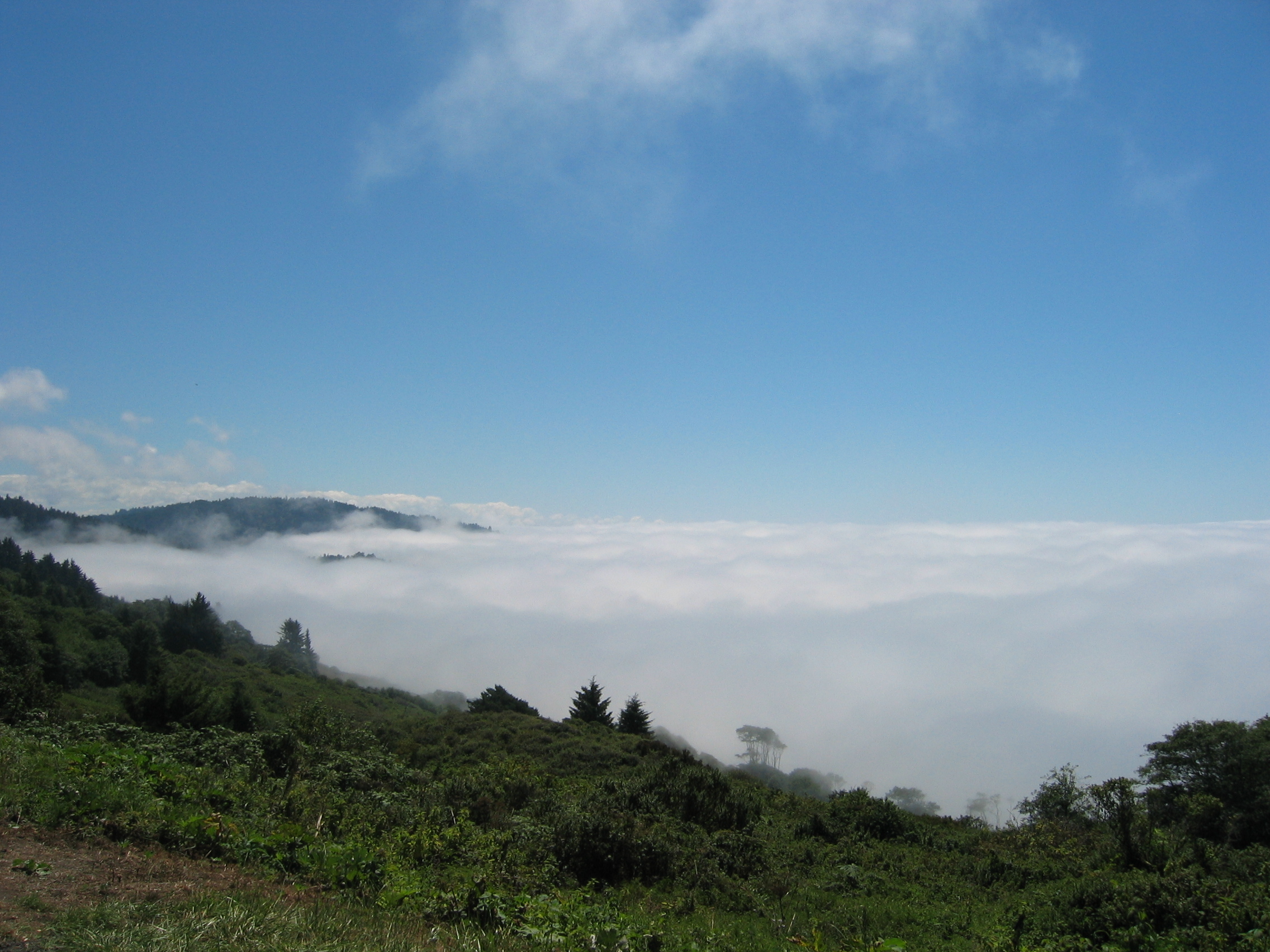
Swiss readers of my homepage are excused for assuming this to be
a photograph of their Swiss
Plateau during the period from mid-October to the following
April - it is not, though I admit that the resemblance is striking.
It really is the Californian Pacific coastline in summer, believe
me.
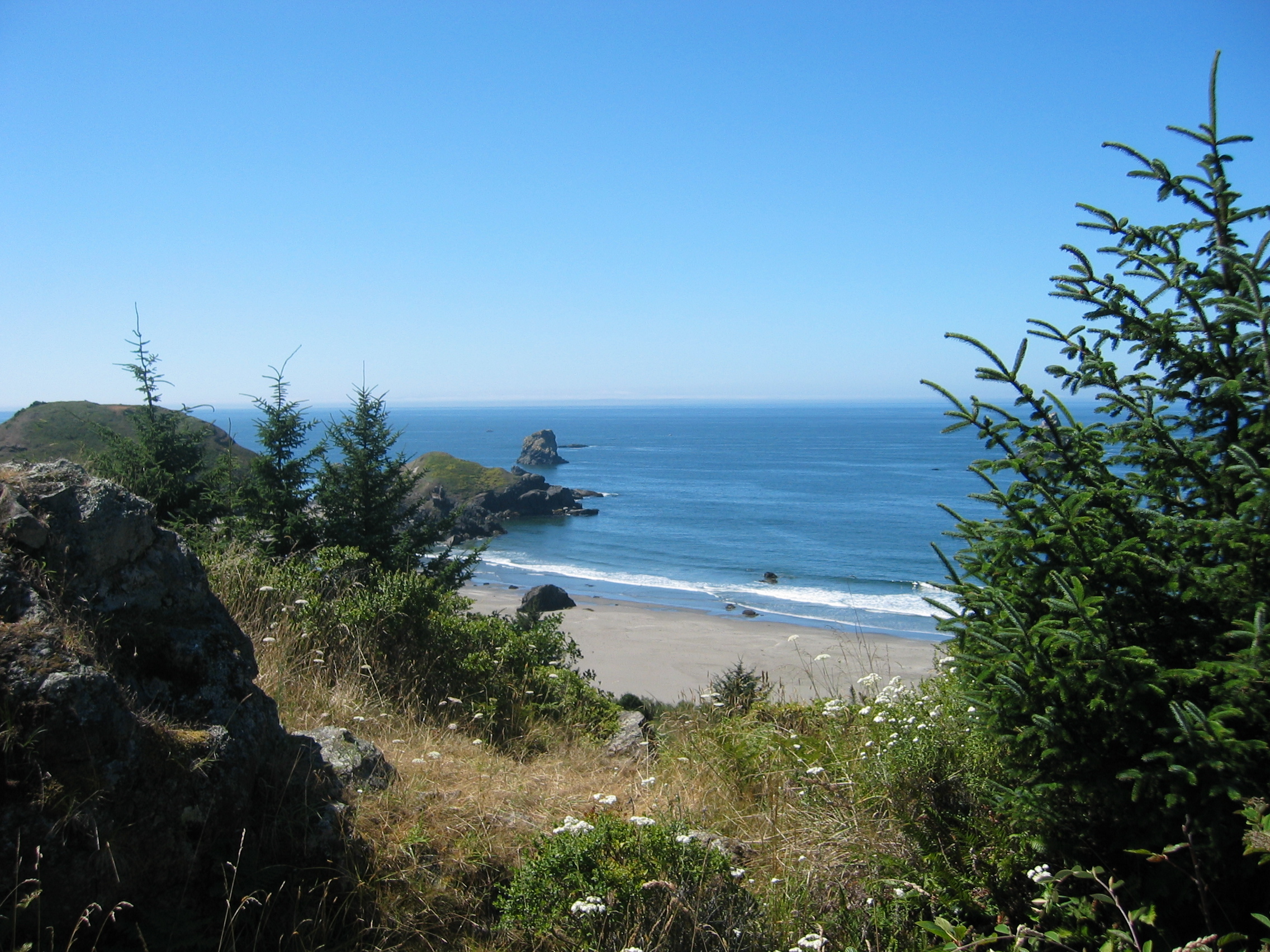
The area I am entering now is famous for its giant Redwood
trees, of which I am sure you have heard before. It is difficult
to show in a picture how big these trees really are. I have tried
in this snapshot by matching them up against humans, Kitty and cars:
Entering such a forest is impressive; the trees wipe out all the
light and at the bottom it is nearly dark. And other than the New
Zealanders with their Kauri
trees, here in California large areas of pristine 400 to 600 years
old Redwood forests have remained untouched by humans.
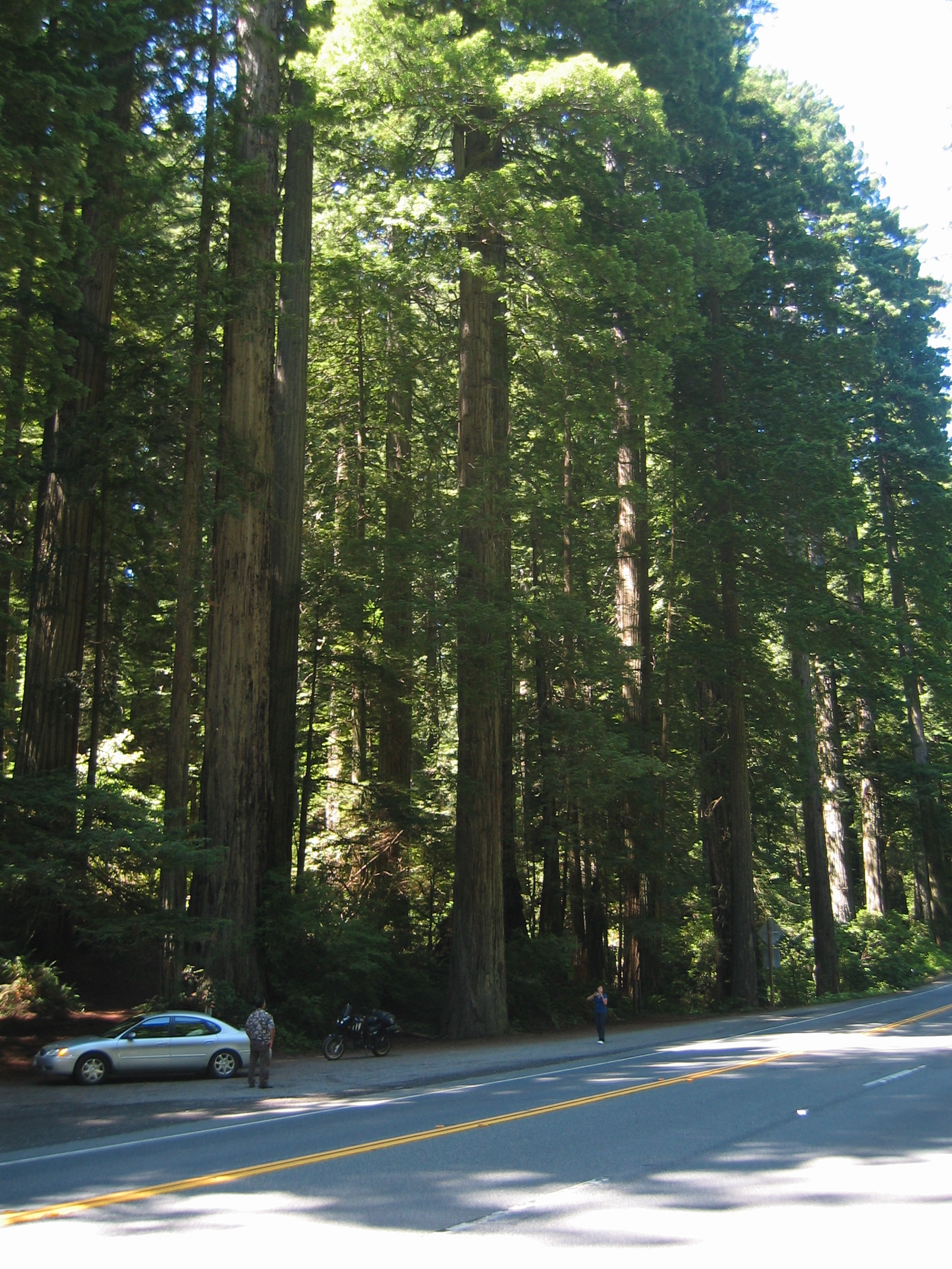
Near Rio
Dell there is a 32 miles long parallel road along highway 101,
called the "Avenue
of the Giants", which of course is a must for me. In reality
this piece of road was the old highway 101, before the new freeway
was put in place. For most of the time I bike in pitch darkness
under a canopy of giant trees. Here is an impression:
As you can see from the reflection of the cat eyes on the road
and the illuminated signpost, the flash of my camera fired because
it is so dark down here.
The one drawback this routing has is that it takes me about twenty
miles inland and away from the cooling coast. As an old sailplane
pilot I know very well that the effect of the sea breeze reaches
about thirty miles inland, but already it is significantly warmer
out here than directly on the coast.
I end the day right within the forests at the tiny hamlet of Dean
Creek.
- 169500 km on the bike
I am rolling at 10.30 am, first for a few miles on highway 101,
but then heading out west on highway
1 back to the coast.
Highway 1 is brilliant for motorbiking, with many winding sections
and an infinite supply of great coastal views. The only thing that
I do not see using this road are the vast vineyards that exist inland,
but I can live with that.
Once again the temperature here along the coast is around 63 degrees.
I will not bore you with yet another lot of coastal views, just
watch this single one if you are a surfer:
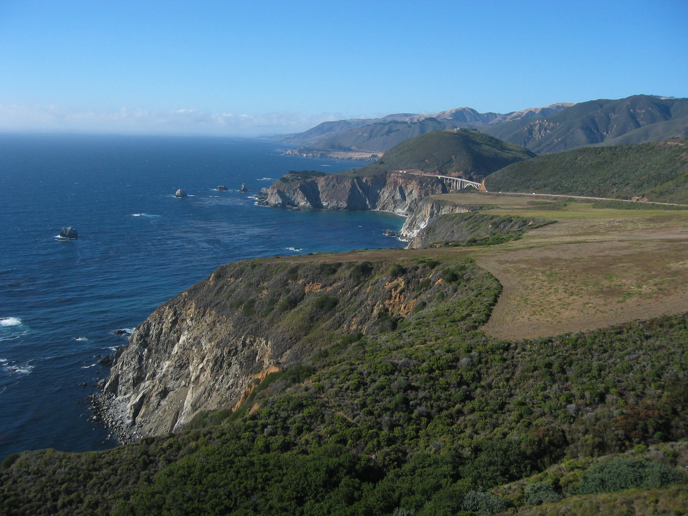
At Fort Bragg I have a Chinese lunch and later at Bodega Bay I check out the motels. But I find that the coast is very popular with the Californians, and motels here are very expensive. I decide to move a bit inland and try at Santa Rosa. I end up a few miles down the road at Rohnert Park. The reason why my average daily mileage is down on previous performances is simply due to the winding roads and the many sites where one just has to stop and look at the scenery.
- 169800 km on the bike
This morning I ride back to highway 1 - it is amazing what a huge
difference the proximity to the water makes. Inland it is already
burning hot by 10 am, while at the coast one sometimes wishes for
a few degrees more.
Today is Saturday, so what Californians like to do on weekends is
best shown in this picture:
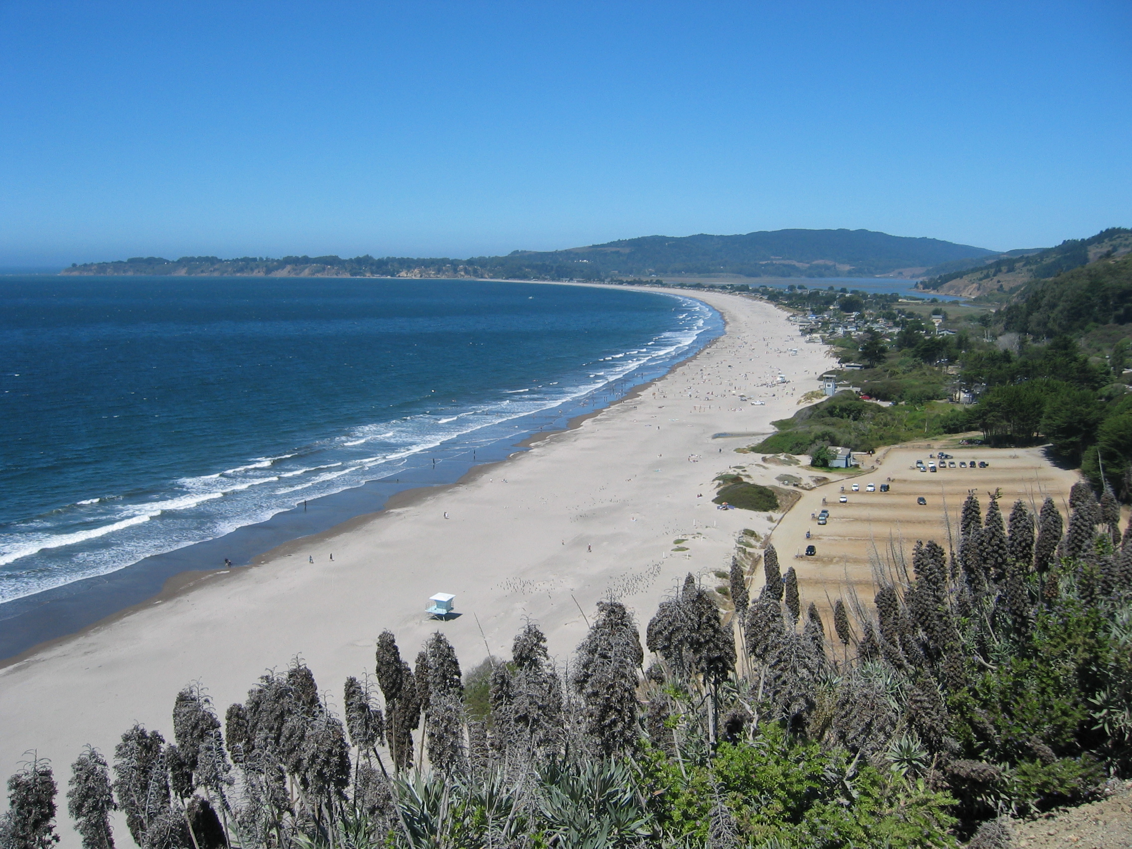
They like beach life, especially if the interior of the land is
scorching, while at the beach it is nice and cool. Cars and vans
loaded with surfboards, kayaks and other sort of beach kit are out
in force. It soon dawns on me that this invasion of weekend warriors
may make finding a place to stay quite difficult today.
But I am used to tackle one thing after the other. Let's leave "multi-tasking"
to a future life. I am slowly approaching San
Francisco. This means that from now on most place names, counties
and suburbs are familiar to you all out there - because we all have
been weaned on a diet of Tinseltown
movies, and these movies have exported about any place name along
the coast one way or another. By the way, at Bodega Bay where I
came through yesterday, Hitchcock
filmed "Birds",
but I did not mention it because Hitchcock was an exception. Most
movie makers stay much closer to Hollywood than he did. But from
here onwards I assume that you, dear reader, know your (movie -)
California. So I will just mention the places, but no longer explain
them.
The first such place is just ahead: I have my lunch at a Chinese
takeaway in Sausalito.
The area here is far away from Frisco's Chinatown,
but everyone here appears to be of Asian origin; the newspaper dispensers
sell only Chinese
newspapers, the Chinese takeaway staff has profound difficulties
with my British
English, and no obese people are to be seen anywhere - I am
quite far away from real America here.
But soon the next thing we all know so well is in the way: the
Golden
Gate bridge, spanning the San
Francisco Bay. Well, I suppose you all know that bridge, but
do you know that it costs five bucks to cross the bay on it? And
with that usual inefficiency that drives me completely nuts these
Yanks charge five dollars for any car or bike - as they just charge
$2.50 per axle, completely ignoring the vehicle gross weight. The
average truck pays $ 12.50 for 60 tons, while I pay five for 0.3
tons.
San Francisco is not your typical U.S. town. Buildings here are
actually much closer to European standards rather than the usual
U.S. cardboard box standards. Another thing that endears the city
to the Old-World traveller are the functioning public transport
systems (they even have electrically powered trolley buses) and
of course the fact that the roads in town really go up and down
the hill sides just like we saw it in all those movies. The one
thing I hope not to experience here is an earthquake.
Highway 1 is a good way to avoid most of Frisco. Soon I am back
on the open road along the coast of the Pacific Ocean. At Santa
Cruz the road takes a shortcut inland - and immediately it gets
burning hot. Monterey
I reach by 4 pm. The local Super 6 budget motel wants 170 dollars
for their cheapest room. Hmmh, I think I have to contemplate that
other problem out here - room prices on weekends just treble due
to all those weekend warriors out and about.
Two hours later I try again at San
Simeon: the place is an utter tourist trap, and they want to
unload their last room on me for 280 dollars. Screw them, for that
money they must offer me the Hearst
Castle up on the nearby hill.
But what should I do? Two weeks ago it was still bright daylight
at 11 pm, but down here sunset is at 8 pm and by 8.30 pm it is pitch
dark.
I will go a long way to prevent being ripped off, but there is one
thing I try to avoid at all cost; biking at night. That is statistically
six times more dangerous than biking during daytime. I decide to
do a compromise: I can bike to San
Luis Obispo and reach that place with the last light. That town
is fairly big, is 15 miles inland and hopefully much cheaper than
the other resorts.
I arrive after 550 km in that town at 8 pm, having done another
nine hours of solid biking. I get one of the last three rooms in
the local motel for 135 dollars (the owner tells me that tomorrow
the same room will cost 58 dollars). Stranger, if you are ever out
here on the coast, ensure that you spend your weekends in some inner
city where they do not do weekend rip-offs. You can download my
routes and tracklogs along the coast here.
- 170350 km on the bike
I am up early and on the road by 9.30 am. The highway is good and
fast and Kitty eats the miles. I think it is not necessary to mention
the places I pass - you should know them anyway, places like Santa
Barbara, Malibu
etc. I also come along Vandenberg
AFB, yes, the place where the space
shuttle lands if it rains in Florida.
There is also a giant cloud of smoke in the air to my left. It looks
like an erupted volcano, but I know that this is really a massive
wildfire
in the mountains above Los Angeles.
The road has eight or more lanes while approaching LA. Suddenly
a Toyota
Tundra appears and nearly forces me off the road. Then the guy
in the Tundra cuts off a Pontiac
ahead of me - that guy drives like a maniac. I think to myself "where
are the cops when you need them?". In that very instant a black
and white pulls out from behind a bridge pillar, and one minute
later the Tundra driver has some difficult explaining to do to the
two cops inside. Law enforcement appears to work around here.
By 1 pm I am in Los
Angeles. I am normally not a big city boy, but as a movie aficionado
(and even some Hollywood ones) I have to take a look at Tinseltown
myself. First I have a look at Beverly
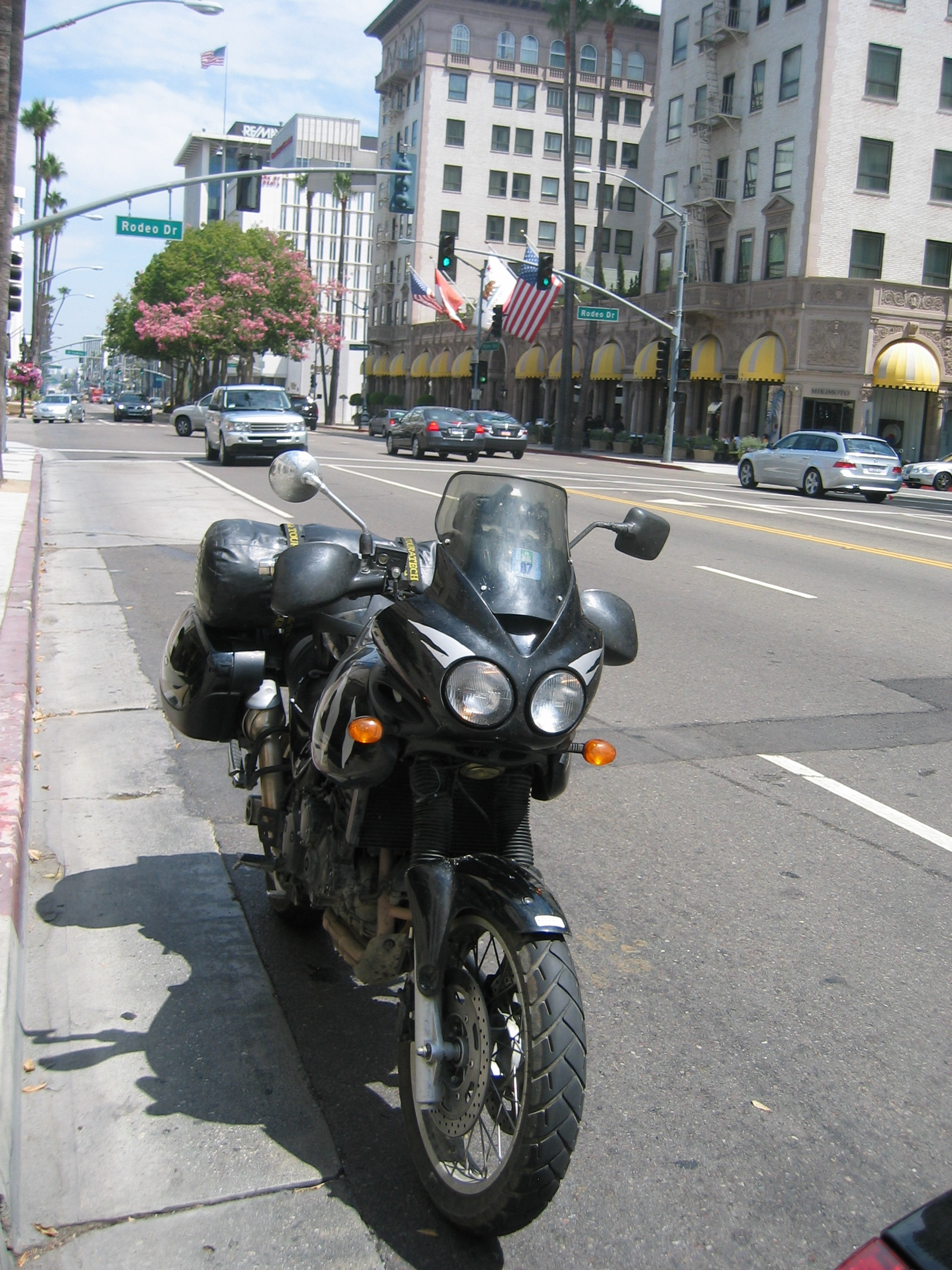
Hills. Here is a snap of Kitty sitting at the corner of Wiltshire
Boulevard and Rodeo
Drive.
I do not stay long - I do not want to get run over by Mad
Mel or some other drug-crazed Hollywood star or being "discovered"
as the next Mad Mel by some wannabe producer.
Next on my agenda is Universal
City film studios. I just want to have a look - and I get it.
There is more security on the beat here than at Fort
Knox. They must be very afraid that some spaced-out terrorist
is going to shoot Hollywood actors. Hey, you terrorists out there,
if you are currently hatching a plan to do in a couple of Hollywood
actors, script writers, producers or directors - please contact
me first. I have a long list of bad ones, which the world of movie
making will benefit from getting rid of.
There is Marcos trattoria on Santa
Monica Boulevard, so I stop there for lunch. They have free
wireless, so I do my e-mails while eating there. Though in Beverly
Hills, the prices in this joint are only twice what they are in
the rest of the United States - I pay 20 dollars for my lunch.
Now this is enough Big City Life for me. It is time to get out of
here, so I take highway
14 out of town. This highway has not only the number 14, in
parts it also features 14 lanes, seven in each direction. Even more
impressive is to see those 14 lanes being choked completely with
traffic - we are just crawling along at 5 mph in a sea of motor
vehicles from one horizon to the other, the average number of vehicle
occupants being 0.8.
I ride on north into the Mojave
Desert. Of course it is getting hot, but it also gets up into
the mountains.
I was in this area in 1995 and came across the California
Aqueduct, which provides all those coastal cities including
Los Angeles with drinking water. I can vividly remember my thoughts
back then; "Absolutely unprotected. What if some spaced out
nutter poisons the water?".
Now, 12 years later I am back to see what homeland
security has done since those 9/11
attacks to ensure the safety of this water supply, upon which
millions of lives depend. This picture explains more than I could
do in a thousand words (taken today in the afternoon):
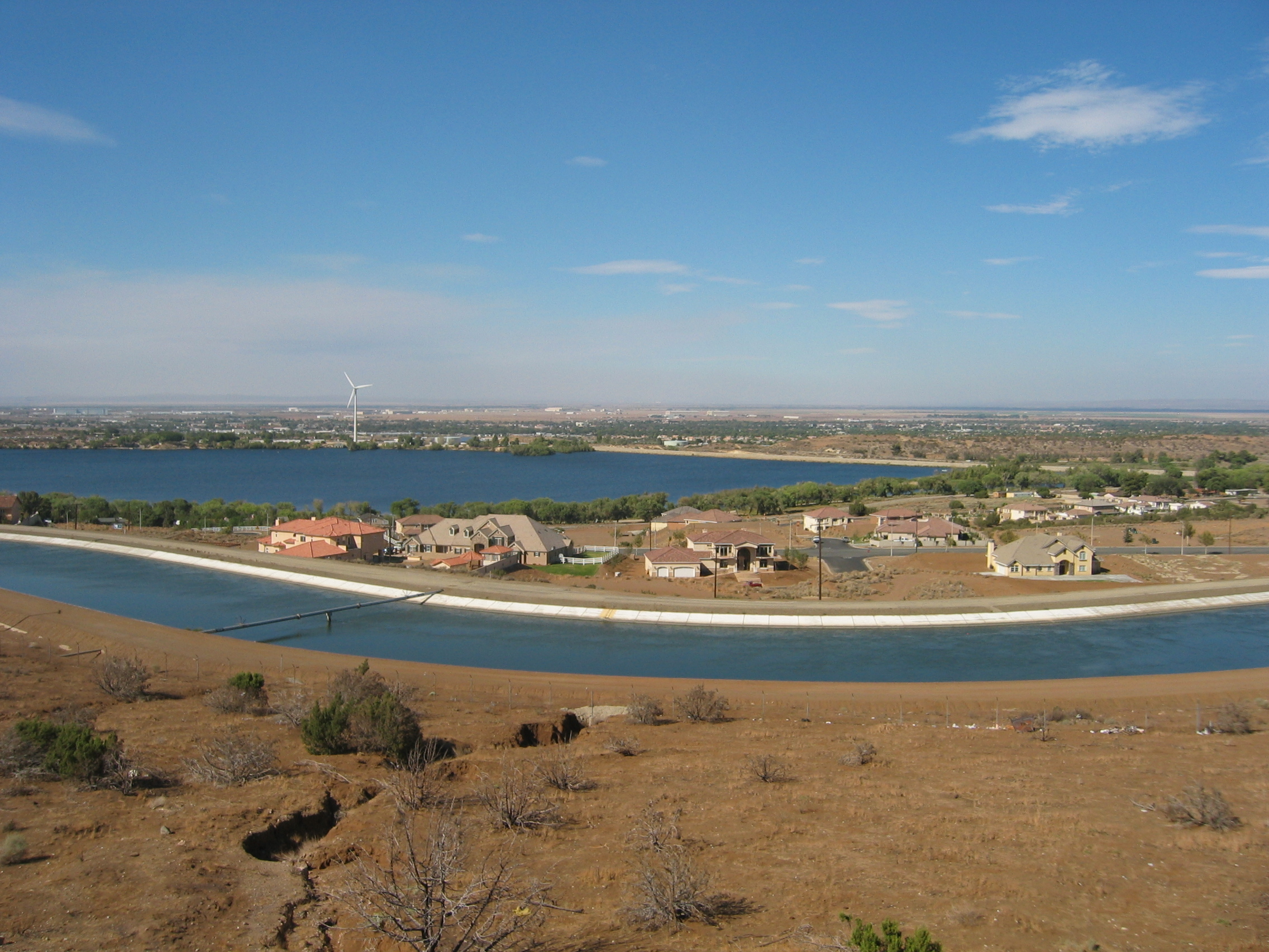
I have found detailed online information upon what checks the LA
waterworks guys are performing on the raw water from above aqueduct,
all the nasty guys need is to find something they don't check for
- and LA is gone.
I ride on to Lancaster
and call it a day after 450 km. Hopefully that place is not using
the aqueduct for its water supply. I lodge at the very comfy Oxford
Inn - luckily the weekend warriors are back home.
- 170800 km on the bike
The motel price includes full American breakfast, so I stuff myself
sufficiently this morning for another 24 hours.
At 10 am I set out into the Mojave
desert. It is already burning hot here, in spite of me being
2000 feet AMSL. But I have come to the conclusion that if I wait
for the heatwave to disappear, I'll probably have to hang out at
the coast until November.
Just after leaving Lancaster I reach Edwards
AFB, yet another place where the space
shuttle sometimes lands.
Initially the countryside rises very slowly to about 1300 metres
AMSL. And soon the air around me gets ever more hazy. I first think
that this is smog, but then I realize that this is the smoke from
the Zaca
wildfire I saw yesterday, now creeping over the mountain ridge
and polluting the next valley. It is burning for five weeks now,
and is so far the second largest wildfire in Californian history.
3000 firefighters are battling it - that's probably no fun in this
stifling heat.
By noon I am approaching Owens
Lake. Most tourists will just see a saltpan to their right and
think nothing of it. But I know better. This lake, the last traces
of which disappeared in 1924, was the first fatality of the Californian
water wars. This place is the prove that our ancestors at the
beginning of the 20th century were just as good as we are today
when it came to turning a pleasant valley into a grim desert for
profits sake.
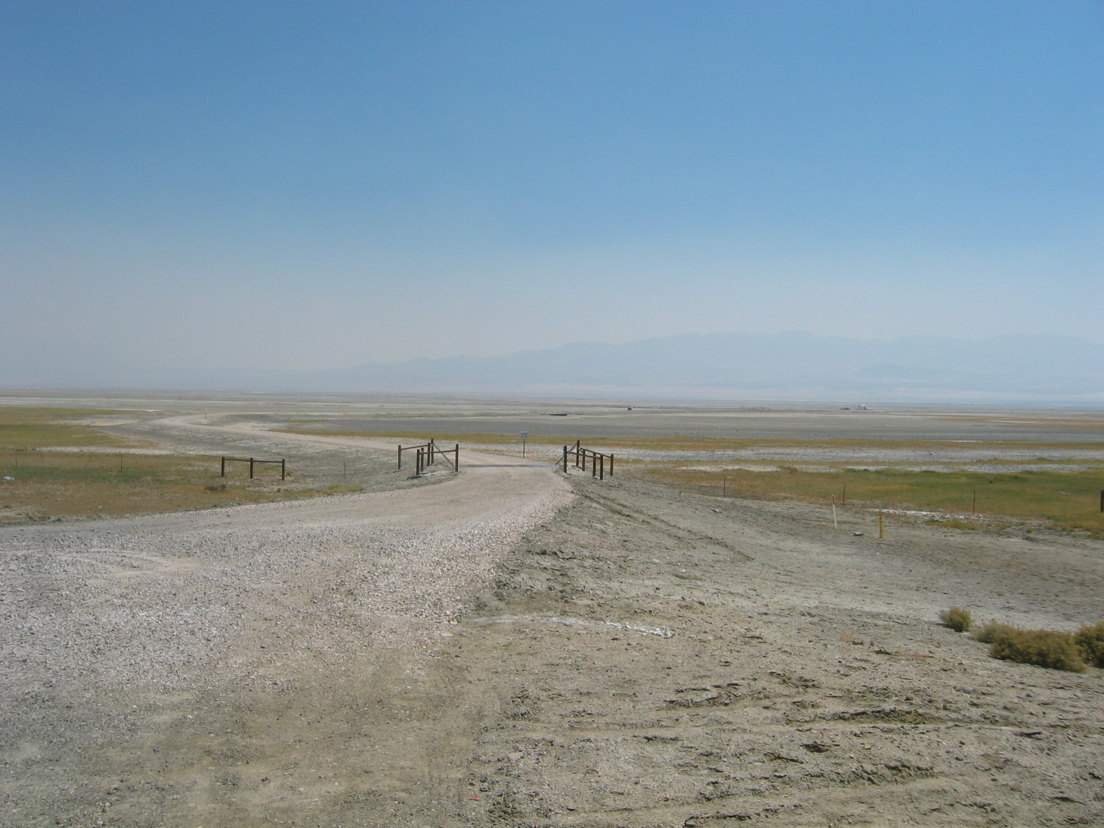
I have been here before and places like Lone Pine are no place for people with breathing problems. The high wind raises caustic soda dust from the former lake bed and pollutes the air with it. But today the situation is completely off the known chart: the usual soda dust is bad, but the added acrid smoke from the forest fire turn this town into a nightmare of air pollution. Governator Arnold A. Schwarzenegger has declared a state of emergency yesterday, but I had no idea that it was so bad. I stop at the Lone Pine visitor centre, and some people working in there are virtually on their last legs. "Air pollution is common around here" I am told by one of the clerks, "but this is the worst we ever had in decades". I am told that the smoke extends up to 40 miles north from here, so I am keen to get on. My throat is scratching and the acrid smoke smells awful. I am also very concerned for Kitty's air filter, already strained heavily by the dust up North in Yukon and Alaska.
The great heat remains bearable all day due to the low humidity
of just 50 percent. Every ounce of sweat evaporates immediately,
so it is just important to drink enough water. This morning I drank
three litres before setting out.
At Bishop
I am finally out of the smoke. Beyond Bishop the road also climbs
rapidly up towards Crowley
Lake to 2400 metres AMSL. It is bliss to feel the heat abate
a little. At a petrol station I find to my utter surprise, that
they are selling unchilled mountain spring water in half
gallon
bottles. Great, just what I need.
I end the day after just over 400 km at Lee
Vining, a small community at Mono
Lake (another casualty of the water
wars, but unlike Owens
Lake not yet entirely dead). I check the web and find that there
is a Triumph dealership in Reno.
I give them a call on my web
phone and they have no problem fitting me and Kitty in for a
spark plug, oil and air filter replacement for tomorrow afternoon.
Maybe the standards of bike dealerships are better out here in the
Wild West? As usual you can download my bike routes and logs here.
- 171200 km on the bike
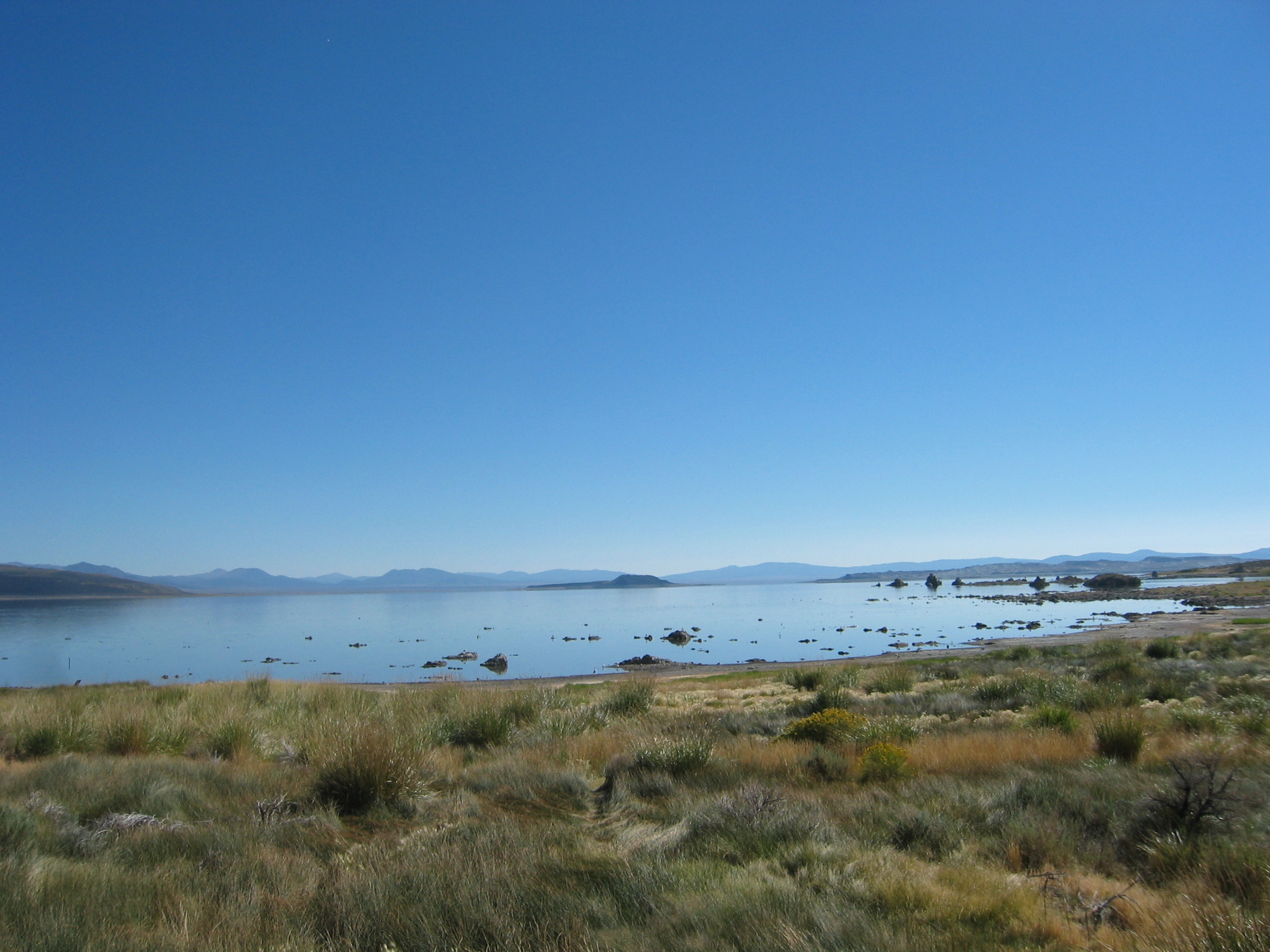
I find that the tap water quality here at Lee Vining is more than excellent. I suggest to the landlady that the town should sell this exquisite liquid as mineral water. But apparently I am not the first one to suggest this; the local spring does support the community, but bottling thousands of gallons would overwhelm its capacity. I fill my half-gallon bottle with the stuff and also drink five pints before I leave the village at 9 am. Here is an impression of nearby Mono Lake at this beautiful morning:
The road remains for many miles above 2000 metres of altitude,
but towards the Nevada
state line it slowly comes down to about 1400 metres. I need petrol,
but here in the outback they charge 4.25 dollars for the gallon
of premium. I coolly fill the tank with just three dollars worth
of juice. That will get me to Carson
City in Nevada. Once there I fill the tank to the brim - at
2.89 dollars per gallon and have my lunch there. Then I head on
those few miles to Reno.
The dealership is a bit hidden, but I find it all right. The air
filter is in surprisingly good nick in spite of the dust in the
Wild North and the 100 miles through wildfire smoke yesterday.
They also sell a range of custom chopper
bikes, typical American style and utterly useless on any type of
road except the American highways:
That changing oil and filter, air filter and spark plugs takes three hours is something I am now used to, having seen American mechanics in action before. Hans and his crew in Switzerland do that kind of work in under 20 minutes, but alas, this is not Switzerland. And the guys here are very friendly and I chat with the staff and the various bikers that visit the place. All agree in one point; they have never seen any bike with that mileage on the clock. By 4.30 pm everything is sorted and the bike ready to roll on until I can finally hand her to Hans for a real service. The mechanic after his test ride can hardly believe that Kitty is still running so smooth and the engine runs just as good as a new one. They also have cleaned the bike, so she is quite nice to look at - another thing that these guys here find very extraordinary.
While chatting with these guys I ask them what true Nevada desert bikers do against the stifling heat around here. "Wear an evaporator" is their prompt reply. Now it is my time to be puzzled. What is an evaporator? They put me into the picture right away. An evaporator is a jacket out of highly hygroscopic material that can soak up half a gallon of water. The biker wears it under his protective jacket, but lets the zip half open to allow the air to evaporate the water. That thing will work for about four hours. After that, one just stops at a petrol station and re-soaks the jacket. This is like me pouring water over my protective vest, just more sophisticated. At 40 dollars the vest is reasonably priced and I buy one on the spot. They also give me one of their Triumph T-shirts as a present - I will wear that next time I see Hans, just to annoy him. They charge me 170 dollars for the work on the bike
By 5 pm I am back on the road. I have also been given a scenic diversion from my planned route; they told me to take highway 431 to Virginia City instead, and that road really is great fun to bike. Virginia City is the same kind of crumbling collection of cheaply built cardboard boxes dating from the second half of the 19th century as Dawson City was in the Yukon Territory. Back home we'd bulldoze these crappy constructions and we'd then build something fit for human habitation instead. But here there is a big problem with that entirely logical solution; though most of these matchwood boxes are only a few decades old, people regard them as part of the national history. Sounds ridiculous, but these guys here are absolutely serious about it.
Luckily for me I need not stay in one of these moulding tourist
traps. There are modern motels at the far end of town, where 55
dollars buy a room where two of the four walls are actually made
from bricks. And there is a view, too; right opposite the motel
is the real thing, the Comstock
Lode mine.
All in all it was a successful day; Kitty is clean and ready for
more mileage and I might not sweat too much tomorrow due to the
evaporator.
- 171400 km on the bike
At 9.30 am I set out until I reach highway 50. I turn eastwards
on this road, nicknamed "The
loneliest Road in America". And especially this stretch
here deserves that nickname - there is just desert and high passes
out here. Seldom do I find myself below 2000 metres - but it is
still burning hot. The evaporator works quite well and also really
cools for four hours - I am very pleased.
At Austin
I fill up the tank and have lunch. Villages out here are usually
more than 100 miles apart, and in between is just sage
brush desert
By 4.30 pm I arrive in Ely,
one of the few larger villages around. The place looks like downtown
Belfast. Murals
are on many walls, but I soon discover that these murals are far
less political the the Irish ones - they depict scenes from when
the town was founded a few years ago.
I choose the Hotel Nevada in the village centre, not because of
its pseudo-history, but because it is the only digs in town not
being build from cardboard sheets.
Like many other towns in Nevada, Ely is also a gambling place. The
two bottom floors of the hotel are just for gamblers. I have seen
these rows of one-armed
bandits once in Sun
City. Droves of elderly people (and also a few younger ones)
sit mesmerized in front of them, each holding a plastic bucket filled
with coins in one hand and feeding those coins into those machines
with the other. I can only assume that these people have such a
dreadfully boring life, that feeding coins into a slot machine is
actually stimulating for them. Save your money, folks, and buy a
motorcycle instead!
At the reception they charge just 40 dollars for the room and also
give me a free drink voucher and two vouchers for the Black Jack
table. I hand the latter two back - I have no idea how to play that
game, or, come to think of it, any games involving money. I find
them all absolutely boring.
But this place is absolutely typical for Nevada; charge little for
the room, because people will loose money while gambling.
I am on my way to have a look at the town, when I realize that the
food buffet is also complimentary - I can't resist and have some
chili and chicken. The only place I can see to eat that food is
the bar, as the rest of the room is full of slot machines. But I
find it very difficult to place my plate on the bar, because they
have built gaming machines into the surface, which thus is quite
uneven. Feel free to download my routes and tracks of the last two
days here.
- 171950 km on the bike
From Ely I head south on highway 95 this morning. The ride is not
overly exciting, but I know that this diversion south will pay off
this afternoon. At Panaca
I fill the tank and turn eastward onto state
route 341 and after a few miles cross the state line into Utah.
At Cedar
City I have a quick chinese lunch and then pull in at the Zion
Bank to get some cash from their ATM machine. I walk around the
entire building, but can't find it. I ask inside, and the clerk
points me to an isolated concrete box near the driveway exit. How
stupid of me. Did I expect the average Yank to get out of his car
and walk to the hole in the wall? Of course not, most banks here
feature just "drive through" ATM's.
I head out of town and immediately the countryside turns very interesting.
I am in the Cedar
Breaks National Monument, a rather spectacular scenery with
just one drawback; for the most interesting stretch of two miles
it is forbidden to stop - so no photo, see the Wiki if you want
any.
But at the top plateau I stop and take this picture of Navajo Lake
near Duck
Creek Village:
The road is also fantastic, winding itself slowly up to over 3000 metres. In Cedar City I have donned my evaporator, but up here I soon find it quite cool with that thing on. And the road remains high up for many miles. I hit highway 89 and turn north. After 400 km today I stop at the small hamlet of Hatch, where they have a very quiet and comfy motel.
- 172350 km on the bike
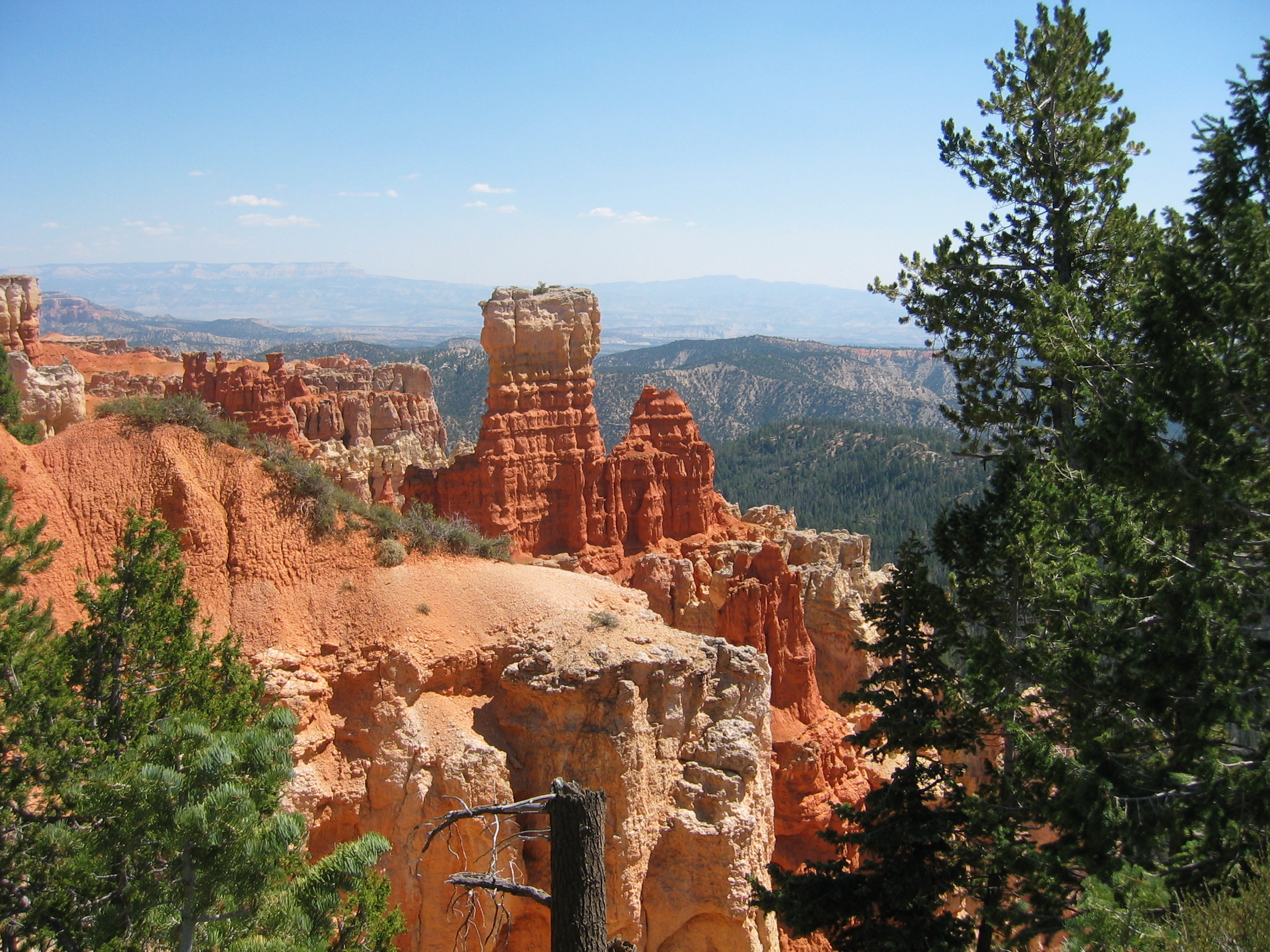
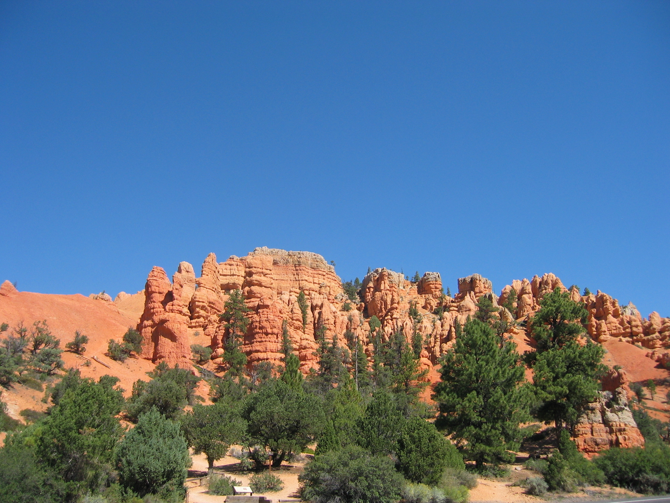
It is just a few miles from Hatch to the junction of highway 89 and state route 12. I turn east on SR 12 and find myself immediately in the fantastic Red Canyon of the Dixie National forest. But that is just the beginning of the fun; after a few great miles the cul-de-sac turnoff into Bryce Canyon appears. There is an entry fee to pay at the park entrance, but this time it is not a flat fee for everyone; cars pay 25 dollars, motorcyclists only 12 - now that's what I call fair.
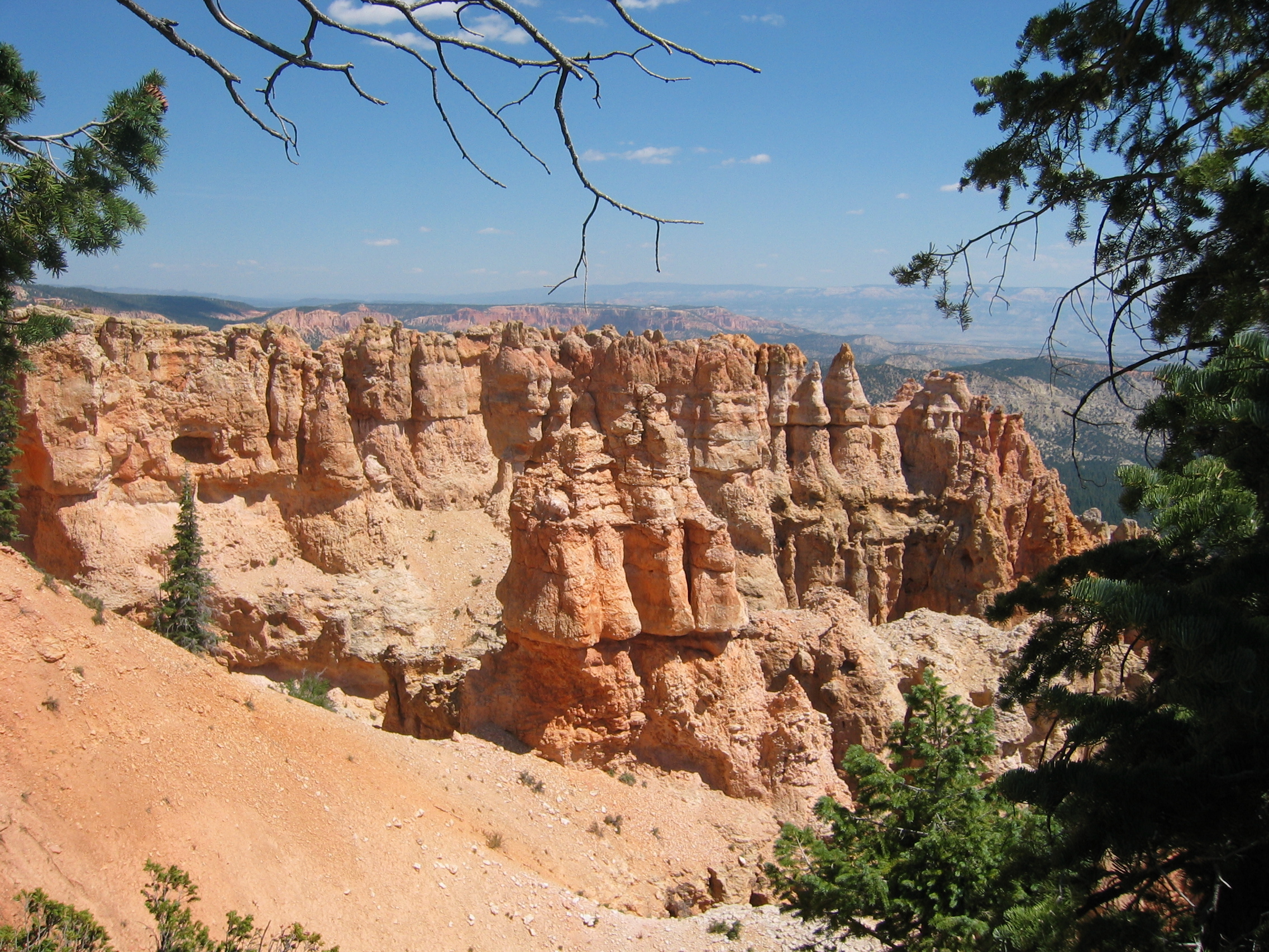
This National Park is an absolute must-see if you are ever in this area. Spectacular views of eroded rock formations are around every corner. I stop every two minutes to take yet another picture fit as a desktop background or cover of National Geographic.
Taking so many pictures slows me down and it takes more than an hour to reach the end of the road at 2700 metres above sea level.
This is the only way for me to give you at least some inkling of
what I have seen today.
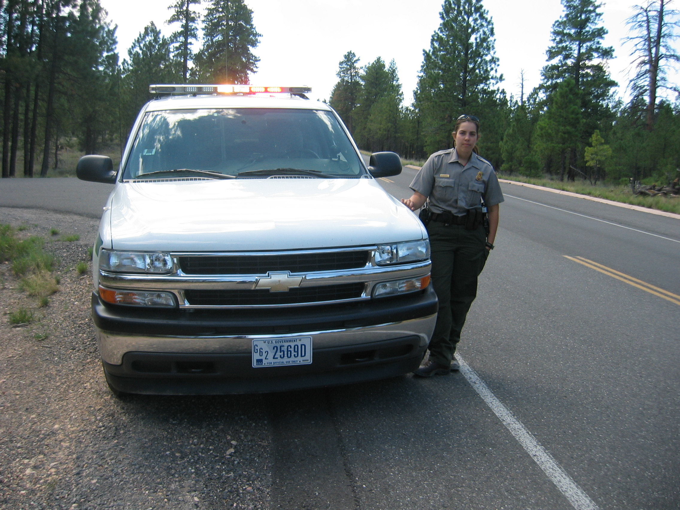
On my way out of the park a Buick
is creeping along ahead of me with 25 mph. The driver appears to
be older than the brand of car he is driving. There is a 35 mph
speed limit in the park. I can take it until we are past the entrance
toll gates and overtake the Buick - only to find a Park
Ranger behind my tail, pulling me over. Officer Neumann, the
cop inside, explains that I was not yet out of the park and points
to a stone structure 100 yards
ahead. She accepts my plea that I thought I was out of the park
and the usual 55 mph speed limit was applicable and waivers the
speeding charges. But the double yellow line does cost me 75 dollars
fine - sadly breaking my personal record; my last fine were ten
Deutschmarks
I had to pay for speeding in Germany in the year of grace 1981 (except
of course the fine I got in NZ which I never paid).
Unlike the cops in New Zealand officer Neumann is allowed to take
cash. She also would accept credit cards or local cheques. I take
it with humour; if I had to pay for all the superflous red lights I have jumped
in America, all those double yellow lines (put in place to protect inept US drivers from themselves) I may have crossed "by accident" and all those
speed limits I interpreted with some imagination - well, I suppose I would have to settle
the United
States trade deficit in fines. And anyway, which of you guys
or gals could charm a copper
to pose for a picture after paying my fine? Here you go:
At Boulder I have a late lunch at a surprisingly good local restaurant.
Outside there is a dusty Mercedes
with New York plates parked at the curb. Its owners are Henry
and Jourdan,
two Big
Apple citizens who are trying out a different way of life. We
have an excellent lunch and an excellent conversation about life,
the universe and all the rest.
I end the day after 300 km at Torrey
in the local EconoLodge
motel. Torrey in itself is a village with a view:
What a great day! I feel like celebrating with a cold beer, but
find to my dismay that Utah is one of those states with bizarre
booze laws; beer sold in supermarkets must not contain more than
3.8 percent of alcohol by volume - so I rather postpone celebrations
until I am in another state where beer tastes like beer.
- 172650 km on the bike
The road today goes initially eastward along the Fremont
River on state
route 24. At Hanksville
the river unites with the Muddy
Creek, and forms the Dirty
Devil River, which I cross at this place, and then head south
on highway
95.
The Lake
Powell appears ahead in the Glen
Canyon. I take a short side road to get a good first look at
the Colorado
River, which forms this large reservoir. By the time I reach
the bridge over that river I am down to 1100 metres above sea -
and it is burning hot down here. Time to put on the evaporator once
more.
From this lowest point the road slowly climbs back to 2000 metres
and stays at this altitude for quite a while until it reaches a
spectacular ridge near Mexican
Hat.
The only view from a ridge road that tops above picture is God's
Window. You can see the road continuing on the valley floor
in above picture. Halfway down the gravel track I meet a biker with
a British-registered BMW and a strong Leicestershire
accent. He is part of a 16-strong team of bikers doing Alaska to
Argentina.
We have a brief chat and then head on.
The next sight ahead is also very well known, because countless
Western movies were made here. I do not know what you people out
there saw today through your office windows. I saw a lot of this
through mine:
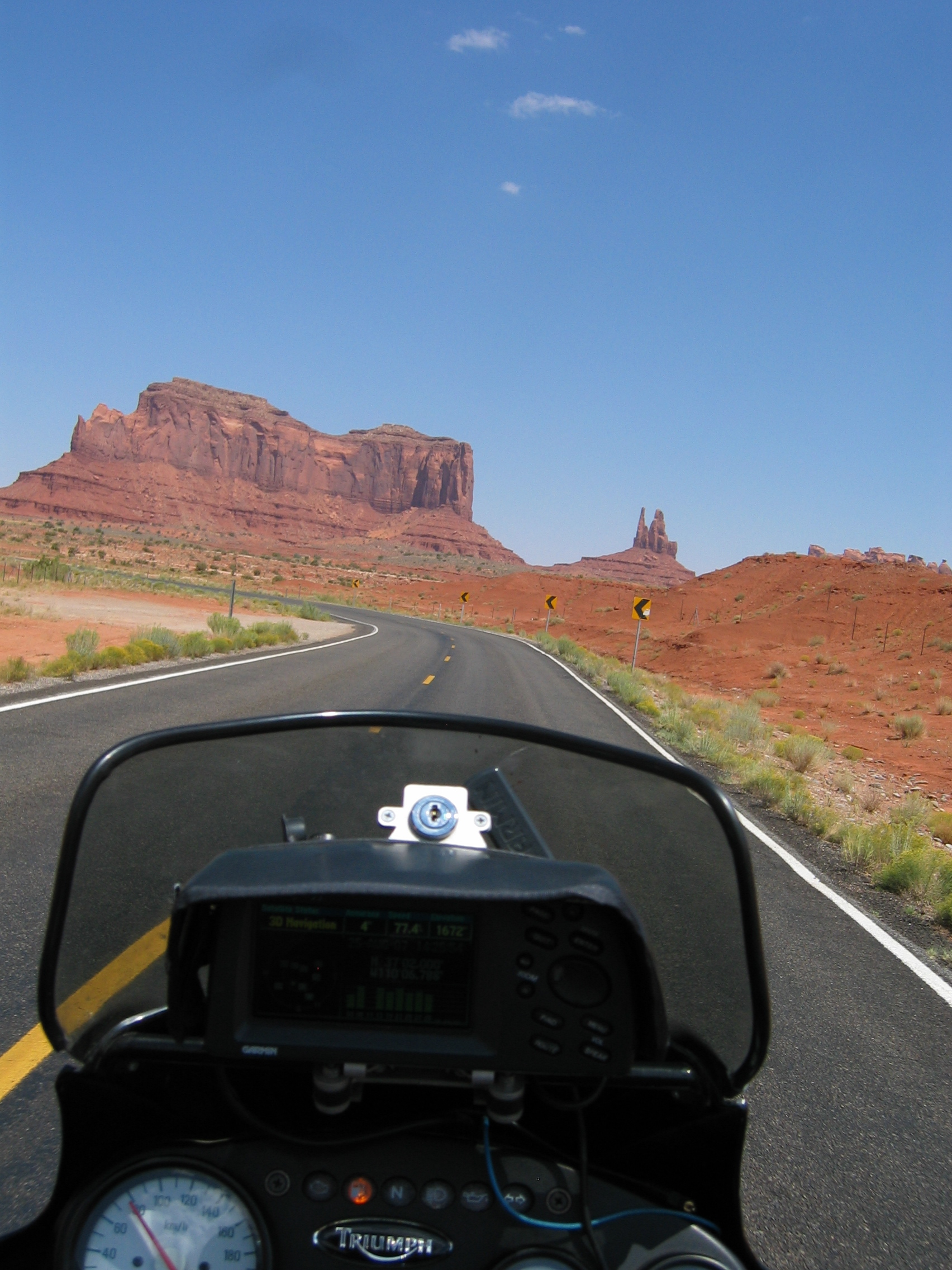
It is Monument Valley, at the border of Utah and Arizona inside the Navajo Indian reservation. All of today was mainly biking through completely unpopulated area with just a trading post and a petrol station every 100 miles. The same can be said about the reservation, especially once I hit highway 160 and further on state route 98 towards Page, the only town in the area. I stop there at the motel 6 at the far end of town. What a great biking day!
- 173200 km on the bike
I set out at 9 am this morning and after 20 miles turn westwards
onto highway
89A. A few miles on and I finally leave the Navajo reservation.
It is an interesting fact, that this Indian reservation all by itself
is 30 percent bigger than all of Switzerland.
The road follows the Marble
Canyon valley and crosses the Colorado River via the Navajo
bridge. Then I head west and finally the road climbs up the
Kaibab
plateau, reaching over 2500 metres altitude, before I reach
state route 67, which forks off south towards the Grand
Canyon. I can see a black thunderstorm cloud ahead - not a good
sign. At a rest area I have a chat with a biker from New
Jersey. He has just been at the North Rim of the canyon and
just got away before the thunderstorm started. He tells me that
the view is very limited, because there are wildfires in the area
and the smoke ruins the view. He also shows me the pictures he took
- and yes, they are far from spectacular. I agree with him that
under these conditions and with the torrential rain and lightning
strikes it is not worth paying 12 dollars park access fee and then
see nothing.
So, folks, I am sorry, but no Grand Canyon views here today. Instead
I head back onto highway 89A. The thunderstorms are now building
rapidly and are moving in from the south-east. Luckily my route
heads north-westwards, but due to the winding road my progress is
slow. Then I am back in Utah and ride through the Zion
National Park. It is a spectacular place, and I even notice
a condor
majestically sailing along the cliffside. But being overloaded with
great erosion canyons in the past couple of days, I squash this
place upon my eyes like an overripe tomato and don't even bother
to take any pictures. It becomes obvious to me that I am in need
of a change of scenery.
At Hurricane
the thunderstorms are all around me, so I call it a day after just
300 km. Let's hope that Nomen
est Omen does not apply here. 40 bucks get me a room at
the local Super
8 Motel and I even have time to put the tarp over the bike before
it starts raining.
The weather forecast predicts that the thundering weather will stay
for many days in this area and temperatures in southern Arizona
will reach 112° F - that is more than 44 degrees Celsius.
As always you can download my trip through Utah's parks here.
- 173500 km on the bike
Below is the usual map with my GPS tracklog and some trip markers.