- The Coromandel Peninsula and Rotorua
If you'd ask me what is the best month to visit Paris, then I'd say
right away "August". The reason for that is simple; Paris
in August is empty, because everyone is down in the South of France.
I call that the "French disease", because I think the French
are fools in that respect.
But how surprised I am when I find that Kiwis also suffer from this
disease. Motorparks and campsites outside the main tourist attractions
are almost deserted, though the weather is fine and warm.
It appears that people around here take their vacations from Christmas
up to around mid-January. During that time there is not a single place
available at any campsite in North Island or northern South Island.
This behaviour is about as foolish as the French way of vacating.
This is the more so because during that period North Island is far
too warm for comfort - while at the same time the deserted south of
South Island is at its most beautiful.
All this simply means for me that I have to be in the far South by
Christmas to escape the mad rush of Kiwis choking the North.
My plan is simple; to travel down south along the eastern coast of
North Island towards Wellington,
then take the ferry to South Island and stay on South Island until
maybe the end of February, then return back north, this time along
the West Coast.
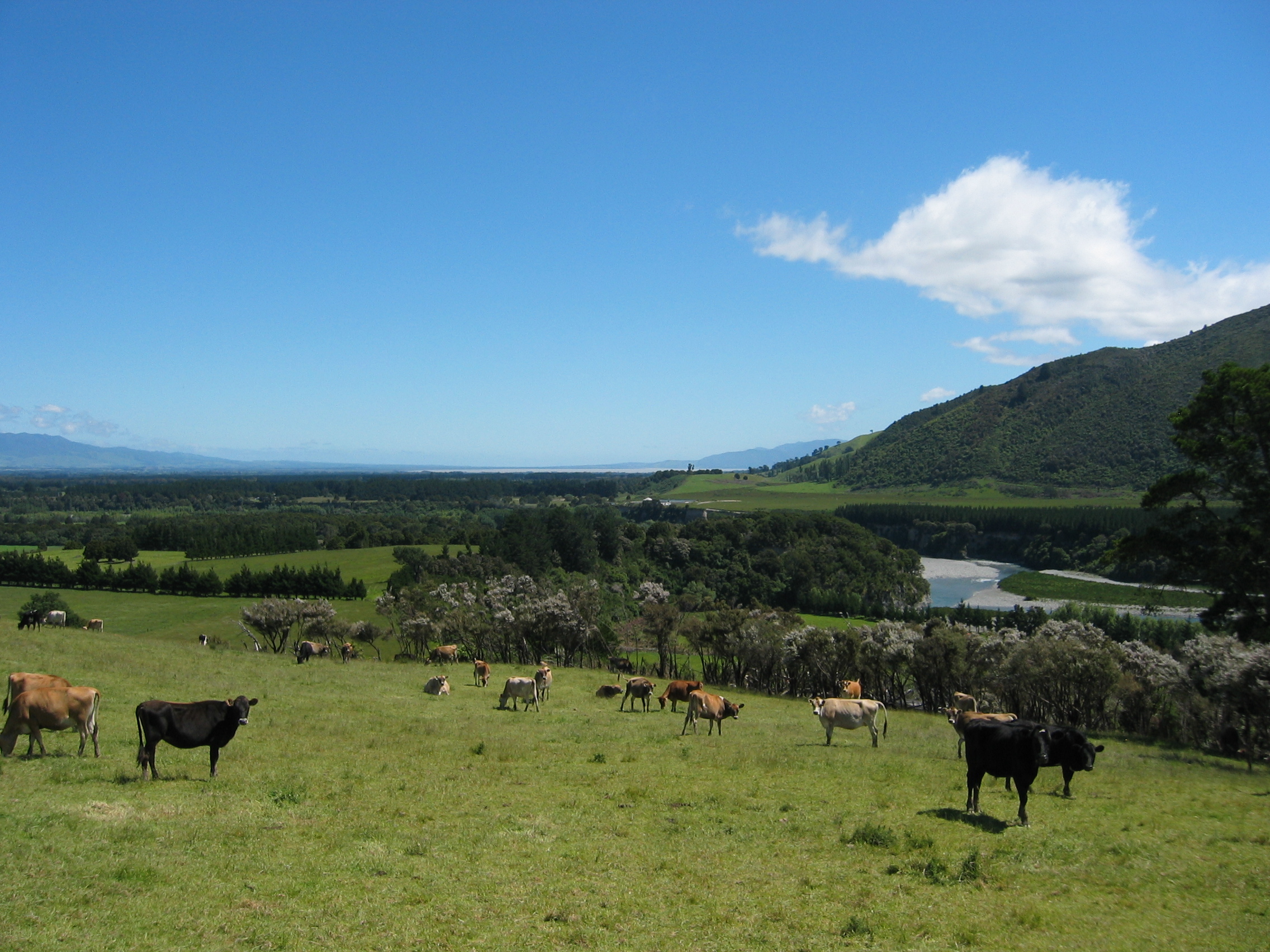
The first scenic area south of Auckland is the Coromandel
Peninsula. This peninsula is known for the rough beauty of its
nature and also for its great roads along the coast of the Hauraki
Gulf. On the Eastern side I am already driving along the shore
of the Bay
of Plenty. If you want to know more about the various places I
suggest you follow the link and check out the Wiki. After staying
overnight in Thames
I continue along the coast of the bay until I reach Tauranga.
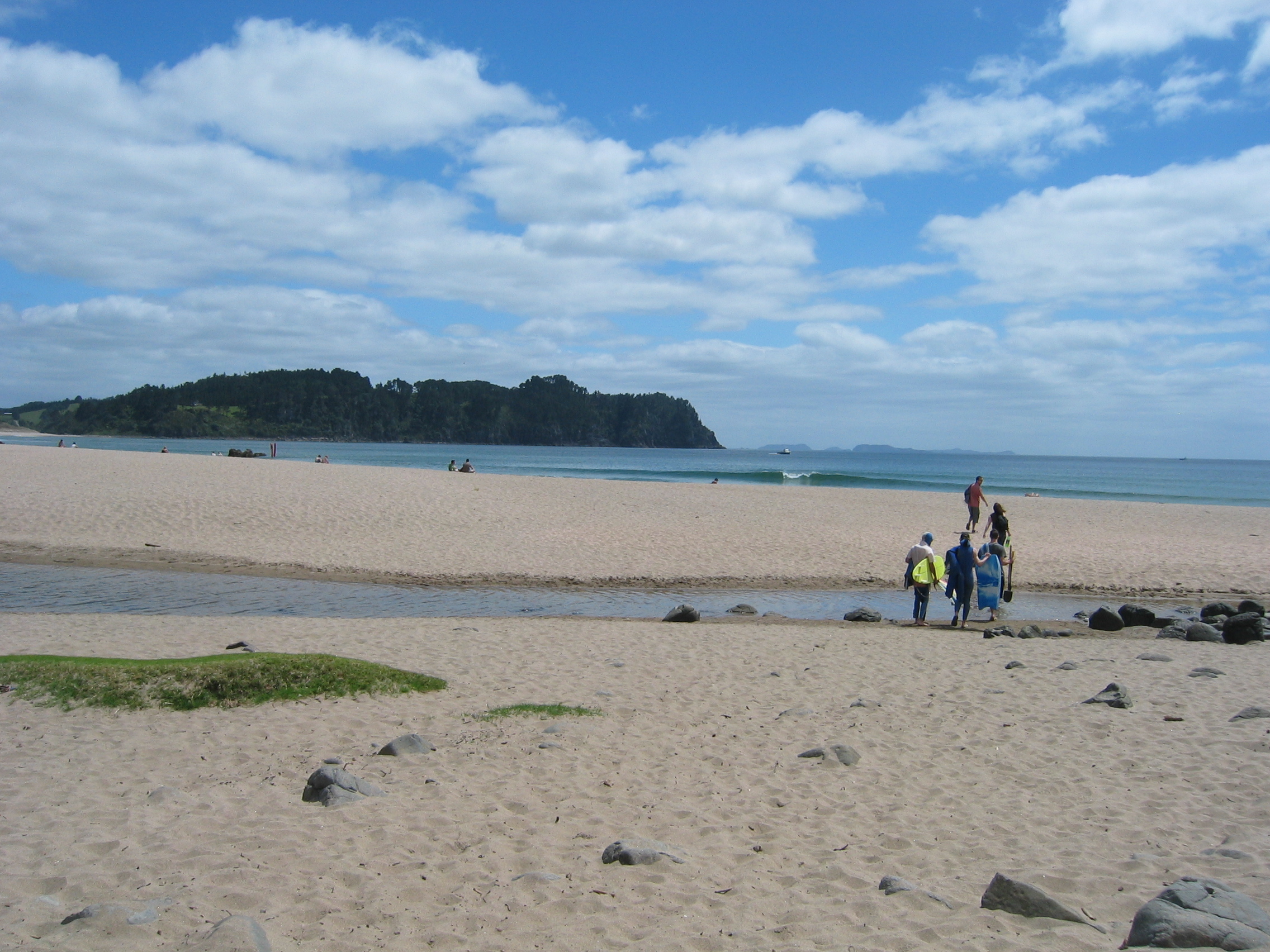
On the way I come across another "Must-Do" for Kiwis, the
Hot
Water Beach:
Have a look at the kid on the right in this picture. Can you see
that he is carrying a spade? Well, you may think he is a bit too old
for building sand castles on the beach. But that is not what he is
after. Instead he wants a hot tub. Yes, on Hot Water Beach there are
two geothermal springs. Two hours either side of slack water you can
dig yourself a hole in the sand. The hole will fill with hot water
and you can enjoy your own, private hot water spa right on the beach.
At Tauranga I turn south to see the famed geothermal activity around
Rotorua.
I stay for three days in the town. It is the biggest disappointment
so far in New Zealand. The attractions are there, but what is a small-sized
geysers,
some bubbling mud and a geothermal power station, if they are crowded
by thousands of tourists?
I see none of the attractions, as they are so ruthlessly marketed
that even Disneyland
could learn a thing or two from these Kiwis. I find the place disgusting.
I think after this I need to find myself a quieter spot.
- The Eastern Cape
I take the road back north towards the coast at Whakatane.
A young Maori
is holding up his thumb at the end of Rotorua, so I give him a ride.
He lives in Whakatane and knows every stone along the road by first
name. I thus get a a running commentary about everything along the
80 km road to Whakatane.
About 40 miles beyond Opotiki
I find a splendid motor park in the middle of nowhere. This is the
East
Cape region, about as lonely as it gets. Europeans will find it
difficult to believe how empty this country is, so I'll try an example.
Imagine you'd live in Hicks Bay on the Eastern Cape. How big is that
place? Well, on my map of New Zealand it shows about as big as Coventry
would on a map of the UK. Here is a picture of it:
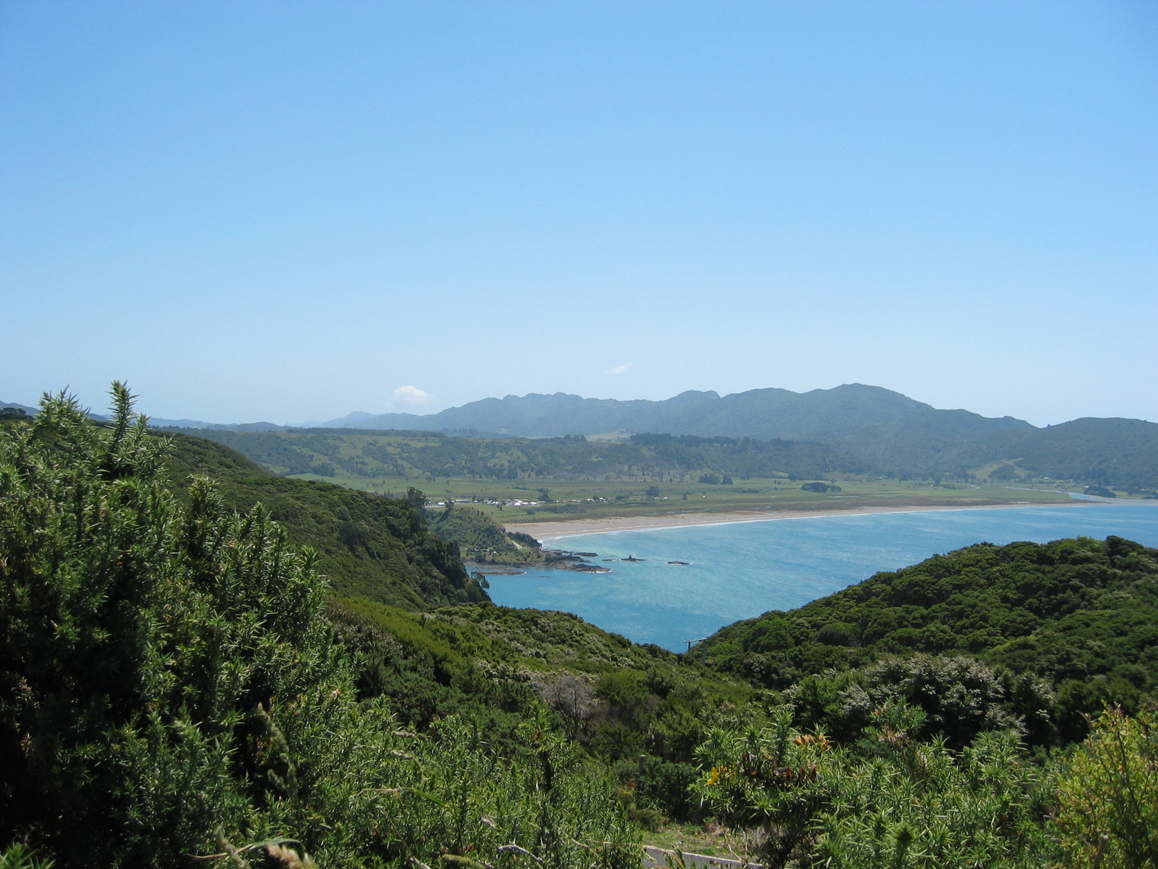
Yes, those few dotted houses behind that not really overcrowded beach,
that is Hicks Bay. Now while being a rather scenic location, living
here is somewhat different from Coventry. Imagine your family has
decided to spice up a rainy Sunday by renting a few movies. Your nearest
movie rental place would be either in Gisborne
or in Opotiki - in both case it would take you about three hours by
car to get there, six hours return. Of course, then you'd have to
return the movies next day...
Luckily I came prepared; I hired a couple of movies in Opotiki, so
in spite of the lonesome campsite I stay at, I can watch the occasional
movie in the evening on my laptop. I first thought about using my
TV card, but Kiwi
TV is an atrocious blend of commercials and boring programs -
that is if you have any reception at all. Most people out here have
rigged a satellite dish and receive an adapted version of the UK's
Sky
TV.
But who needs TV anyway? It is much nicer to sit on the rocks at the
waterline, feet dangling in the Pacific Ocean, smoking a pipe and
thinking about the meaning of life. This empty country is much more
to my liking than the bustling masses at Rotorua, so I stay for three
days. You can do fantastic hiking here, and you have miles and miles
of great beaches entirely for yourself. You can walk all day without
ever seeing another human being.
Like with Cape Reinga in the north I do not bother driving out to
the East Cape itself - again that is a 15 mile dirt track just to
see a lighthouse, which I don't need to see. Instead I follow the
main highway no. 35 south towards Gisborne. This area is very popular
with surfers. No wonder, as the waves crashing against the shoreline
had a long way to build up strength - all the way from Chile.
Gisborne itself is like most rural cities around here; just a few
roads lined by shops and restaurants, a superstore etc. But one has
to consider that this is the centre point for the entire population
of an area about the size of Switzerland.
Beyond the town the road to Wairoa
turns hilly - and I notice that on the steep climbs the temperature
needle is beginning to creep above its normal position. I stop and
check the fan; yes, the viscous coupling is loose again. The casing
must have a fracture that allows the oil to slowly seep out.
I might just as well fix that in Wairoa as anywhere else, so once
there I ask at "Norton's Auto Electrics" where I can find
a decent workshop. When I mention that I could do the job myself (having
once been a mechanic myself) the guy offers me the use of his tools.
Great, I like that attitude.
It takes me 40 minutes to cure the problem. I take the coupling apart
and simply put a square inch of an old rag between the gearwheel and
the casing. This does lock the coupling solid, regardless of whether
there is oil in the it or not.
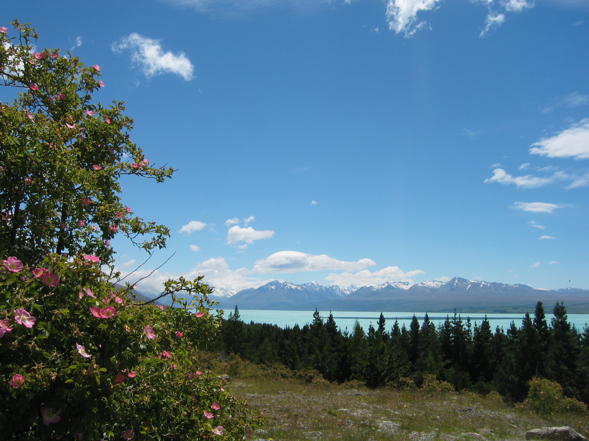
- Lake Taupo
Beyond Wairoa I divert west to Lake
Taupo on HW 5. The drive is very scenic, but the lake is even
more impressive - it is the biggest lake in NZ and well known for
its trout
fishing. The unofficial capital of trout fishing is Turangi
at the southern tip of the lake, where I find a fine motor park 6
miles north of that town. It'll be nice to dangle my feet in sweet
water for a change when I smoke my evening pipe.
An earthquake strikes this night, the epicenter apparently somewhere
near Opotiki. That happens very often in many parts of the country.
But a measly 5.4 on the Richter
scale doesn't impress me - I just lived too long on the Jura
mountain range in Switzerland where that also happens frequently.
I take a leisurely drive around the southern shore of the Lake today
- look at the picture to get an impression how nice it is here:
My plan was to stay only for a day, but in the evening it starts
raining badly and continues so through the entire next day. I drive
to the local tourist info place and ask for indoor activities. The
only thing they have to offer indoors is the local trout museum 2
miles down the road. Well, thanks, but not for me. I'd rather have
a lazy day and see a few of the many movies I have on board - the
day is a complete washout.
Movie rental stores are quite easy going with campervan travellers;
you just show a picture ID and they give you a temporary membership,
the name of the motorcamp I stay in is enough for an address. It is
also quite cheap to hire DVD's: usually you can hire five or six discs
for a week for 10 to 11 dollars. As I haven't been to the movies in
over four years (because the Swiss dub them) I have a huge choice
of stuff I haven't seen yet.
- Tongariro National Park
Next morning I am heading south. The main route towards Waiouru
is the highway no. 1. But I strongly recommend to take the much longer,
but also much more scenic route via highways 46, 47, 4 and 49. This
leads me straight towards the highest mountains in North Island, the
Mount
Ruapehu volcano, Mount
Ngauruhoe and Mount
Tongariro, all within the Tongariro
National Park. Murphy's law has it that the cloud
base is still very low after all that rain yesterday - the mountaintops
are invisible. I will just come along here again next year on my way
back up north. There are two small airfields around here which offer
scenic flights around the park - something else to look forward to.
In spite of the low clouds and the occasional rain shower the drive
is very scenic and the park is breathtaking.
Having missed out on the volcano tops I shall however not miss out
on some fun today; a few miles south of the backwater town of Taihape
I turn left, following the signs for Gravity
Canyon. A scenic drive leads you to a deep gorge in the volcanic
rocks. I can highly recommend the double adrenalin kick you get if
you are willing to shell out the 180 bucks for the double whammy:
jump the 80 meter bungy and ride the Flying Fox - these rides are
far better than what you get at your ordinary fairground. The view
from the bridge down into the gorge with its wild river and thinking
that you are about to jump from the bridge without anyone forcing
you at gunpoint will get your heart rate up, I promise you.
- Hawke Bay
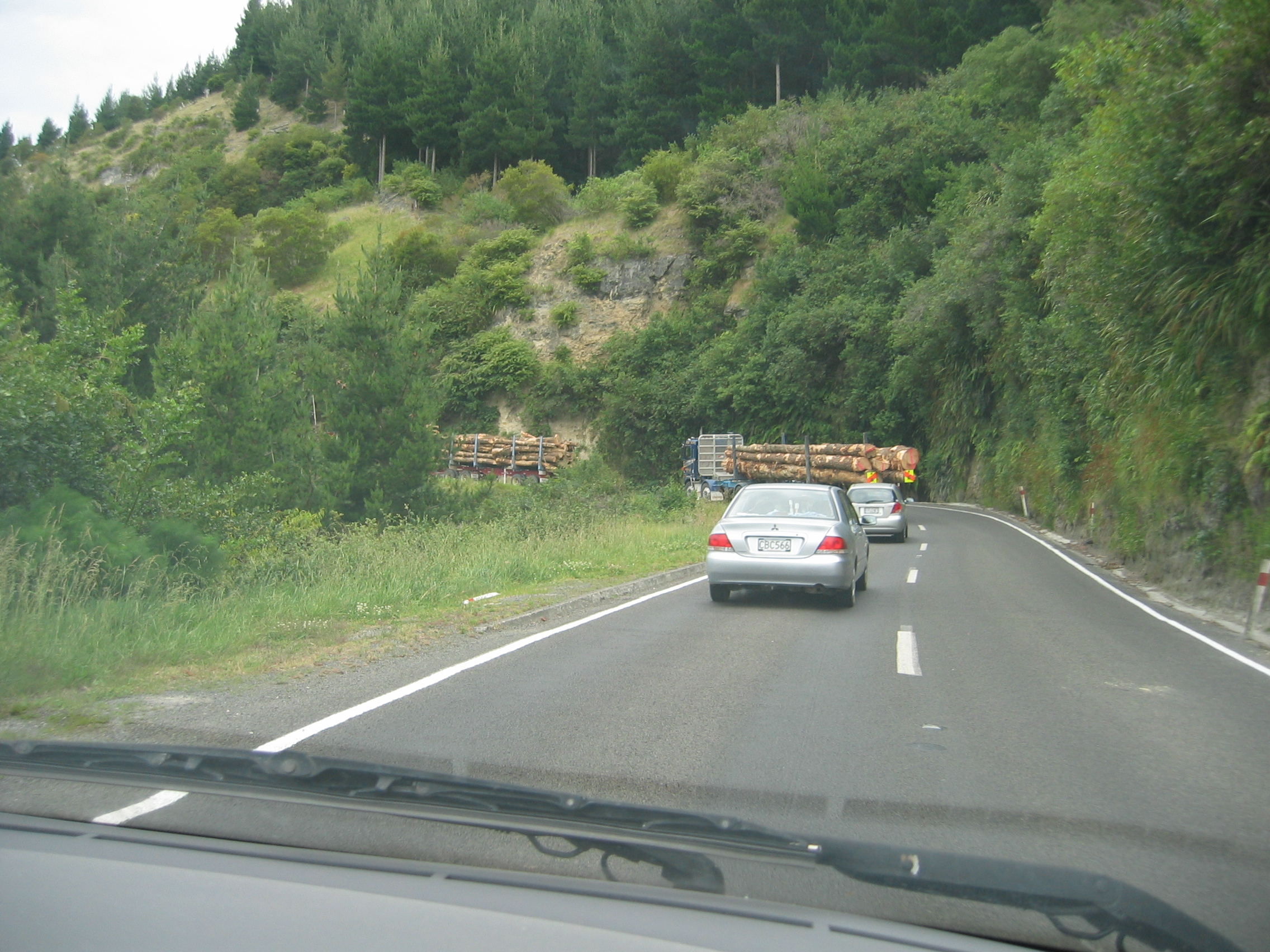
After this kick I need some quiet, rural scenery. Of that there is
plenty here. I turn back to Taihape and turn east on Annie Road towards
Napier.
The road is an absolute treasure; no traffic, fantastic views over
the rolling hills and tranquil valleys full of cattle and sheep.
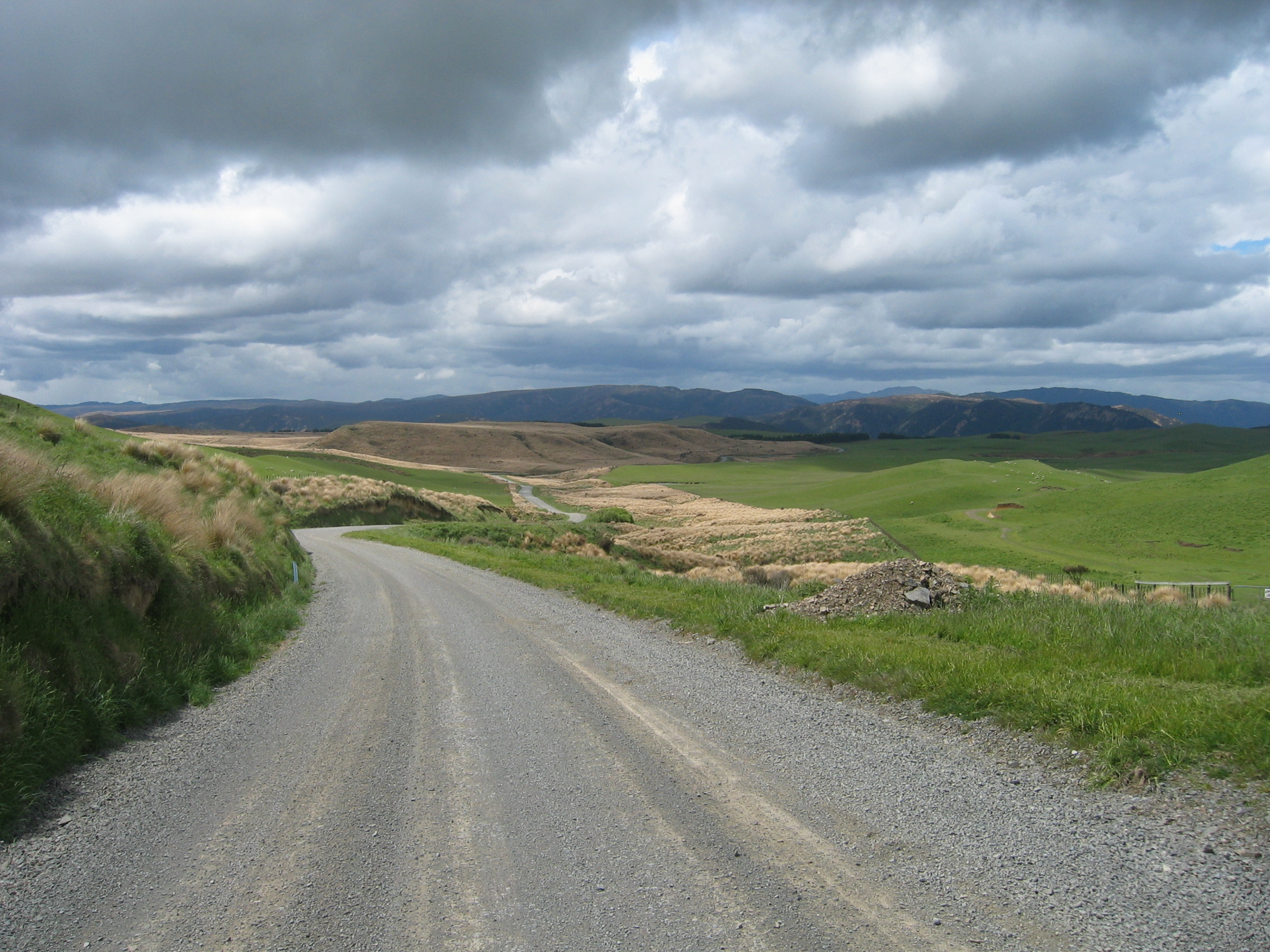
As you can see in the picture, about 20 of the total 100 miles are
unpaved, but the gravel section is in good nick and perfectly suitable
for any car. By 5 pm I arrive in Napier. If you haven't followed the
above link to the Napier Wiki I suggest you do it now, because Napier
is a very special town; it was destroyed by an earthquake measuring
7.8 on the Richter scale in 1931. The town was rebuild in the styles
favoured by the architects of the time: Art
Deco and Spanish
mission. I just drive to the Tourist info and enquire about campsites;
unfortunately the two sites in town are located next to busy roads.
That is not my cup of tea, but I find a nice place in the village
of Clive,
halfway between the twin cities of Napier and Hastings.
Next morning I take a closer look at Napier. The architecture is really
excellent. All buildings are in excellent condition. New Zealanders
in general live in cardboard boxes made from cheap plywood and plasterboards,
badly designed and often infested with damp or mould. About a third
of the housing I have seen so far on North Island is unfit for human
habitation by European standards. The general ignorance of this fact throughout the country
is quite a surprise for me.
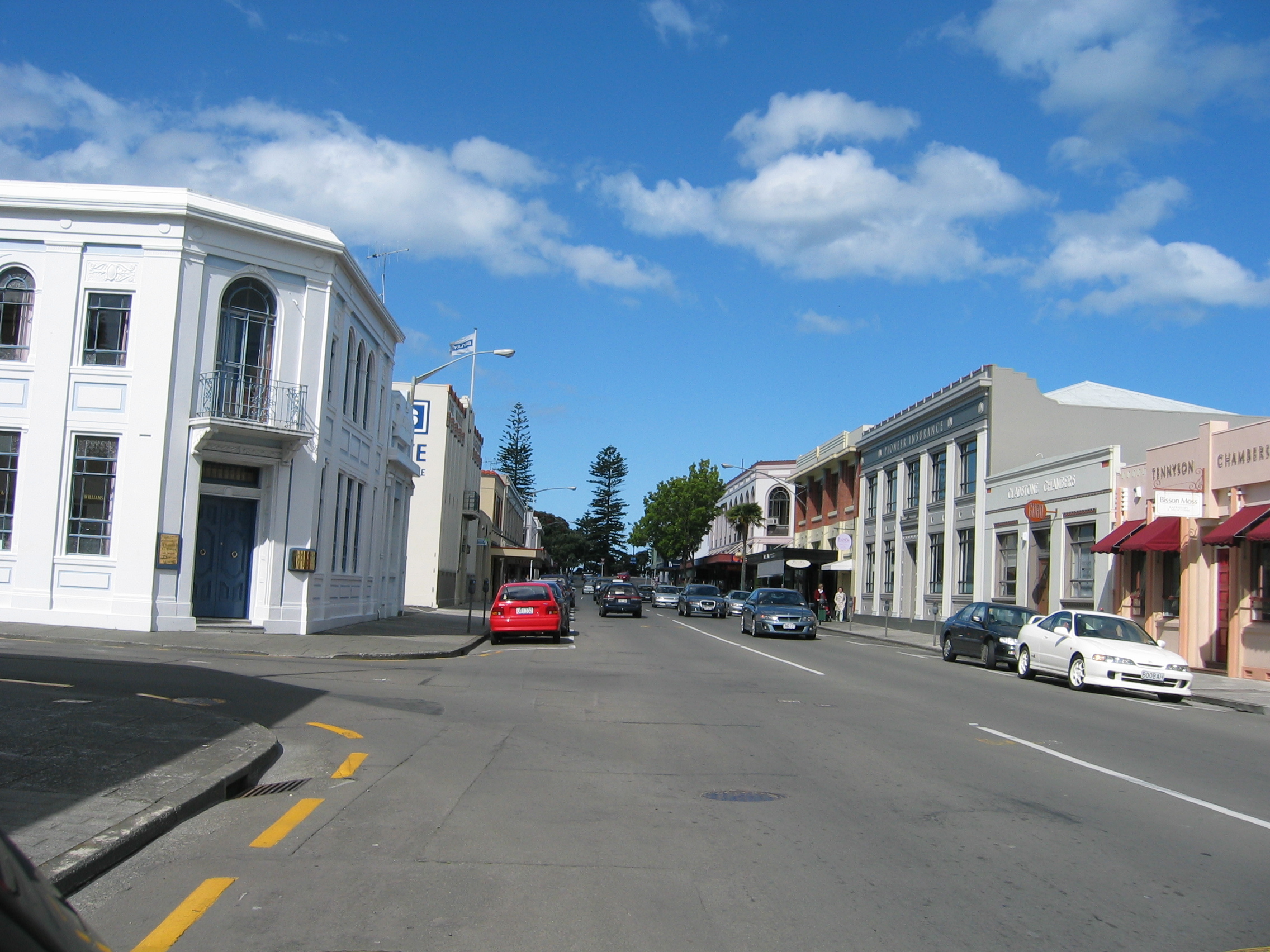
But here in Napier the buildings are made from stone - and with style.
A look down Tennyson Street is very soothing for the eye after having
seen so many ugly, ramshackle structures elsewhere.
Napier is a very busy place. In the afternoon I drive the 20 km to
Hastings. This town was equally destroyed by the great earthquake
in 1931. But here the water mains supply remained intact. While Napier
was gutted after the quake by huge firestorms, the Hastings firefighters
were able to rescue many buildings from complete destruction. Though
Hastings overall population is bigger than Napier's, the town centre
has preserved a much more rural style. Plenty of buildings are in
the Art Deco style and it is another proof that Kiwis can build proper
housing if they want to.
Both cities form the core of the Hawkes
Bay region, named after Hawke
Bay on which coast the region is located.
- Wairarapa, the paradise no one has ever heard of
After a second night at the Clive campsite it is time to continue
further south. The weather all these days was fairly cool for the
time of year with afternoon temperatures seldom climbing above 20
degrees Celsius. I find that much better than having scorching heat
that early in the season as is often the case these days in Europe.
I take state highway no. 2 south via Dannevirke
and Woodville.
This region is called Wairarapa,
which means in Maori something like "Glistening Waters"
- and I immediately fall in love with it. The hills are not as high
as further north, the road not as spectacular as in the Tongariro
park, but this is exactly the kind of place I like. The country is
thinly populated, and the few tiny towns are far apart. The only bigger
town is Masterton
with about 25000 souls.
After a closer close look at my map I decide to make the small town
of Martinborough
my base for a few days to explore this prime area. Though the town
has just 1400 inhabitants, it has all I need; a cash machine, a motor
camp, a supermarket, a cafe and an excellent tourist information office.
Even a Video rental exists on Jellicoe Street in case I want to see
a movie. But what really knocks me off my seat is that they have a
brand new cinema. This of course is only possible, because the town
has a large number of visitors from the farms and hamlets in the surrounding
outback.
At the motor camp I have a chat with my site neighbour Dave. I want
to know why Kiwis prefer to live in damp, mouldy cardboard boxes instead
of proper houses. I have found the right man to answer that; Dave
is a builder by trade and like me is quite disgusted with the ordinary
Kiwi building standards. He invites me to inspect a place he is building
at the far end of the town. We take a look and the place is a far
cry from the usual pisspoor buildings. It is made from stone, properly
insulated and has a modern underfloor heating system. I still find
things to improve; inner walls are still mainly from timber frames,
there is no cellar and the large sections of outer wall that have
been finished as sliding glass panes in aluminium frames will allow
too much heat in in summer (requiring air conditioning) and loose
too much energy in winter because they are not triple glazed.
But we have a good chat about how Kiwis do things and the building
is yet another proof, that these people can build proper housing if
they want to.
Next morning the rain is hammering on the roof of my van. I am remembering
the words of the tourist info lady in town from yesterday: "Martinborough
is the driest area in North Island". Murphy's law again. It doesn't
stop once all day, so I get me a couple of DVD's and download a few
more books - the Martinborough
Village Campsite has a WLAN set up for the guests and ranks among
the top ten sites I have seen so far in the country. I strongly recommend
to make this place your base if you ever come to this peaceful part
of the world.
[Postscript 2016 - The young couple owning the place in 2006 have gone and obviously sold the place
to a conglomerate owning numerous campsites throughout the country. Their website is now available in English and Chinese,
so you may want to check it out before making a booking based on my (outdated) advice.]
Next day the weather is much improved and I set out for Cape
Palliser, the southernmost tip of North Island.
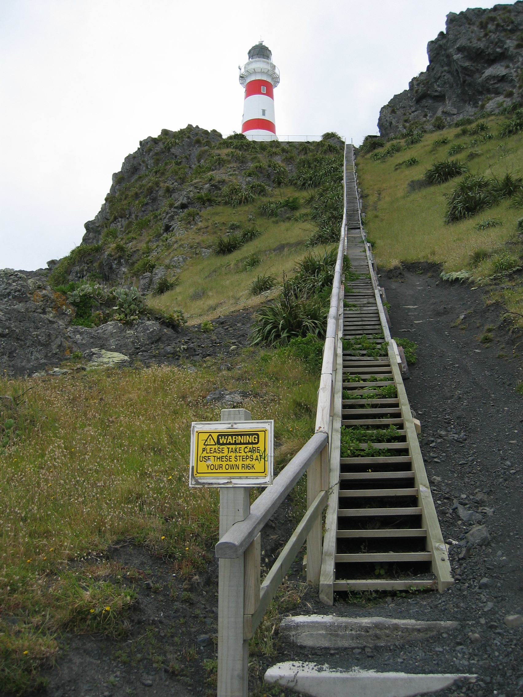
I actually climbed those 250 steps of the ladder in above picture.
Until 1986 you may have been greeted by the lighthouse keeper in this
forlorn part of the coast. But these days the lighthouse keeper sits
in an air conditioned office in bustling downtown Wellington,
30 miles away, and controls the lighthouse via computer.
The coast is just populated by a few fishermen who live in the tiny
hamlet of Ngawi
- together with about ten times the number of bulldozers needed to
move their boats in and out of the sea.
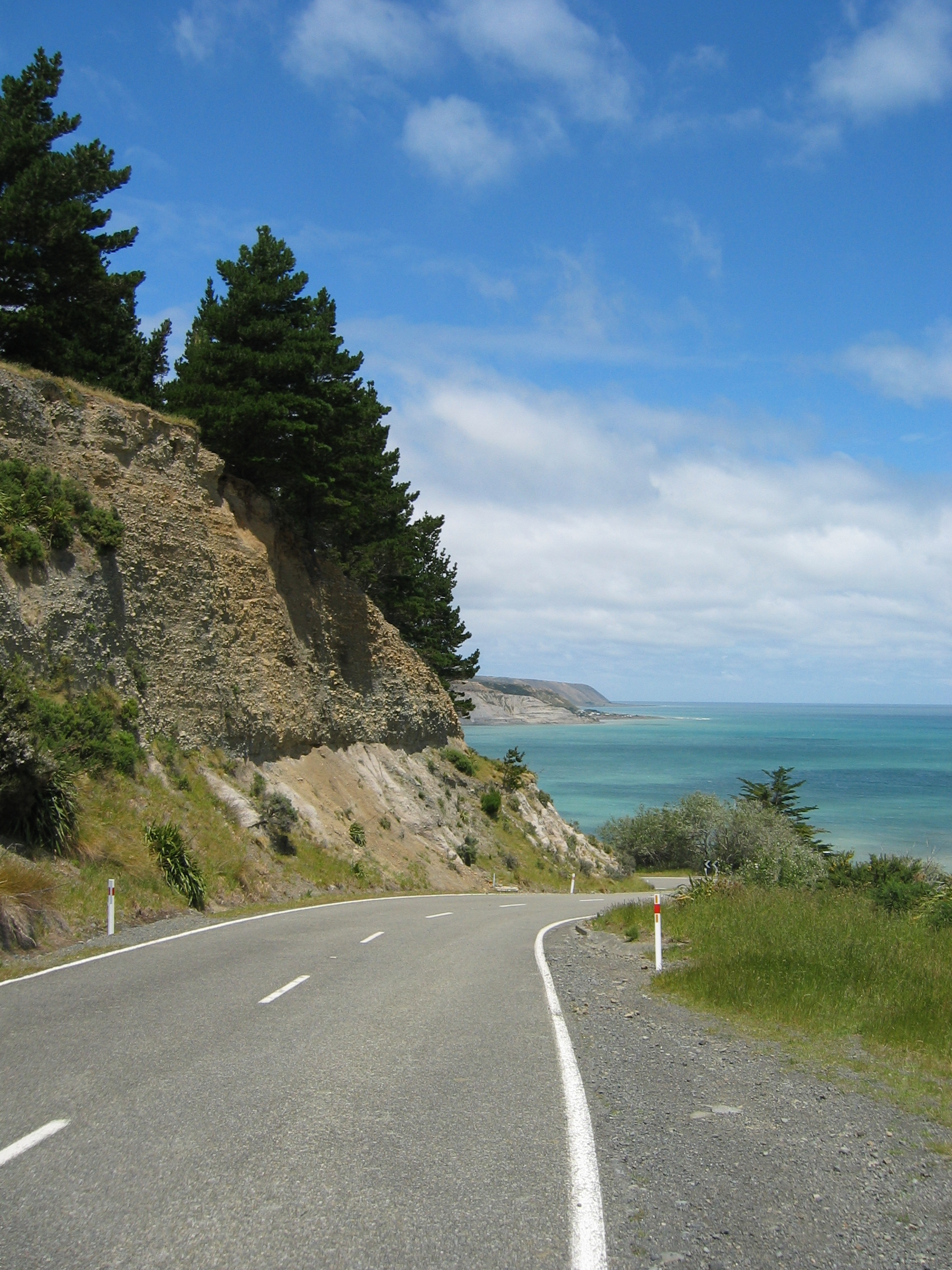
The drive back to Martinborough is sheer bliss:
In the evening I make good use of the campsites internet connection
and book myself a ticket to cross the Cook
Strait in a few days time. There are only two ferry companies
offering transport of passengers and vehicles; the Interislander
and the Bluebridge
company. Bluebridge is cheaper at 169 dollars for my Toyota and myself,
so I book me in for the noon sailing next Thursday. That leaves me
two more days to explore this magic part of the world.
Next day the weather is once again fine, but cool and windy. This,
I am told, is a consequence of the "El
Niño" effect; it keeps the anticyclones
from reaching us here. Instead the road is clear for lots of cool
air from the south. The positive side of that; while the European
Alps will be glacier-free within a few decades, the glaciers of the
Southern
Alps down here are currently growing larger.
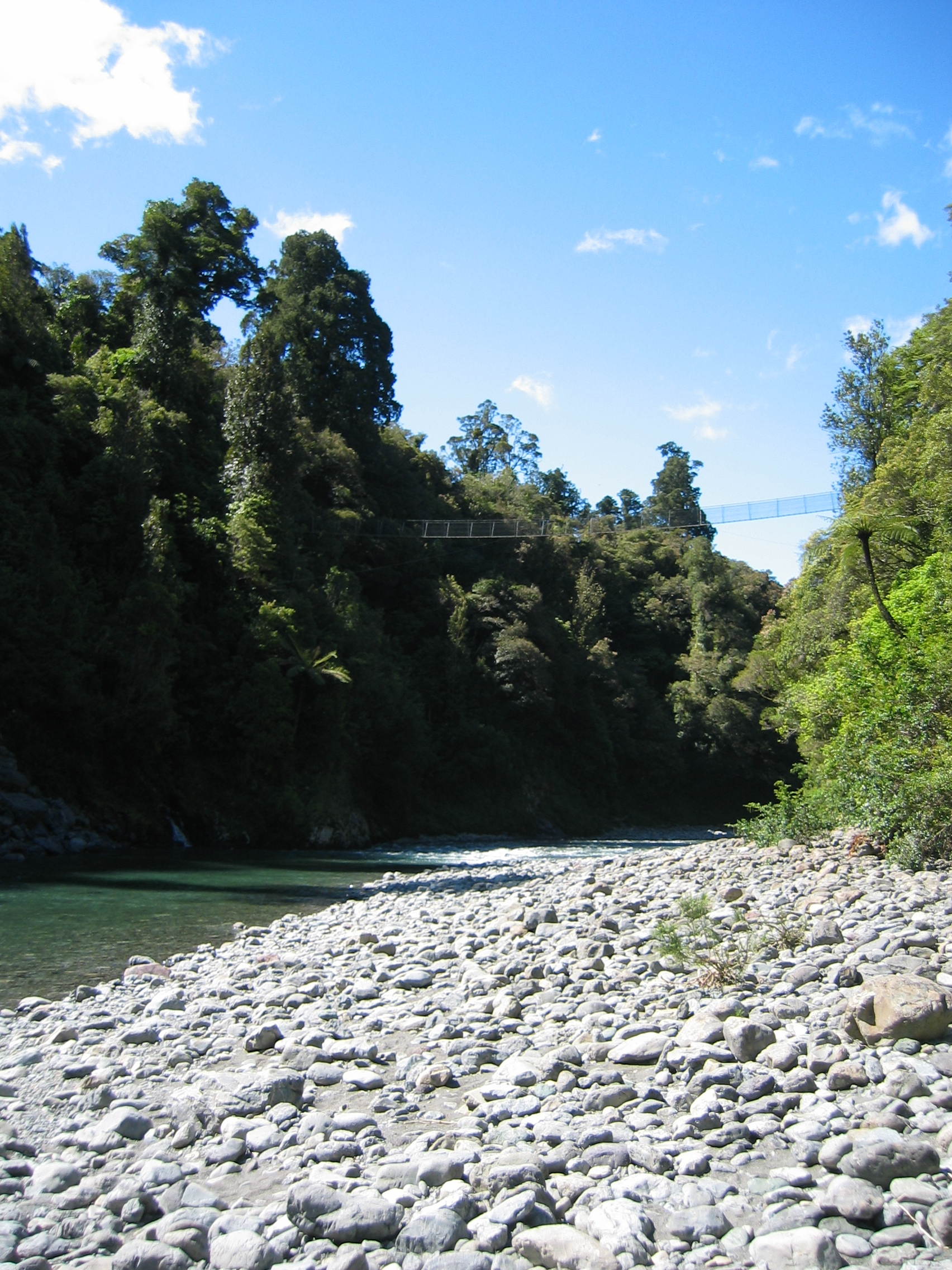
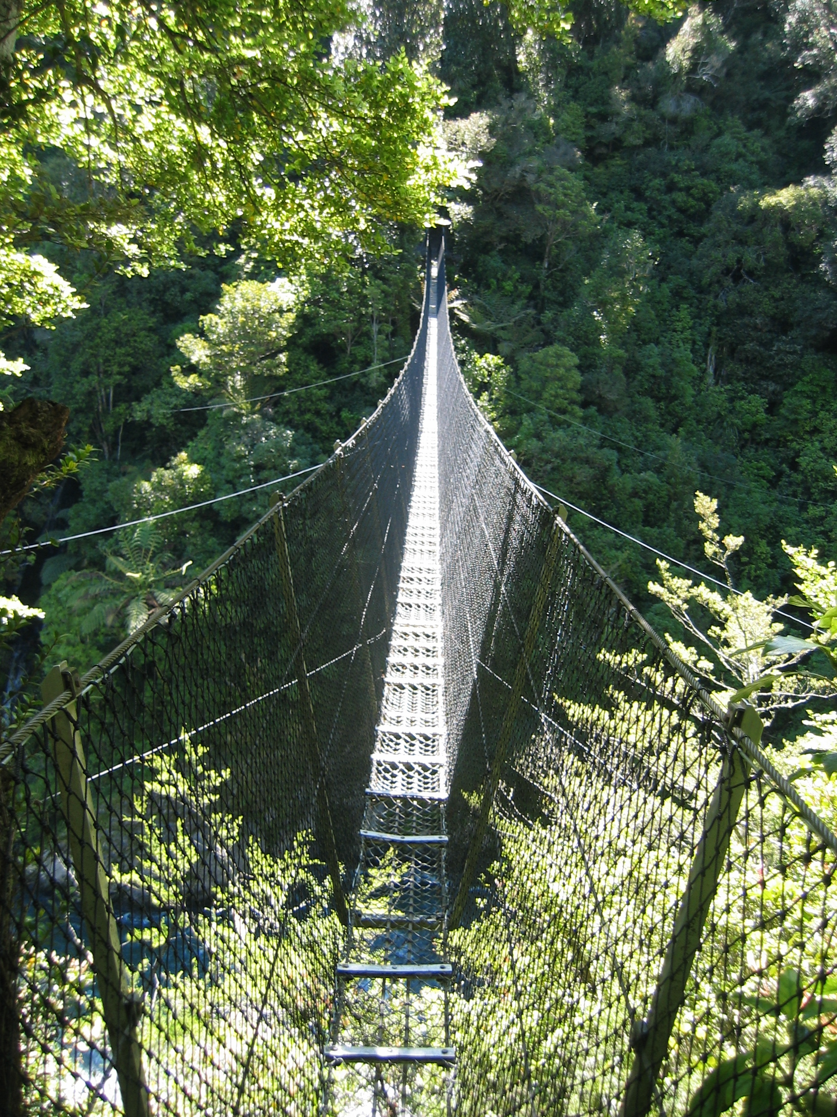
I think that this day will be ideal to visit the Waiohine Gorge,
a few miles north of Carterton,
in the Tararua mountain range. While Wairarapa is mainly flat, the
region is separated from Wellington by this range of mountains. Into
one of the valleys of this range a river has dug a deep gorge.
I take my Toyota through a car wash, not having noticed that the access
road to the gorge is unpaved - within two hours the van again looks
like it has taken part in the D-Day
landings. The last bit of the road is even fairly tricky to drive.
Once at the gorge I notice that I am the only one up here without
four-wheel-drive. Kiwis are not only the worst drivers in the civilized
world (yes, they are even worse than the notorious Belgians), they
are obviously also pussies when it comes to taking the family saloon
a bit off the beaten track.
The gorge is badly signposted. If you ever come here, follow the gravel
road to the campsite for abseiling. Beyond that the road deteriorates.
Be undaunted and continue another two miles until you reach the forestry
campsite. At the far end of the site you will find two unmarked paths.
The left one (closer towards the gorge) leads you to the bottom of
the gorge. Be careful down there, the river banks are a paradise for
sandflys
- once bitten you'll have a nasty, itching blister for about three
days.
The right path is the one leading to the swing bridge over the gorge.
Traversing that bridge gives a good rush of adrenalin - especially
if like myself you suffer from mild vertigo.
For all of you who always want to see these things, but never find
the time, here is an impression:
The next day is overcast and showery again, but it is supposed to
clear up later. A good day to drive to Masterton,
the biggest town in Wairarapa after Palmerston North. I am interested
in the foodstuffs that are on sale in New Zealand. I mean the one's
I fancy.
I find that even the biggest supermarkets have no cheese on sale that
is not produced in New Zealand. Swiss people may be annoyed with the
French labeling some mass-produced rubber "Emmental",
but the label piracy carried out down here is shocking; Many renowned
European cheese brands are remorselessly copied by various Kiwi cheese
makers. I wouldn't mind them copying the stuff, if they had the "real
thing" on sale as well. But no luck here. Soon some Kiwi will
get stinking rich by importing the originals from Europe - and allow
his fellow countrymen to sample cheeses that have not just two decades
of tradition, but two millennia instead.
The same applies to wine; a huge selection of Kiwi wines, but a decent
Beaujolais
or Rioja
are nowhere to be found. When I have some time in a larger city, I
will have to check out a deli, to see if the foreign food situation
really is this desperate.
- Across the Cook Strait into South Island
Next morning it is time to say goodbye to Wairarapa for a while.
I head over the mountains those 50 miles towards Wellington. The ferry
leaves at 1 pm, so I have time to drive into the city. Other than
Auckland this city is a compact place with a well defined city centre.
This allows the efficient use of public transport (which is nearly
impossible in spread-out Auckland) and I even see passenger railway
carriages. Many people from Wairarapa commute to Wellington using
the railway.
Later at the harbour I have some sort of maritime "déjà
vu"; the Santa
Regina, the ferry boat of the Bluebridge line seems strangely
familiar. It is an old rustbucket, but I distinctively remember it.
A quick enquiry with the purser clarifies matters: the Santa Regina
was operated by a French company out of Marseille
to Corsica
ever since her launch in 1979. In 2003 the Bluebridge company bought
it, and ever since this worn out RORO ("roll on, roll off")
ferry is the flagship of the company.
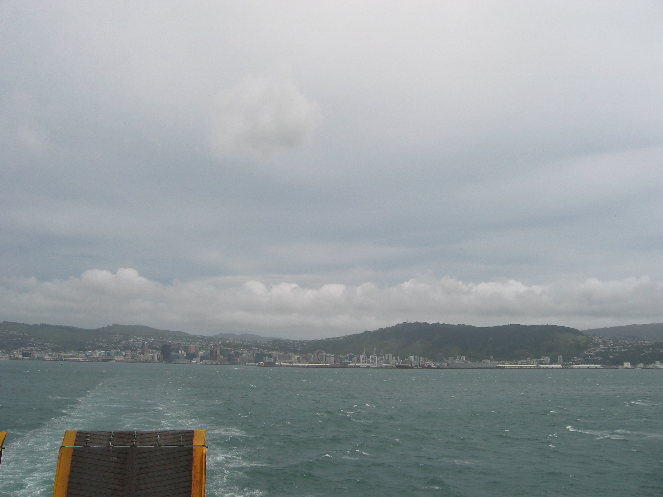
The crossing of the Cook Strait takes over three hours. The main
reason for this slow progress is that our destination harbour, Picton,
lies at the far end of the long Queen
Charlotte Sound. Even worse, the boat has to take the narrow Tory
Channel, the southern entry into the sound. At its mouth the channel
is just 64 meters wide - a maritime eye of the needle.
Our captain gets the old lady into port without a mishap. Queen Charlotte
Sound is a wildlife paradise, and my plan is to hang out here for
a few days to see a bit more of it.
- Marlborough county and the Kaikoura coast
I find a suitable motor park just north of Blenheim,
at Spring Creek. But the following day another cold front is moving
in from the south. In the morning the rain starts hammering down on
my van. Not a good idea to join one of the many boat cruises offered
in the Sound.
Instead I drive into Blenheim and see a movie at the excellent cinema
they have (Casino
Royale, the current blockbuster). Diner consists of a Turkish
Kebab. The kebab forge is run by a turkish family, but the adjustments
they have made to make their kebabs acceptable for the Kiwi palate
would probably net them a few blood feuds if they'd ever dared to
sell them like that in Istanbul.
The next day is Saturday. The rain is gone, but it once more blows
a gale - no chance to enjoy a trip in an open boat - Marlborough
county is not wanting me on the water, it appears. But that is
no problem, because today at Omaka, just outside Blenheim, the brand-new
Aviation Heritage
centre opens its doors to the public for the first time. I am
even given a splendidly decorated commemoration card - number 148
out of the 500 they give away to their first ever visitors.
They have one of the finest collections of World
War I aircrafts on the planet - many are originals and most are
perfectly airworthy. It is truly amazing to see these machines so
far from their original locations.
To celebrate the grand opening they also have a big air show at the
airfield next to the museum. While inside the museum WW I aircraft
are on display, outside I can admire many WW
II aircraft, on the ground and in the air. The sound of the numerous
fighters with their big radials
or 35-litre V12
engines, doing mock dogfights
at low altitude, gives the event a bit of a Battle
of Britain flair.

Rummaging through the museum in the morning and watching these fighters
in the air in the afternoon is a perfect replacement for the boat
trip I missed out on. I can still do that when I come through here
next time on my way back north.
Next day I set out further south on HW 1, direction Christchurch.
After continuing for a few miles inland the highway finally hits the
coast. There are only a few sand beaches here, but this coast is not
known for its beaches, but for its spectacular views and wildlife.
Check out the fur
seals in this picture:
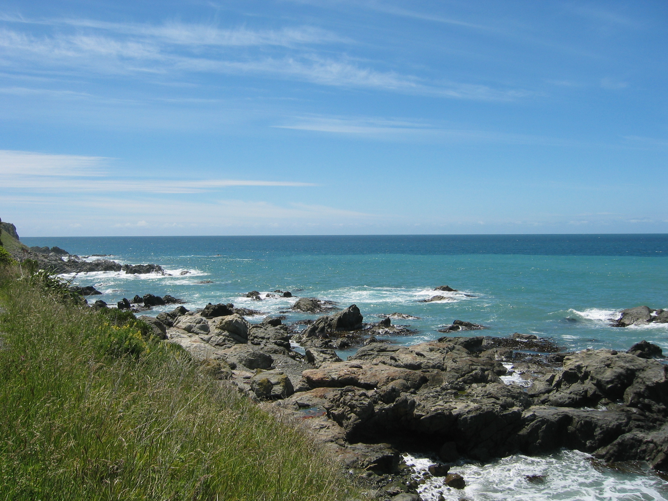
I count over thirty of them. This picture I did while having a break
at a parking lot - the seals are just a few yards off the main highway.
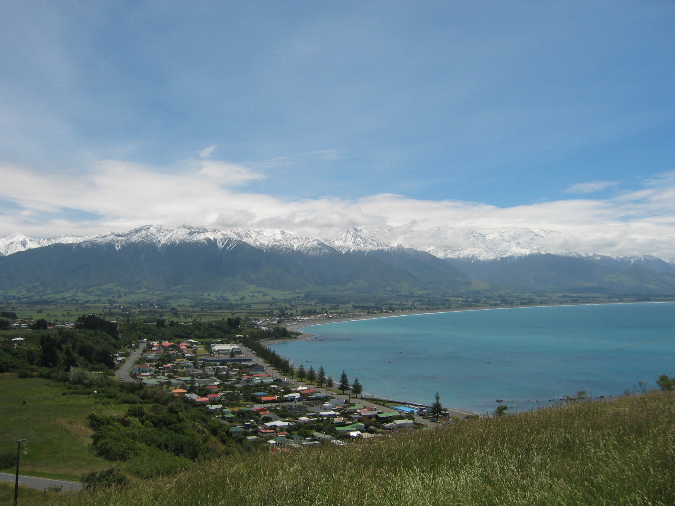
Another highlight is the seaward Kaikoura
Mountain range. These mountains are not overly high if compared
to the Southern Alps, but the scenery is nonetheless nothing short
of spectacular. Have a look at this snapshot, made just above Kaikoura
town (which is in the foreground):
That is much nicer than sitting out a winter in the Northern Hemisphere.
Only the temperature is far too low. I am about 40 degrees south of
the equator and mid-December is equivalent to mid-June in Europe -
and the day maximum temperature struggles to make it over 20 degrees
Celsius, while the sun on the other extreme is nearly shining vertically
out of the sky.
I find a nice campsite a few miles south of Kaikoura,
at Hawkswood Farm. The location is fantastic, a good kilometer off
the main HW no. 1. The farm is family-owned for 139 years now. In
Kiwi terms that that's the equivalent of HBC ("Here before Christ").
The landlady, Gypsy by nickname, resides with her husband over a magic
kingdom of crumbling wooden buildings, ancient sawmill machinery (with
which she won't part at any price) and a great view of the mountains
on the horizon. At eight dollars per night all included I won't mind
the basic equipment and the ramshackle buildings.
- Otago, the south of South Island
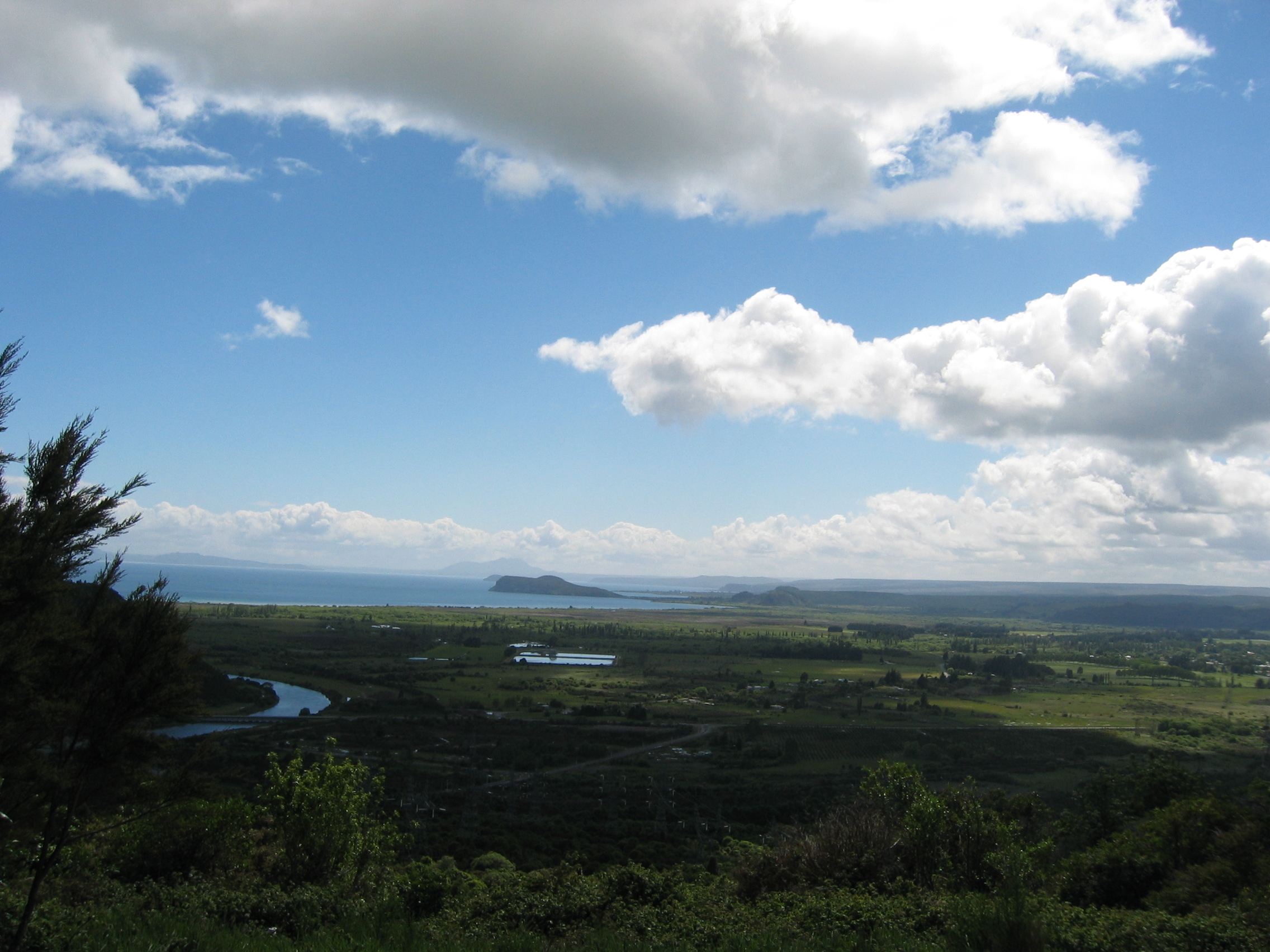
Next day I continue south on HW 1. Just under two hours later I arrive
in Christchurch.
I have a good look around the town, but after having seen so many
others I can't bring myself to stay very long. Soon I find myself
again heading south.
My original plan was to drive further inland, via the more scenic
highways 73, 77 and 72. But somehow I get lost in the Kiwi signposting
and find myself again on HW 1. That highway is rather boring compared
with the inland route, but after a few hours I find myself at the
turnoff of highway 79 and later HW 8 westwards towards Geraldine
and Fairlie.
Immediately the countryside becomes interesting again.
After staying overnight at Fairlie I reach the southern shore of lake
Tekapo by noon. Here is an impression of that lake:
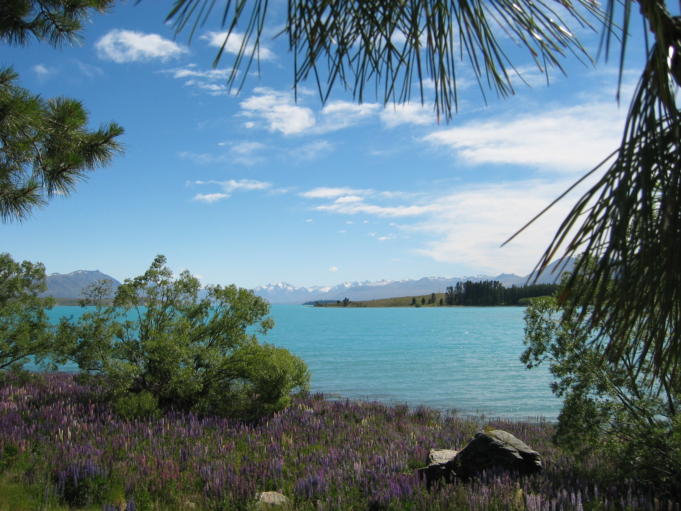
In the background the Southern Alps are clearly visible. The highway then turns south, running parallel to the Southern Alps until I reach the junction with HW 80. This highway is a forty mile long cul-de-sac, running north-west along the shore of lake Pukaki into the heart of the mountains; to the eastern flanks of Mount Cook. This mountain is 12000 feet high and the highest mountain in all of New Zealand. I reach it around 2 pm after battering the stormy wind all the time, which nearly blows my van off the road.
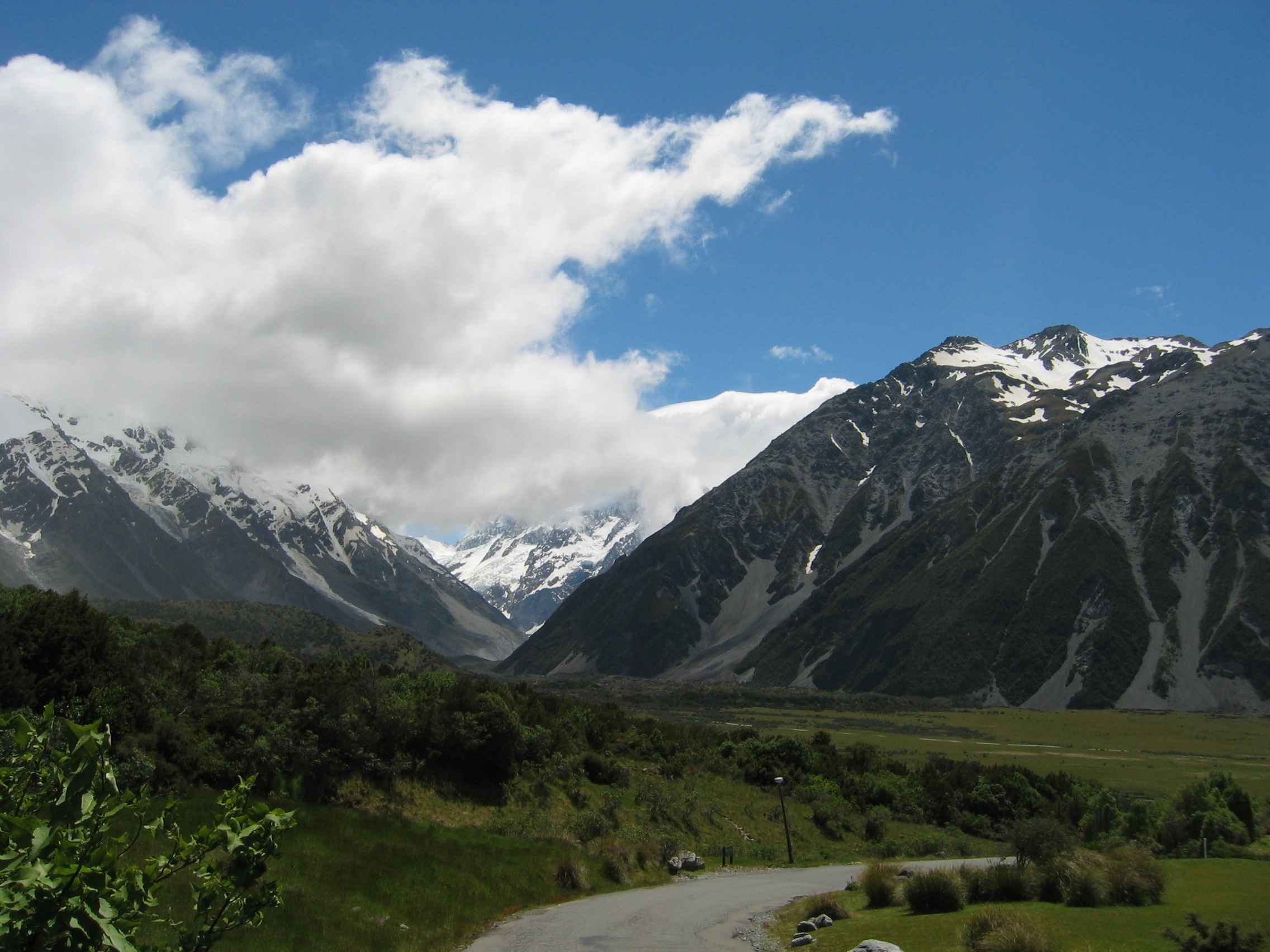
The town Mount Cook itself is not very attractive; 12-storey hotel buildings, ugly backpacker dwellings and fast food stalls ensure, that after just 15 minutes of enjoying the breathtaking scenery I am heading back the way I came. I take one last picture of the lake at a place aptly named "Peter's lookout":
By 4 pm I am back on HW 8, which is now turning back south-eastwards
along the Waitaki River towards Oamaru on the coast. The local I-site
tourist office recommends the Olive
Grove Holiday Park just south of the village of Herbert.
[Postscript 2016 - The campsite apparently no longer exists, a quite common event in fast-moving NZ.]
When I tell the owner, Kim Simpson, that he was recommended to me
by the tourist office, he is quite perplexed. Apparently I am the
first person ever that they sent him.
He is even more surprised that 10 minutes later another campervan
arrives - also directed here by the tourist office. Kim is wondering
whether the "spell" is finally broken. And his site is far
from fully booked for the mayhem weeks during and after those Christian
bank holidays coming up in a few days. Hmmh, at last a place where
I could safely hole up for those mad days without being bothered by
the maddening crowds. I book myself in for two days:
Next morning I set out back to Oamaru.
The town is most famous for its penguin colonies right at the waterfront.
But I am more interested in checking out alternative options for the
bank holiday period. My idea is simple; last week there was yet another
military coup in Fiji.
As a result 80 percent of tourists cancelled their holidays in Fiji,
fearing unrest or civil war. That means that the tourist industry
of Fiji, which generates 50 percent of these islands income, is in
the doldrums. I am hoping that I can get some cheap bargain for myself.
But to my surprise there are none. A friendly lady at the travel agency
explains; sure the Fijians would be more than happy to offer excellent
terms, but these would have to be negotiated with the New Zealand
travel companies. And as all these companies explicitly warn tourists
currently from going to Fiji (though the other coups in past year
show that any violence is usually restricted to the capital Suva,
not the tourist areas on the coral coast or the outer islands), for
these reasons there are no special offers available.
The only method she can suggest is to just book a flight (around 1000
Kiwi dollars return out of Christchurch) and negotiate myself with
the local hotels and guest houses for the best terms. I will not decide
that on the spot, but look into this later.
The best access to the Internet in Oamaru can be found at the Lagonda
café and milk bar. I spend two hours there, getting the latest
news from around the planet.
The people at the local tourist information office also unveil the
mystery, how a man can get a packet of pipe tobacco in this country:
it appears that many barber shops double-function as tobacconists.
And yes, just next to the milk bar is a barber/tobacconist where I
manage to replenish my dwindling stock of pipe tobacco.
After another quiet evening at the campsite I set out on HW 1 next
morning, due south towards Palmerston.
I have a look at the Moeraki
boulders, about 8 miles south of the campsite. But I am not very
impressed; just a few rocks on the beach that have some obscure relevance
to Maori culture. New Zealanders are extremely "politically correct".
Maoris make up for about 7 percent of the current population - but
75 percent of place-names are in Maori language. Even the Kiwis themselves
admit to have difficulties pronouncing these names correctly.
As you would have expected, I couldn't give a toss for political correctness.
Keeping these place-names created by some stone-age warriors who never
developed writing and who's language would put a knot even into a
Dutchman's tongue is just another Kiwi speciality from my point of
view.
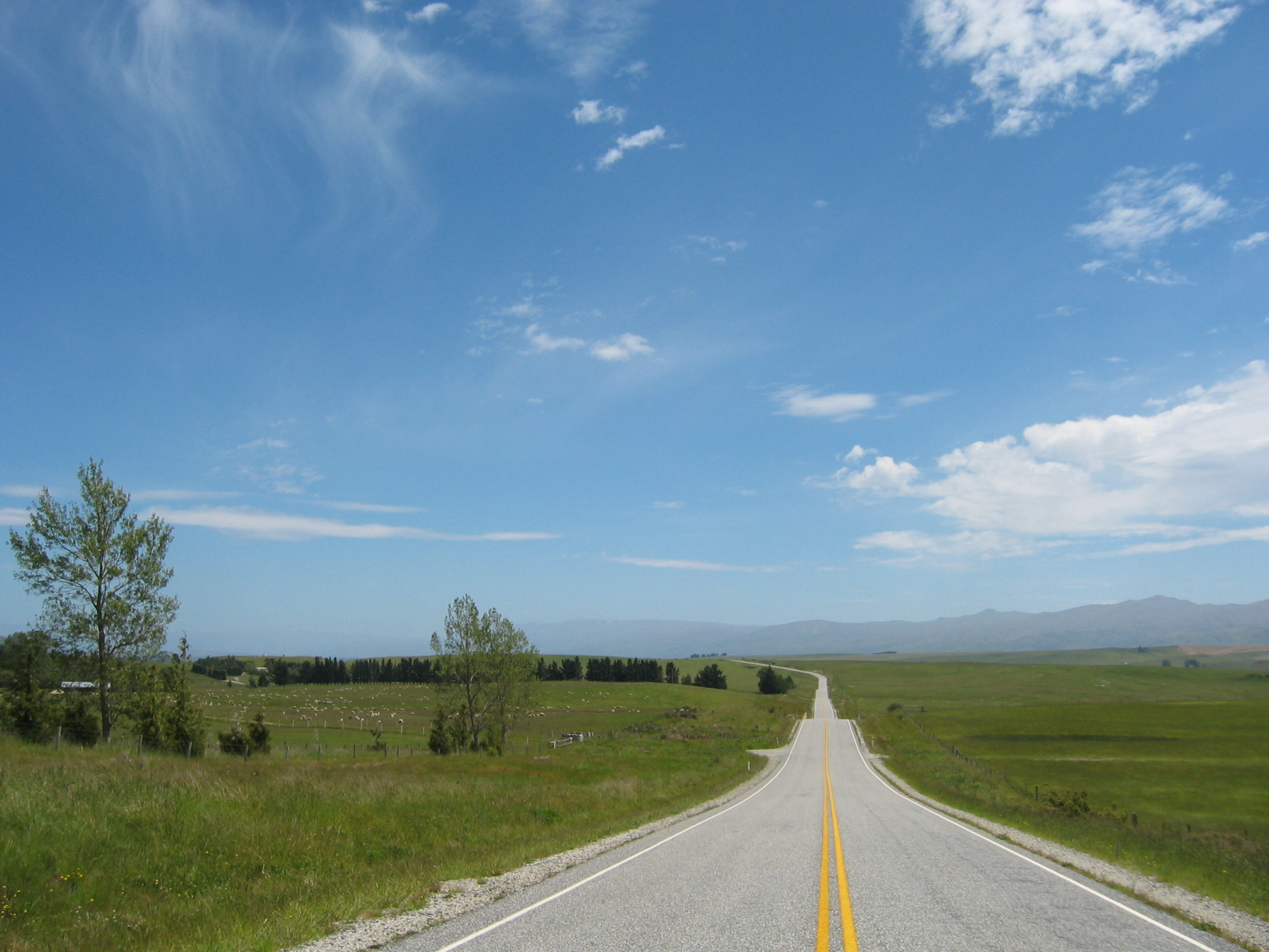
At Palmerston I leave HW 1 for the more scenic HW 85 towards Alexandra
and central Otago
province. The countryside is great and the roads are empty - just
look at this picture:
I am in Alexandra at about 4.30 pm. There are two Motor Parks in
town, one directly on the main highway, the other on a quiet meadow
at the edge of the town. No question, the latter one is for me.
In 1862 gold was discovered in Otago, at Gabriel's
Gully near Lawrence.
Like 15 years before in California, a massive gold rush was the consequence.
The two prospectors who first discovered the goldfield gathered over
30000 ounces in just over a month - just look up the current rate
per ounce to work out how much that is today in your local currency.
Even today the Kiwi gold mining companies refine several tons of gold
each year. So today I am going to visit a mine in one of the original
mining areas north of Clyde.
The ancient mine has been opened for tourists and an interesting collection
of buildings and machinery allows the visitor a good look into the
hard life of those ancient miners.
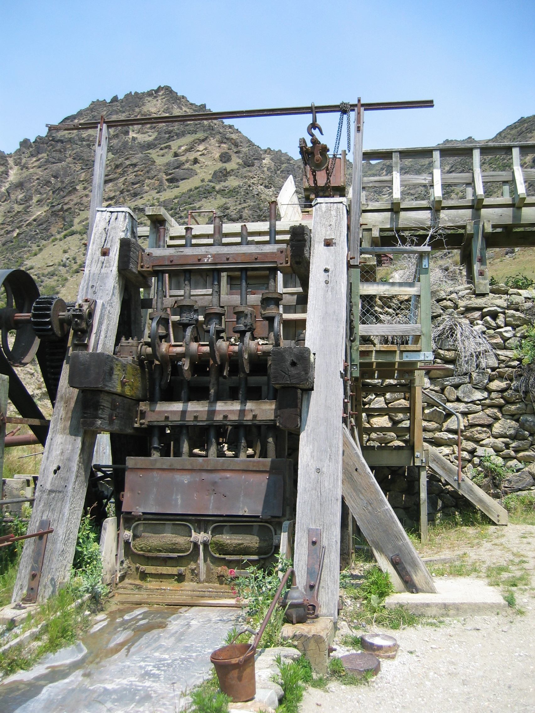
The ground still contains gold - just this morning a twelve year
old Dutch girl found a nugget worth over 300 dollars. So of course I
have a go at panning a few pounds of rubble. This is surprisingly
hard work, as the wet material in the pan weighs several pounds and
needs quite a while of careful panning until at last one may or may
not find a few specks of gold dust at the bottom. Of course I find
absolutely nothing, so I decide that gold digging is not for me.
On my way back I take a look at the village of Cromwell.
Suddenly a cop car appears behind me with blaring sirens. What on
earth is that racket about, I wonder? Apparently I have just run over
a stop sign without fully stopping my van. The cop is just as friendly
as any other Kiwi. Once he realizes that I am a tourist, he spends
the next 15 minutes explaining to me how I can dodge paying the 150
dollars fine. He need not to worry; I know already that the cops have
to send out a reminder after 28 days if the fine is still unpaid.
As that reminder will never arrive I am not required to pay, so I
take it quite easy. The cop warns me that I need to drive more careful
down here. I find it difficult not to laugh right in his face; I wonder
whether he has 29 years no-claim-bonus or knows any Kiwi who ever
drove half a million miles on motorbikes without any accident. In
all probability I could start as an instructor here right away to
teach these lethal Kiwi drivers a few lessons. The only people adhering
to any speed limit here are the foreign tourists.
The next morning I continue my way south-east on HW 8, back towards
the coast near Milton.
I have in effect circumnavigated the town of Dunedin
completely. At Balclutha
I leave the main highway in favour of the "Southern
Scenic Route". This route follows the south coast of South
Island towards Invercargill.
Unfortunately the weather is once more cold, windy and showery, but
in spite of that the wild, lonely countryside is quite enjoyable.
Just north of Invercargill, about half a mile before the junction
of HW 6 and HW 99 is a quiet motor camp. That's how I like to stay
for a few days; five minutes from the town centre, but remote and
away from the main road. I have look around town, go to the movies
and enjoy the fantastic views off the coast towards Stewart
Island. I realize that I have reached about the southernmost point
of my journey, when I find this marker in Bluff,
south of Dunedin:
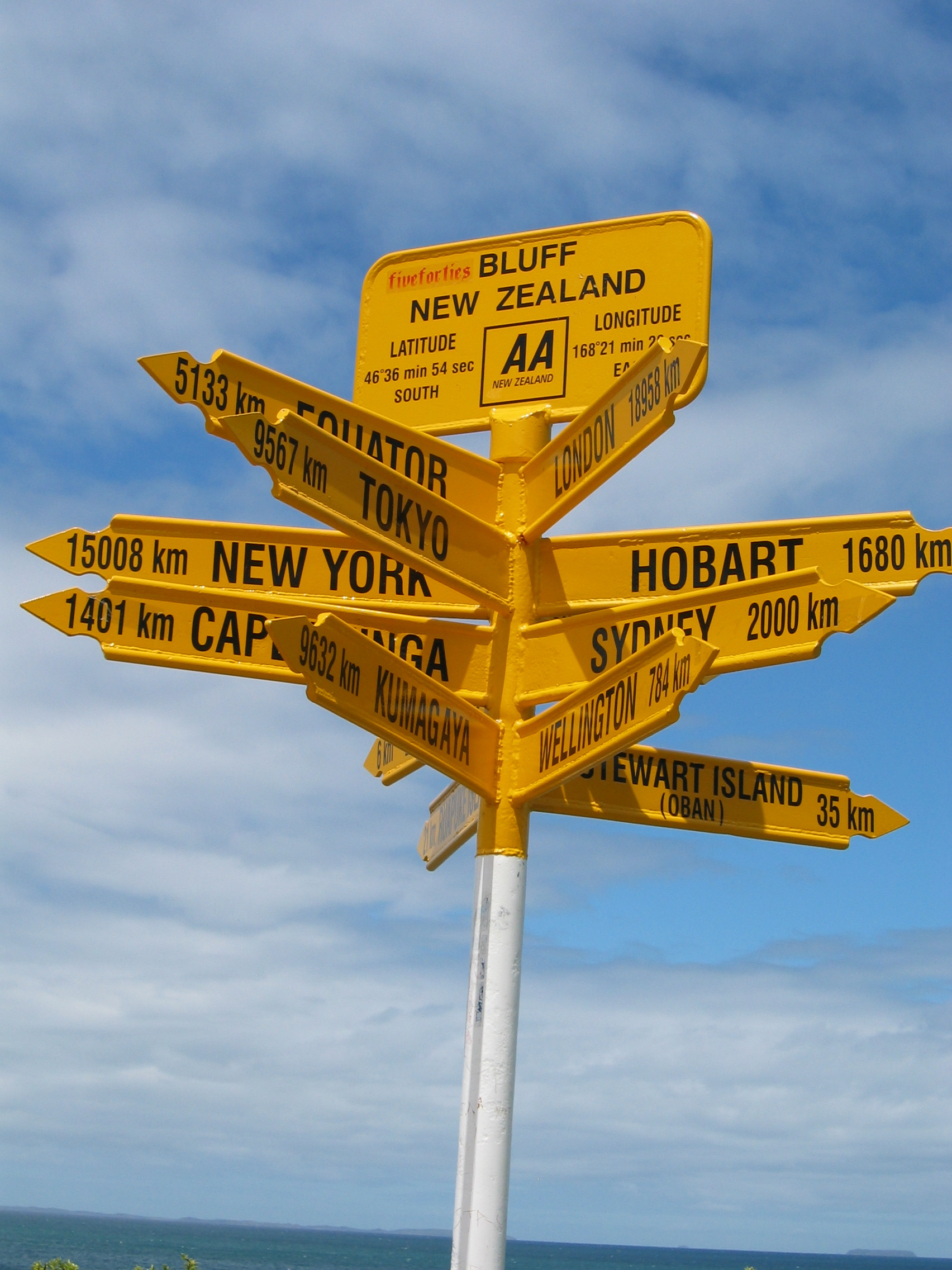
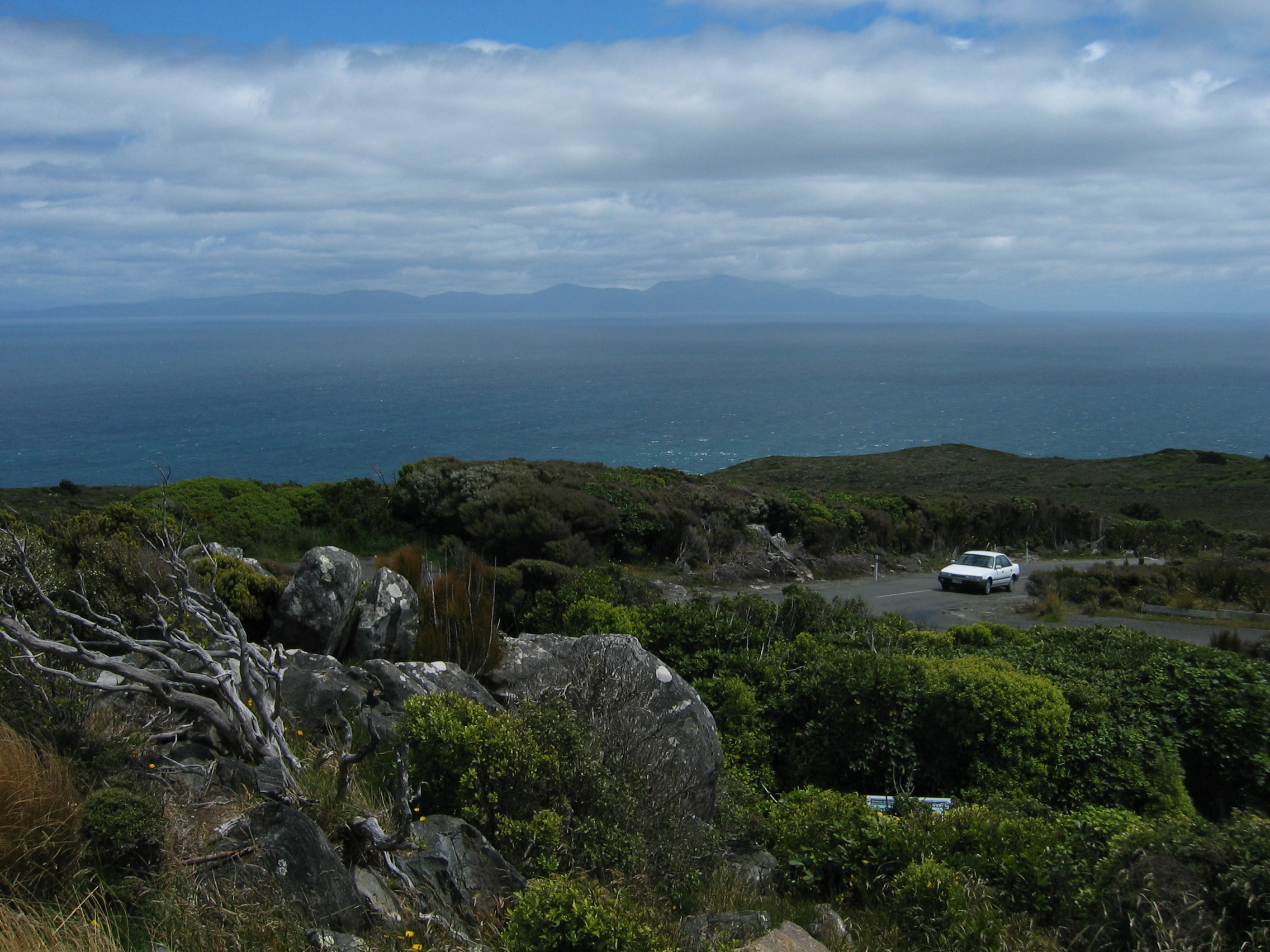
Just under 19000 km to London and 15000 to New York - I have come around in the world, I can say. Afterwards I drive up to the Lookout Point on Bluff Hill above the village. The view is great and makes one forget the bitterly cold wind blowing up here. In the distance you can see Stewart Island, about 25 miles off the coast:
From here onwards the journey will go back up north again, with the general idea being to be back in Northland by the end of April.
Below is the usual map with my GPS tracklog and some trip markers.